


Lannan Gallery
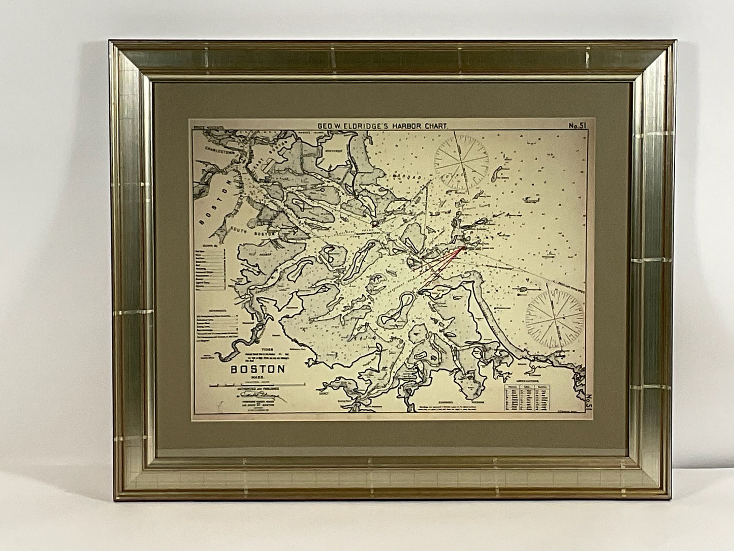
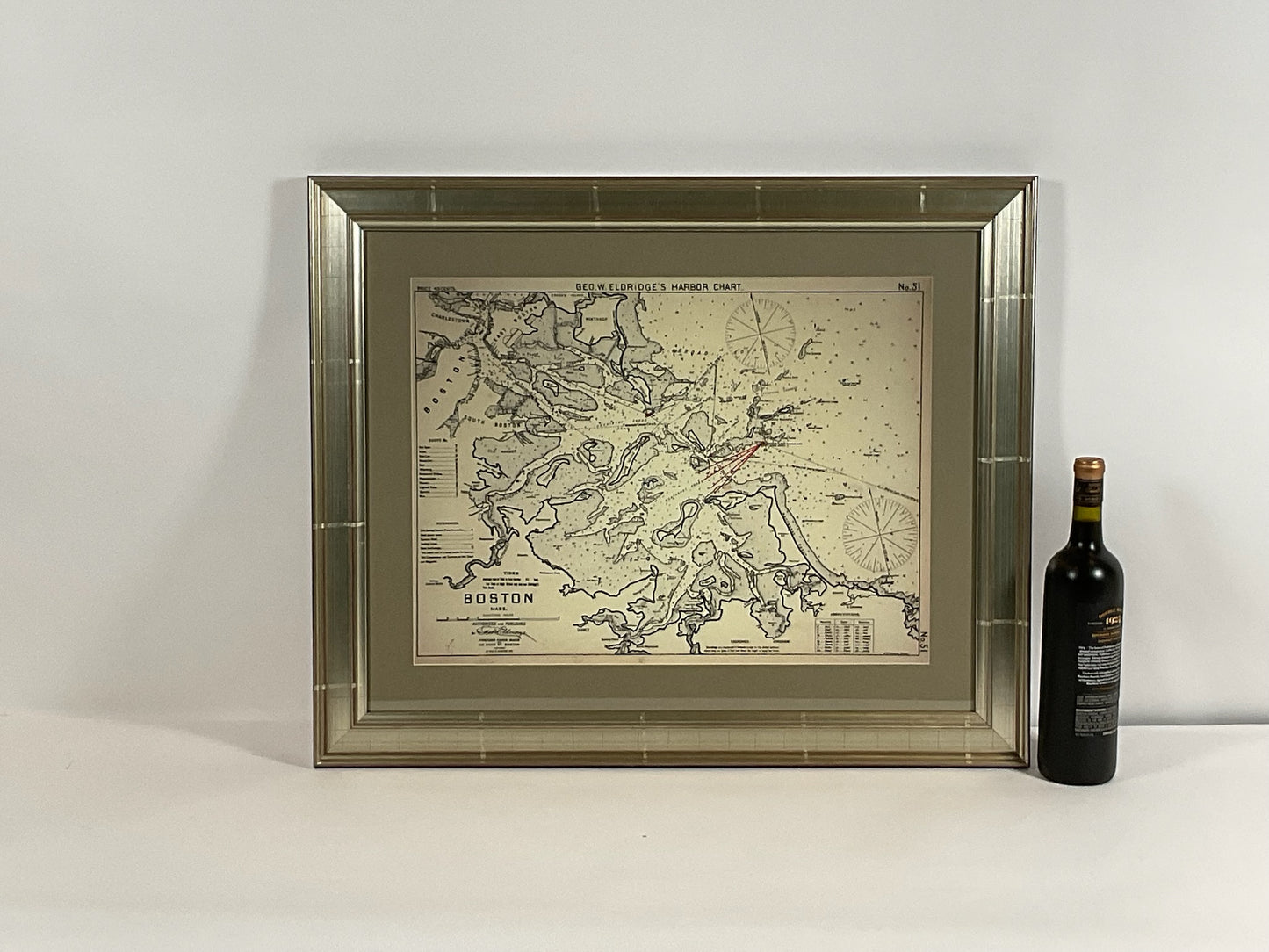
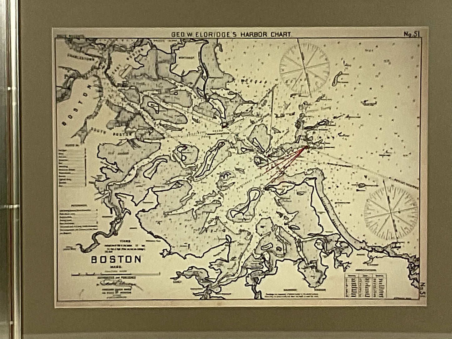
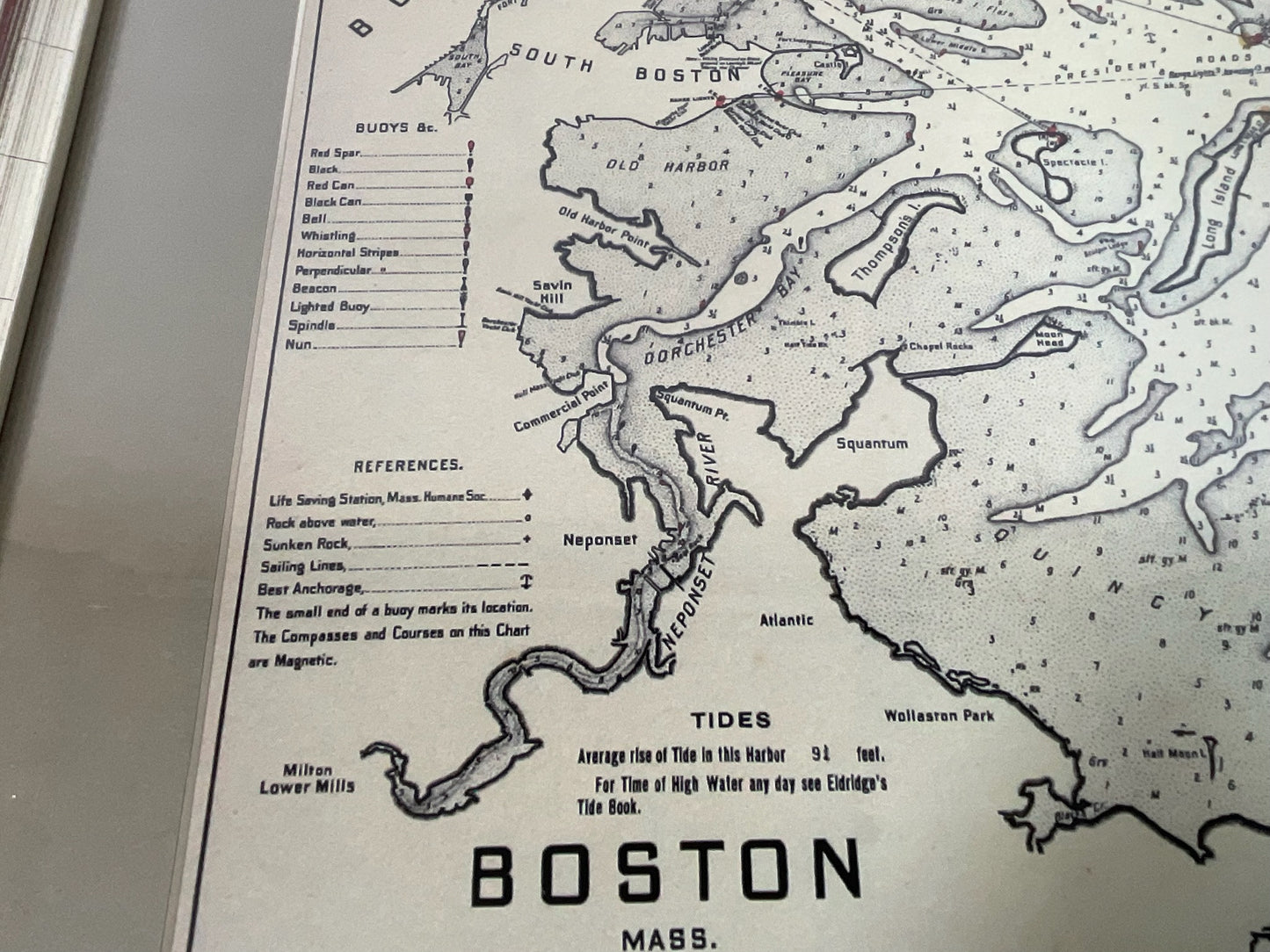
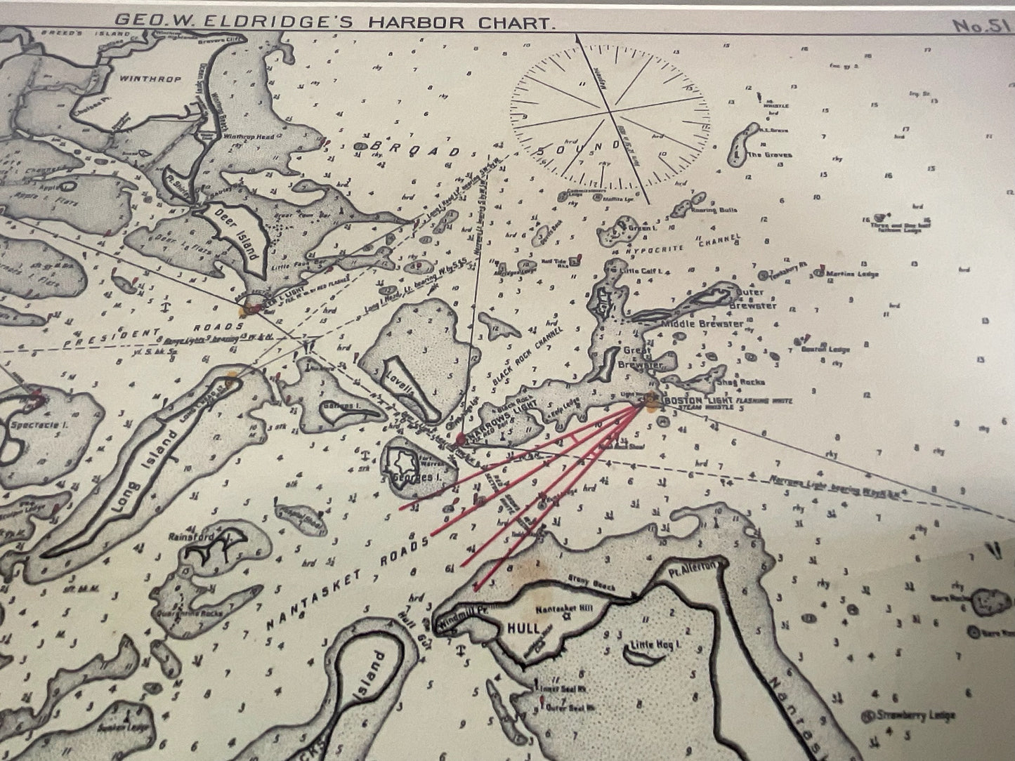
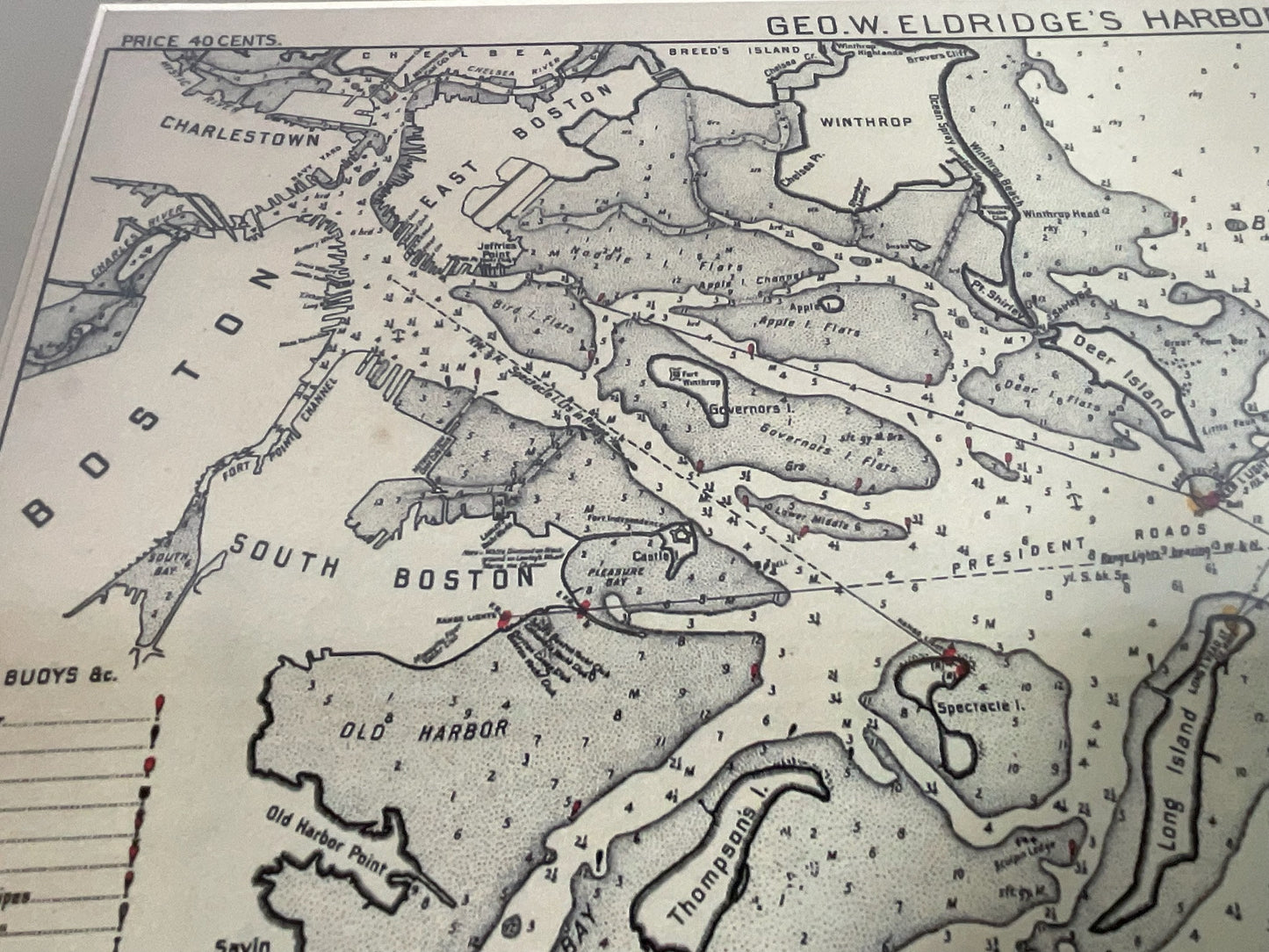
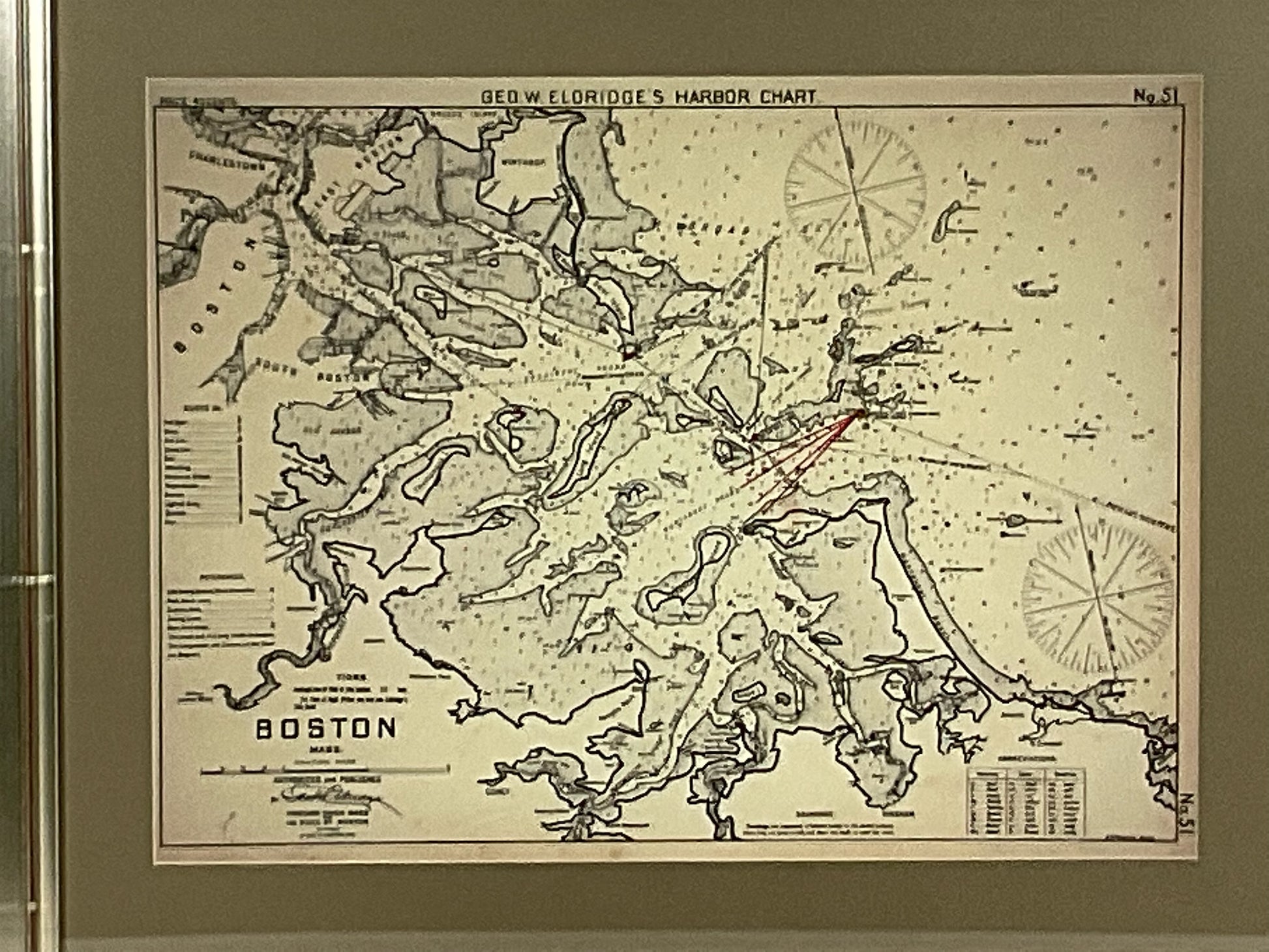
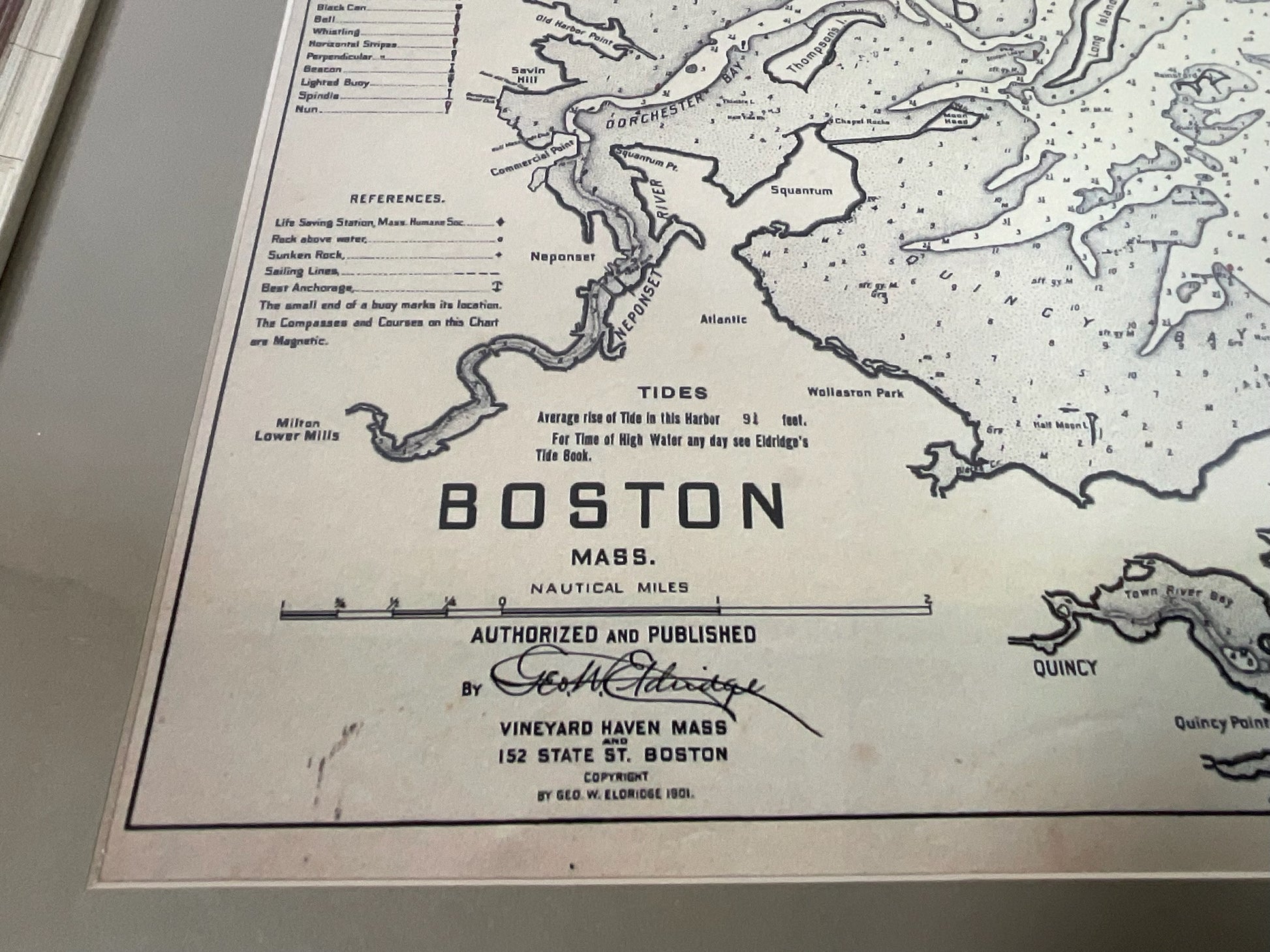
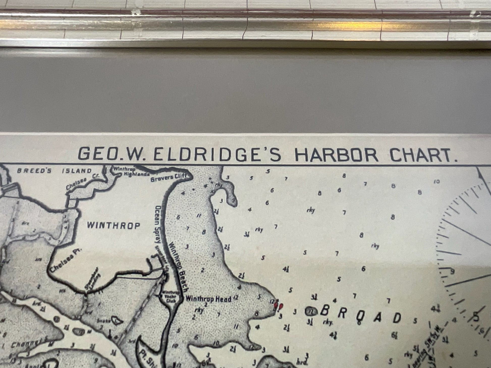
Copy of 1901 Chart of Boston Harbor
Copy of 1901 Chart of Boston Harbor
Regular price
$ 225.00 USD
Regular price
Sale price
$ 225.00 USD
Unit price
per
Couldn't load pickup availability
Later copy after an original Boston Harbor chart by George Eldridge of Vineyard Haven and Boston. Detailed chart of Boston Harbor from the Neponset River in Quincy south down to Kimballs Island in Cohasset. Up to the north to Winthrop. The chart shows the Boston Harbor Islands including Paddocks, Outer Brewster, Middle Brewster, Boston Light, Long Island, Thompsons, etc.. South Shore town and cities include Squantum, Wollaston, Houghs Neck, Quincy, Weymouth, Hingham, Crows Point, World's end, Nantasket, Hull, Etc. Modern copy of a 1901 Original.
Weight: 8 lbs.
Overall Dimensions: 23"H x 28"W
Made: American
Material: Paper
Date: 1913