

Lannan Gallery
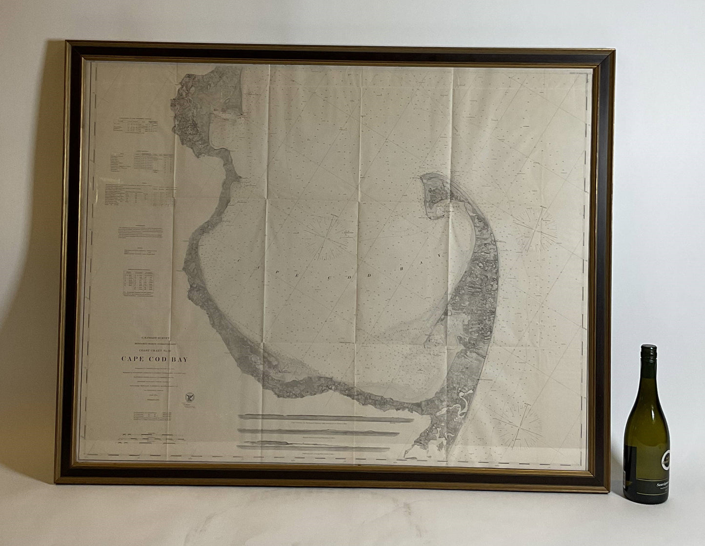
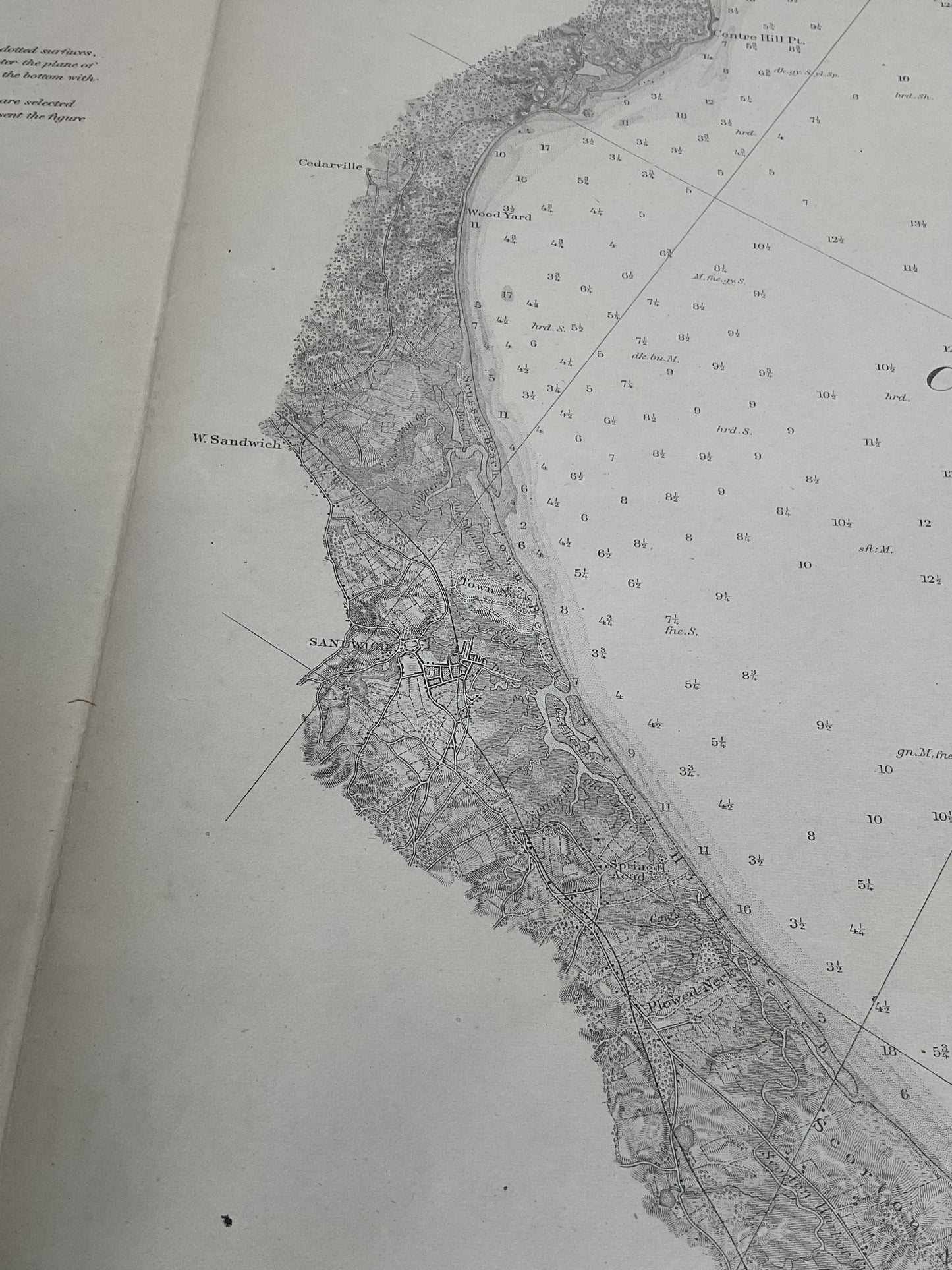
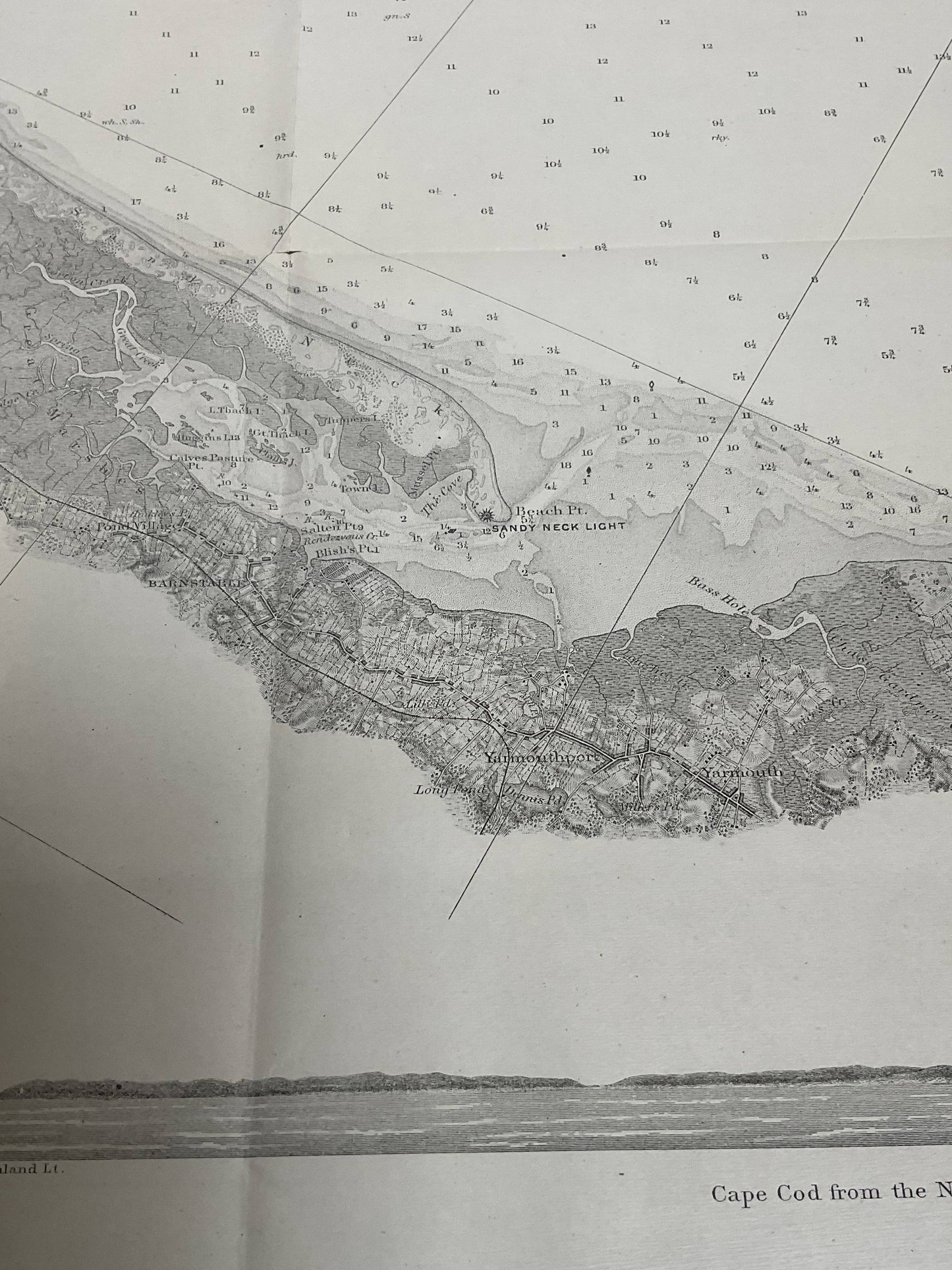
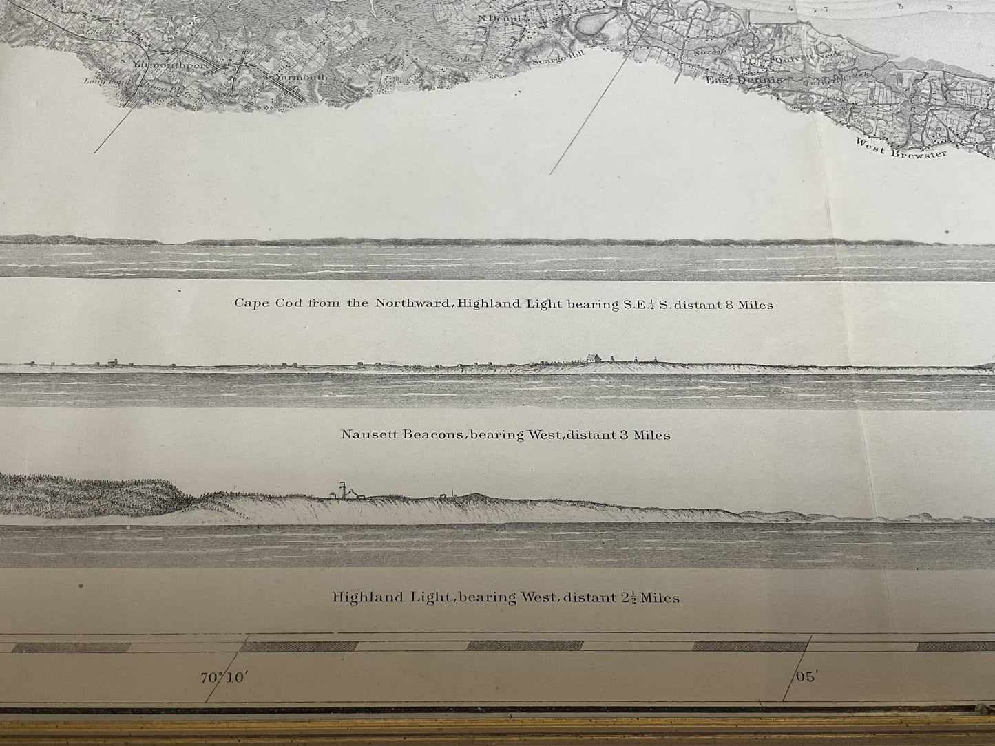
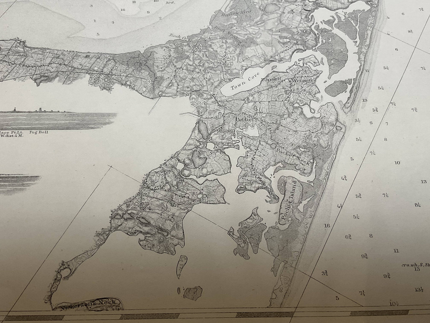
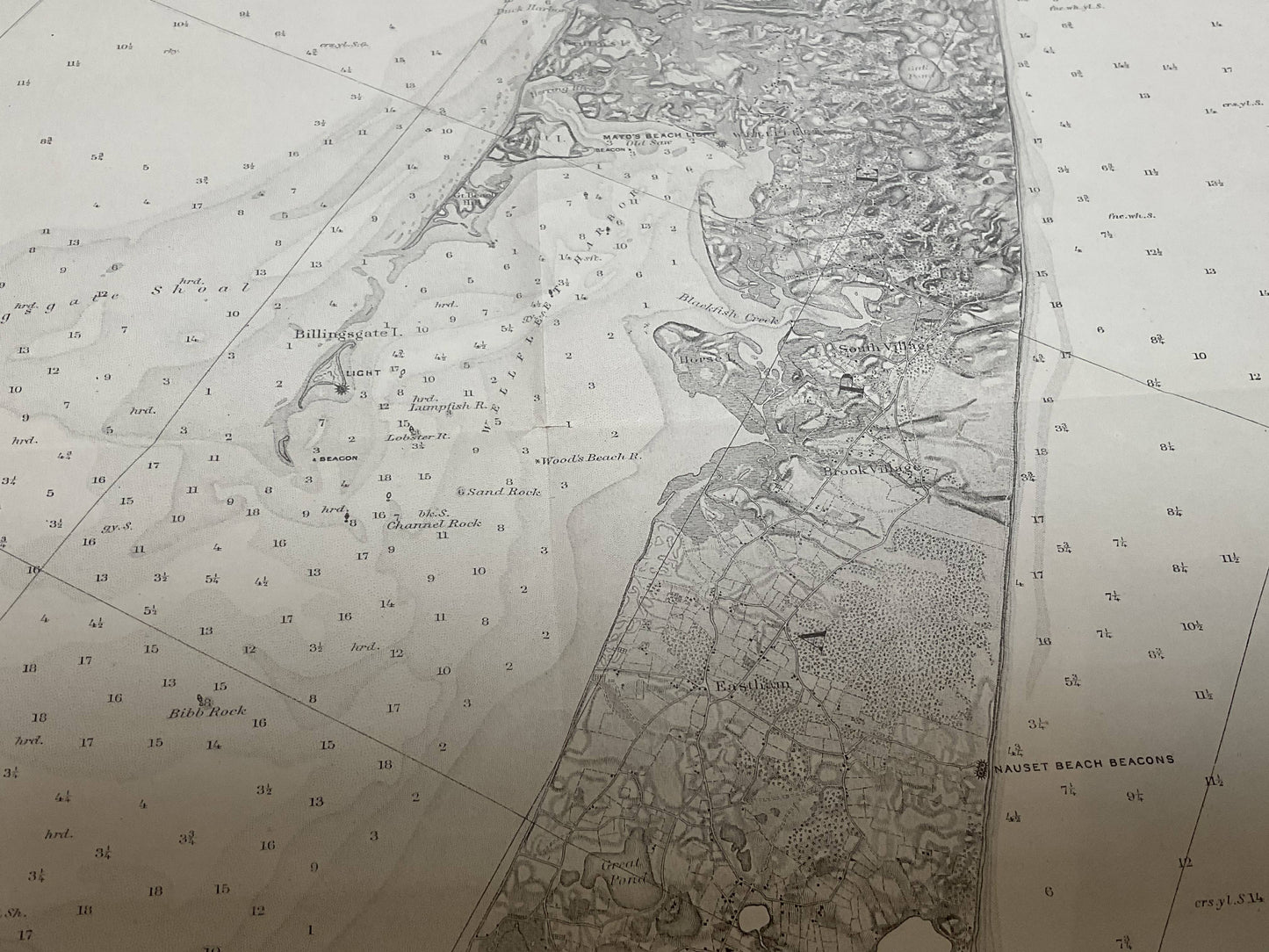
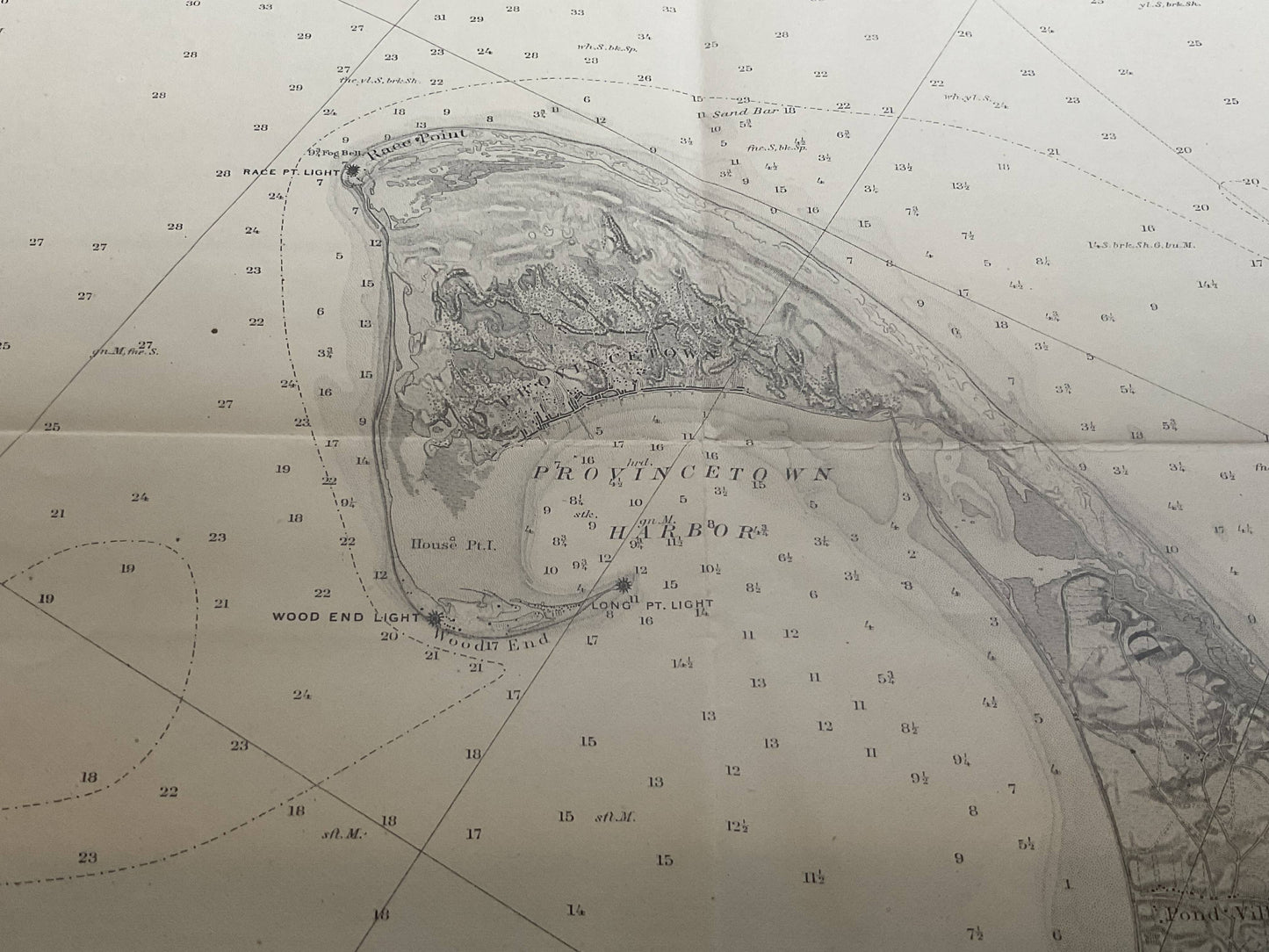
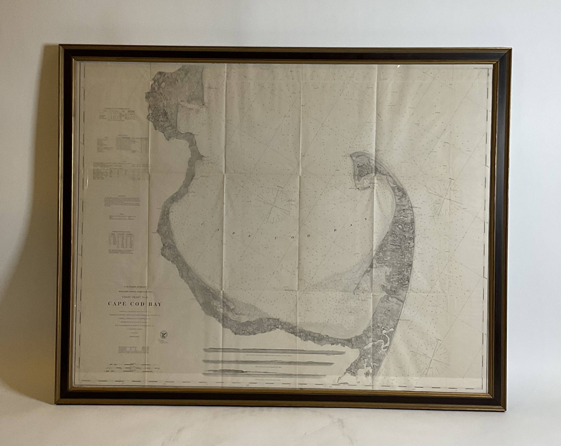
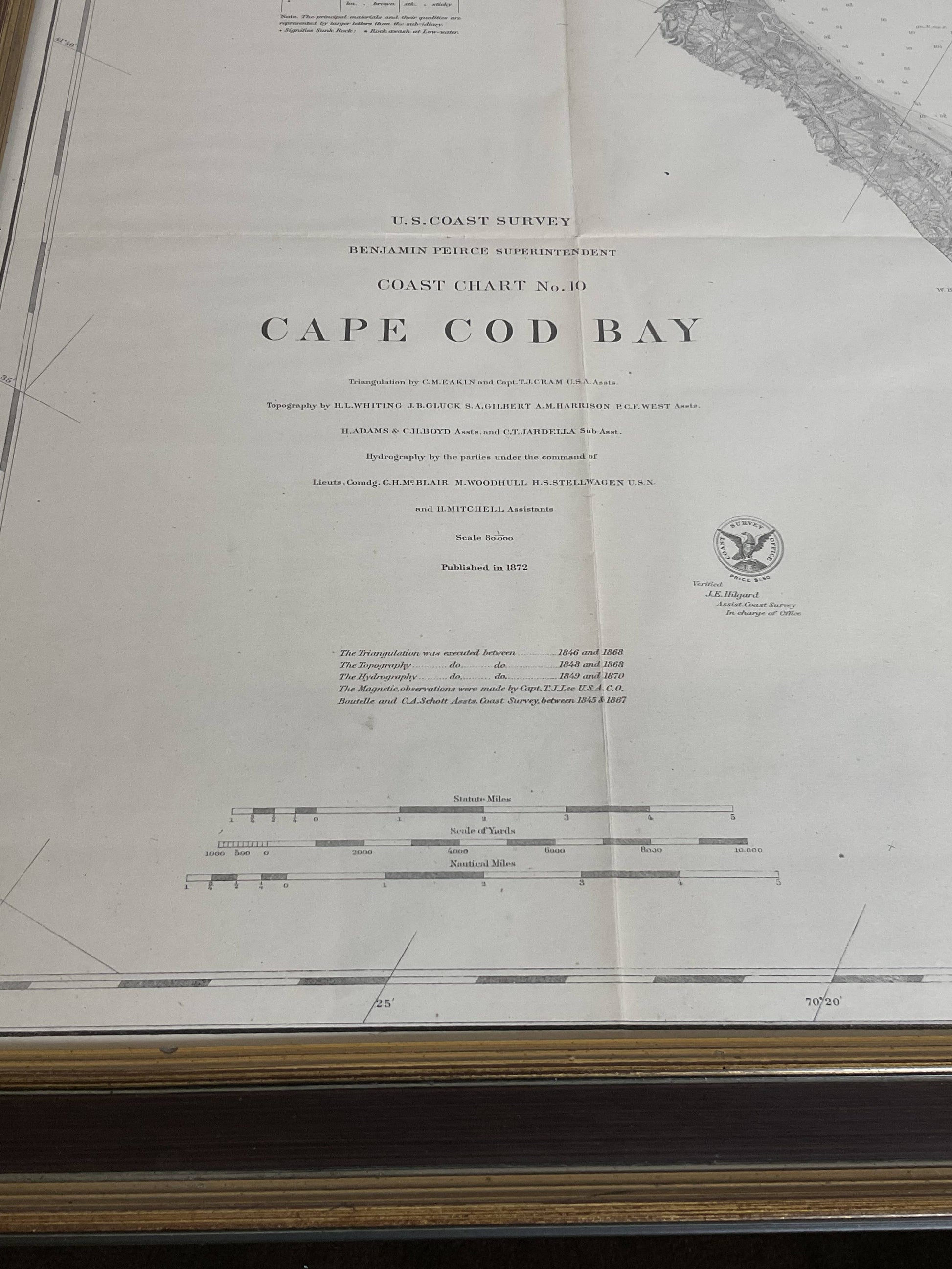
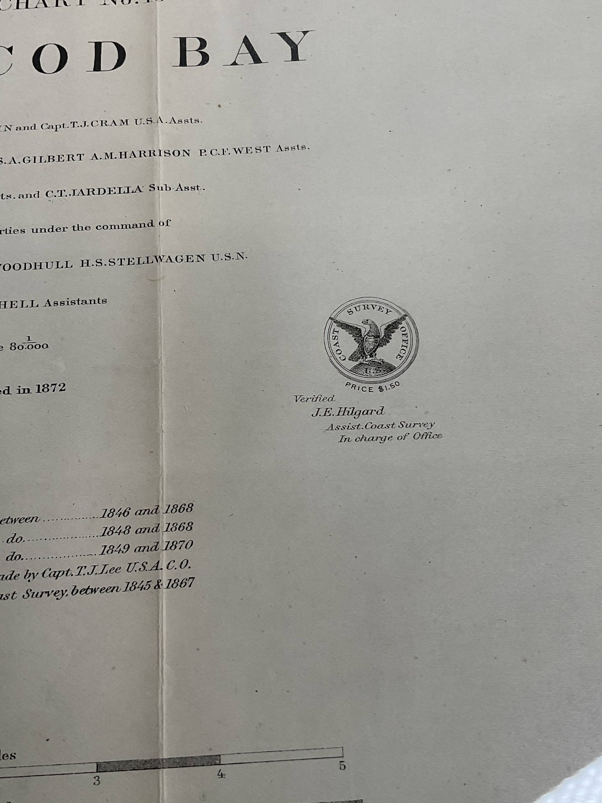
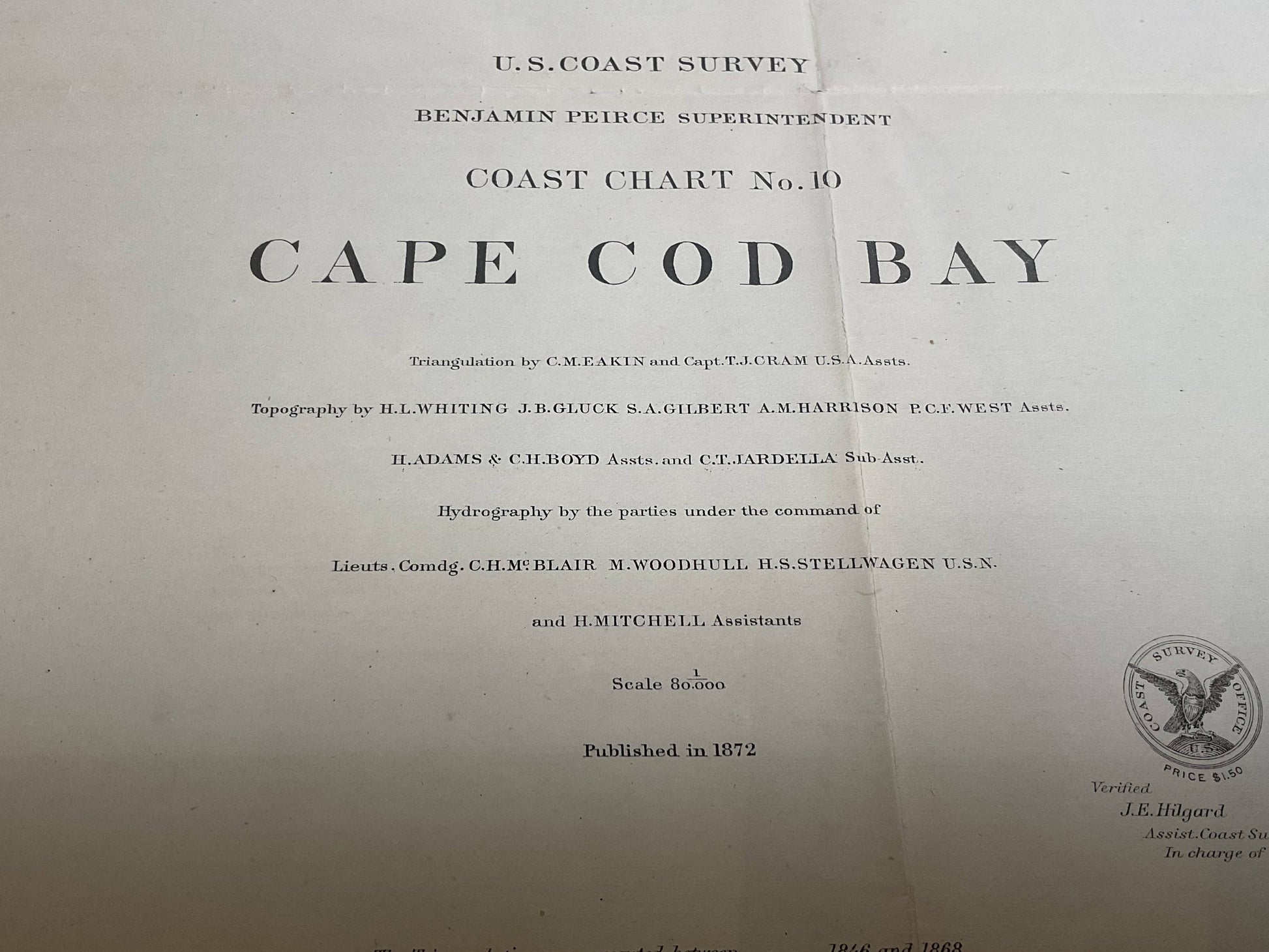
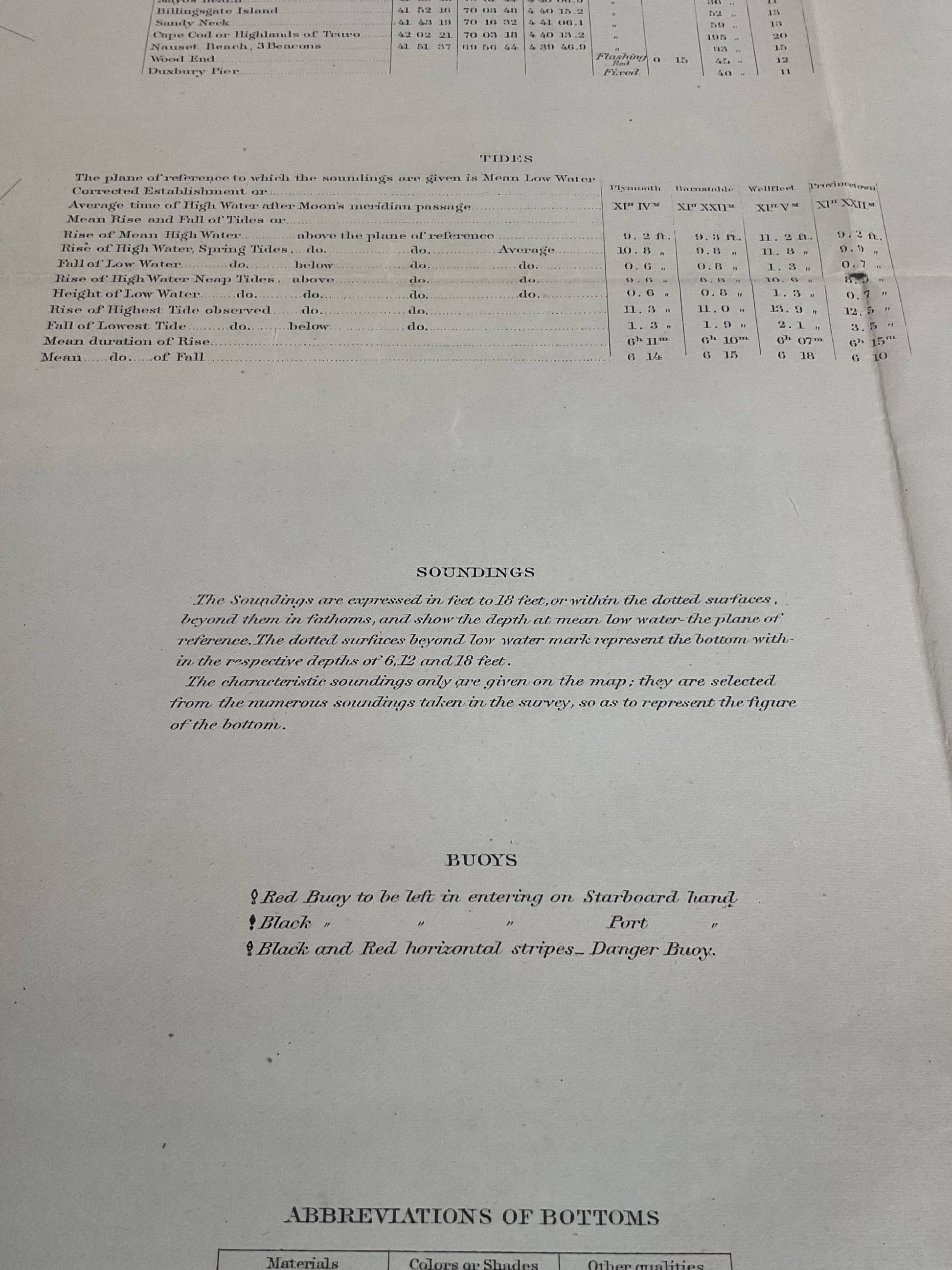
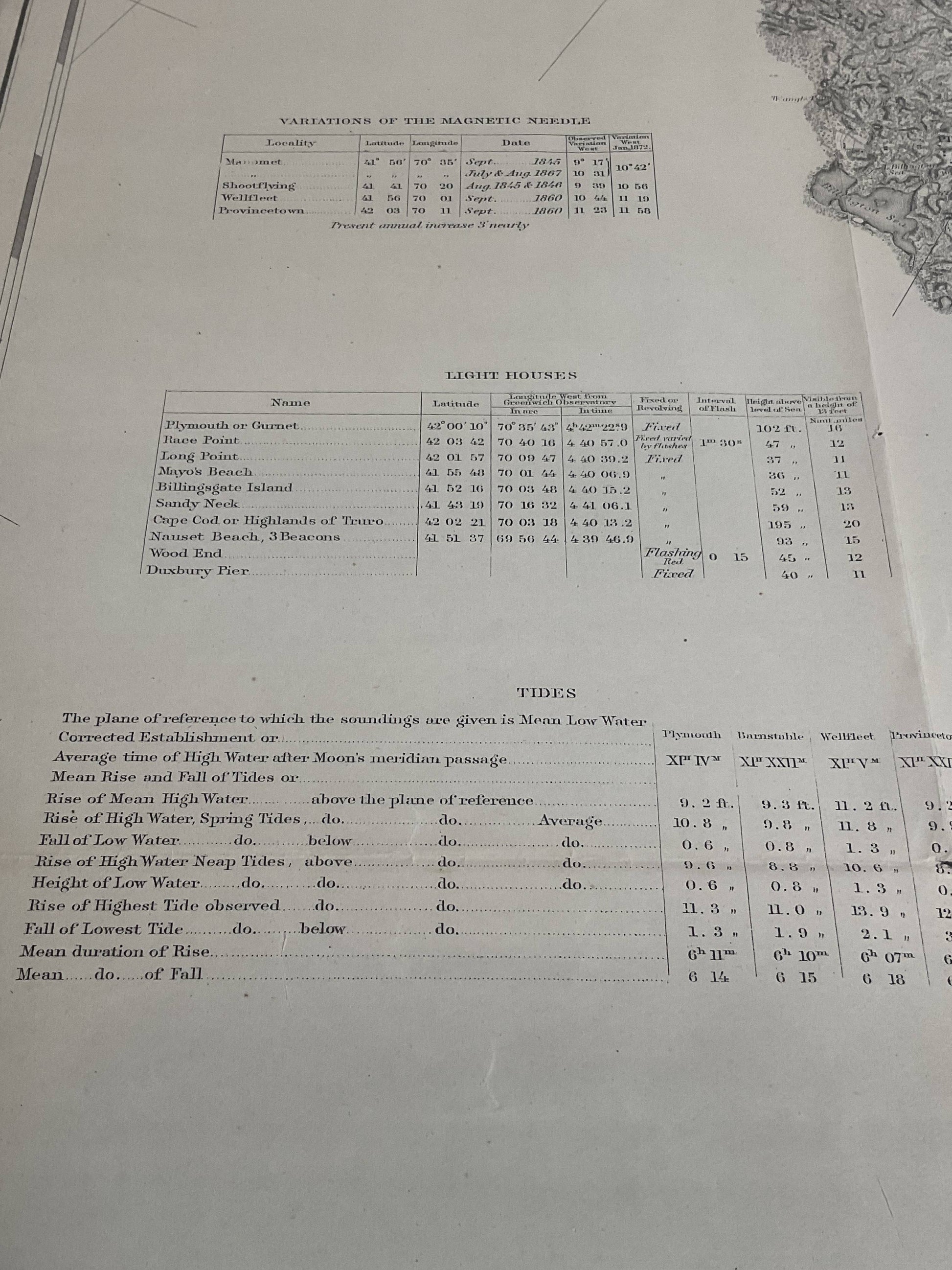
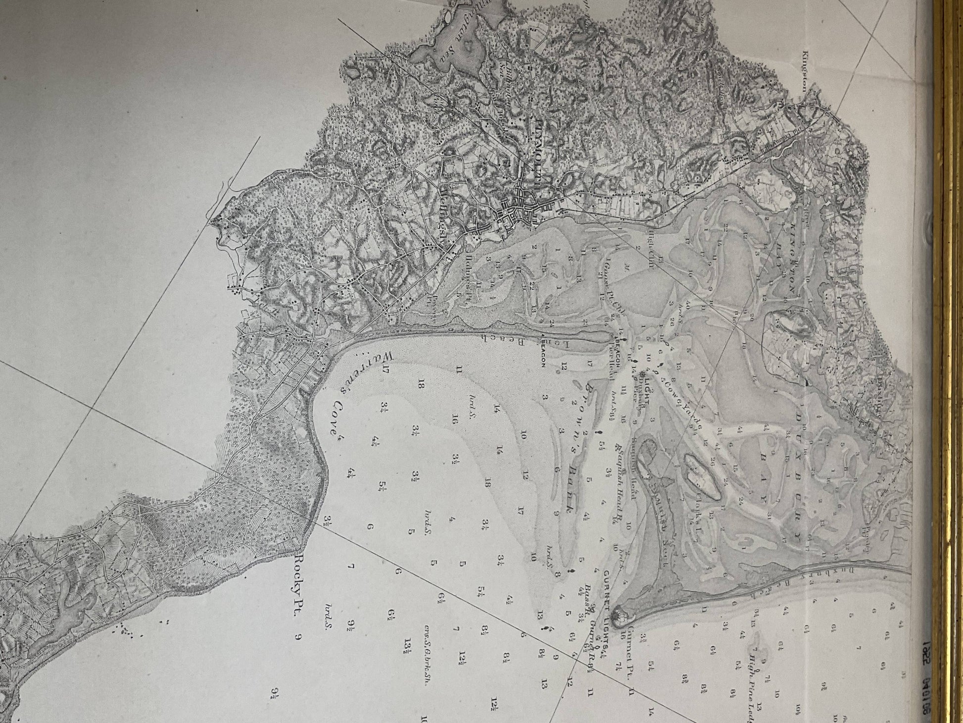
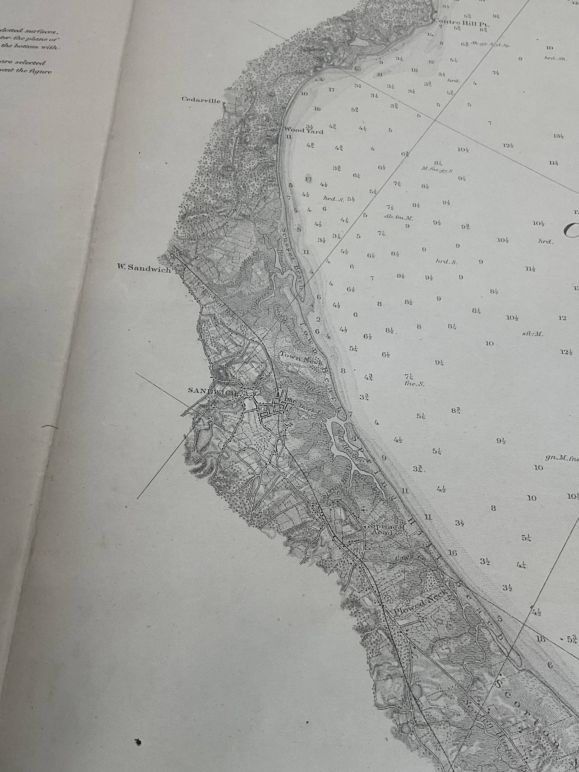
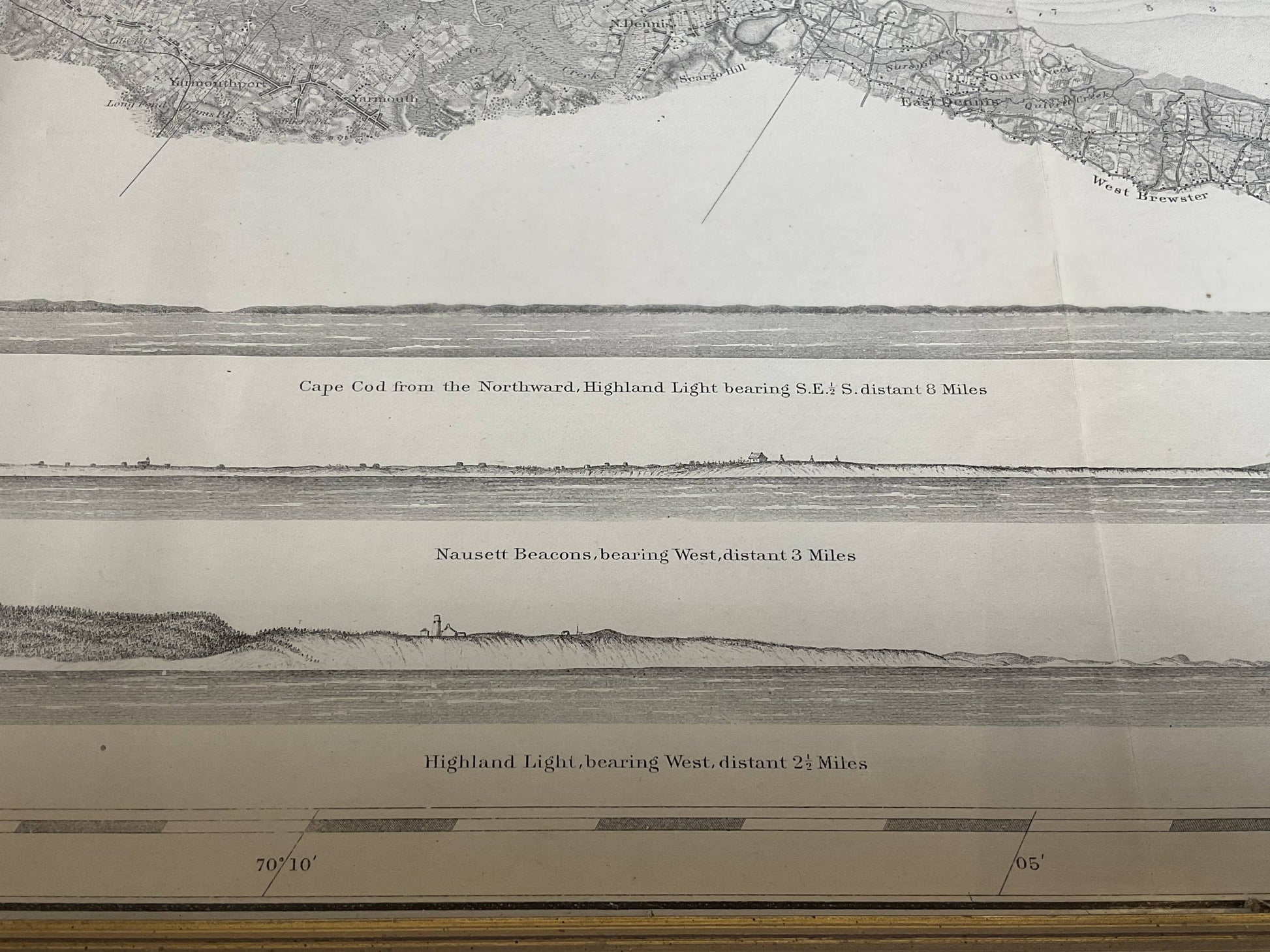
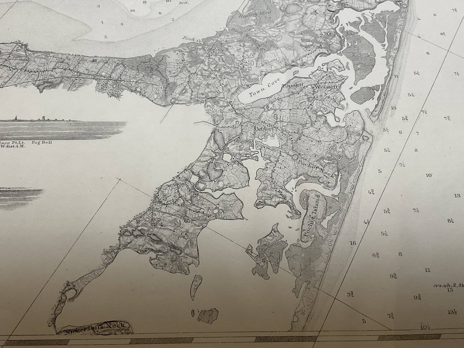
US Coast Survey Chart Of Cape Cod Bay
US Coast Survey Chart Of Cape Cod Bay
Regular price
$ 1,295.00 USD
Regular price
Sale price
$ 1,295.00 USD
Unit price
per
Couldn't load pickup availability
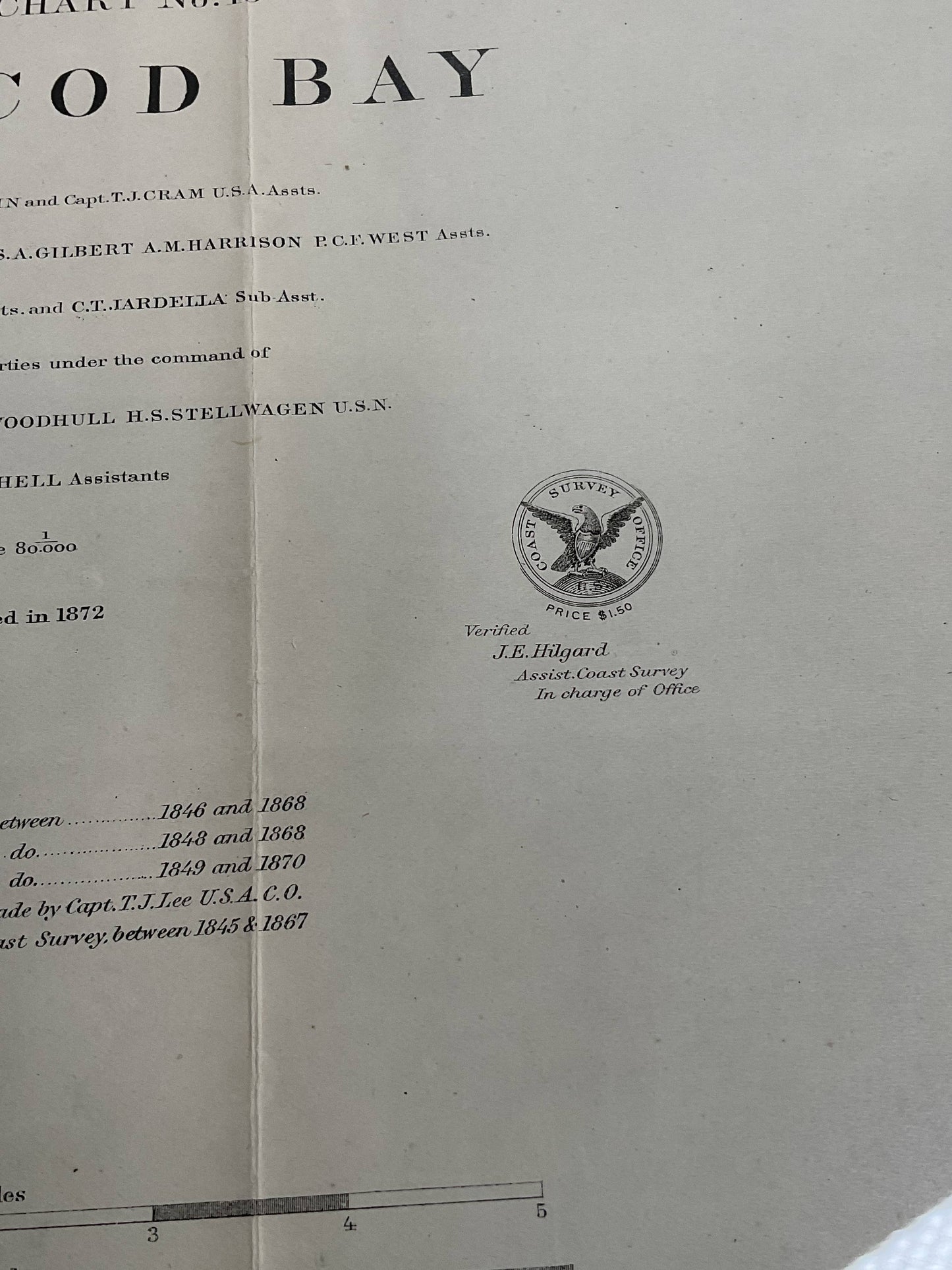
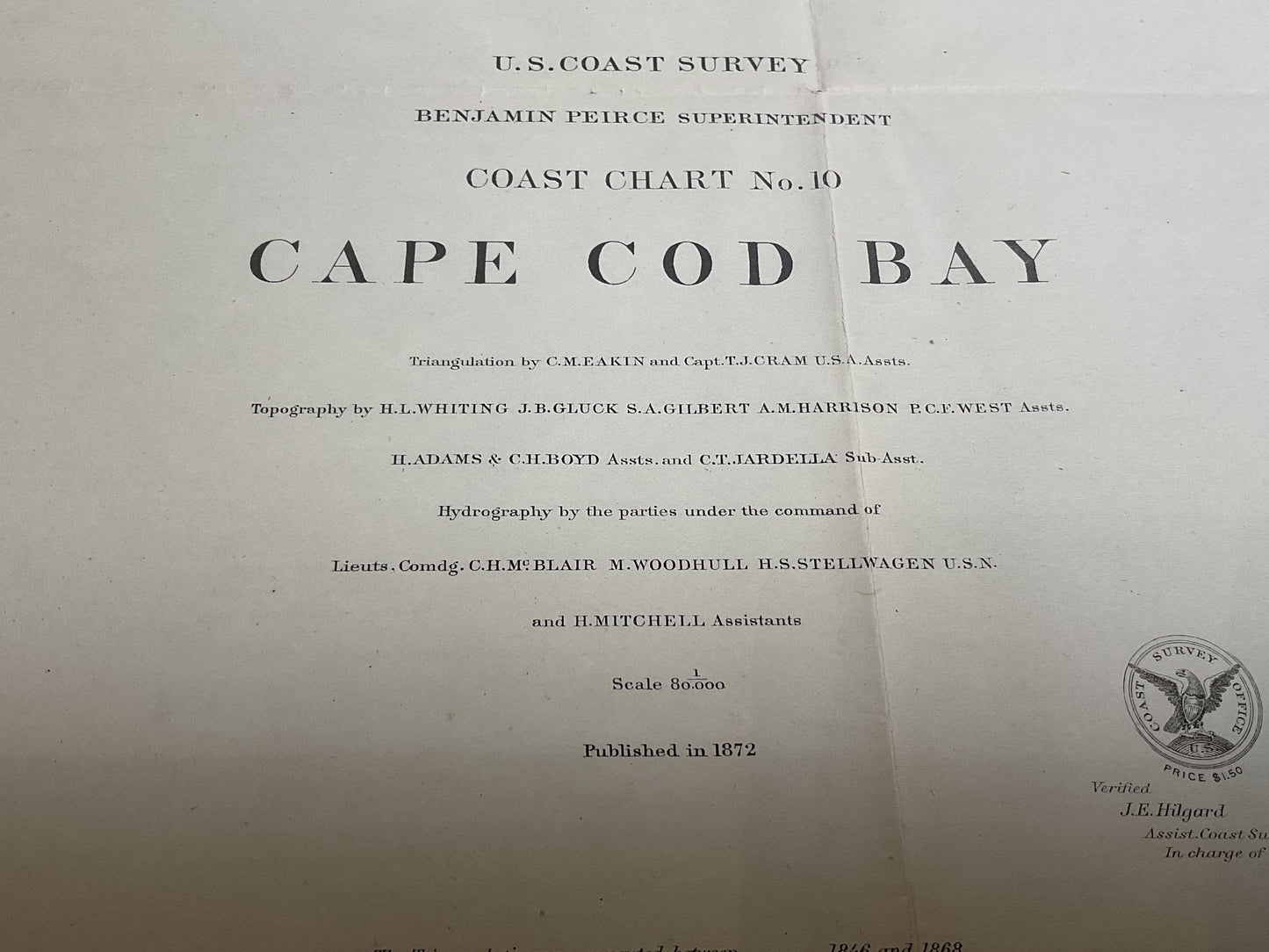
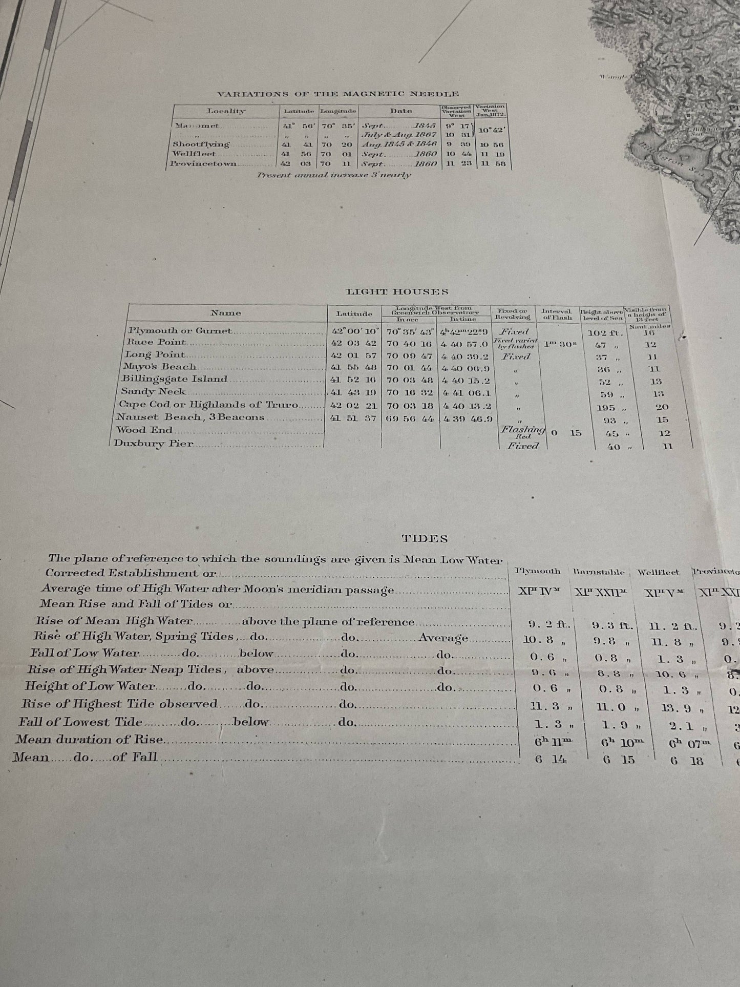
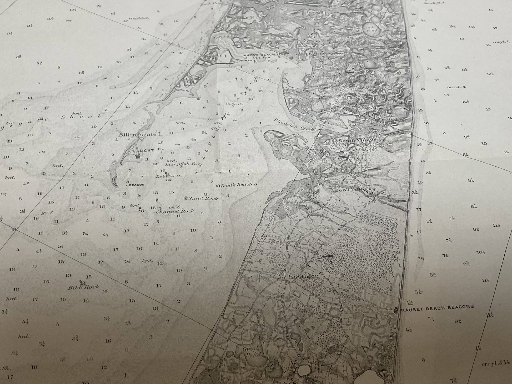
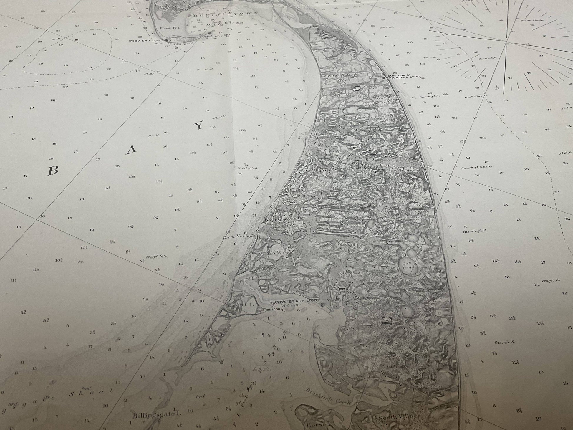
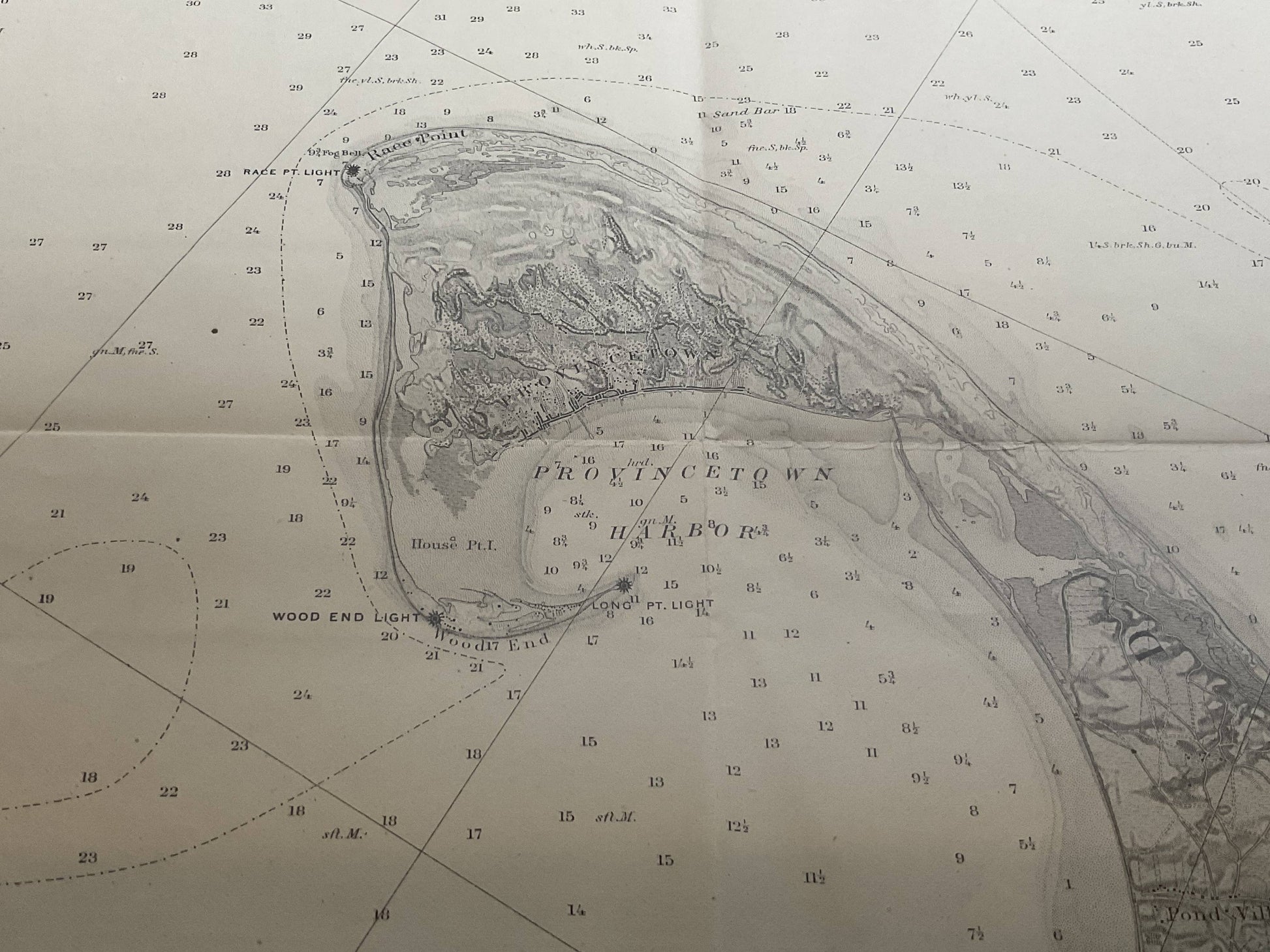
1872 chart of Cape Cod Bay by the "U.S. Coast Survey". Great detail showing the coast of Massachusetts from the tip of Provincetown Massachusetts to Chatnam and Duxbury, with Sandwich, Sandy Neck, Nauset, Truro, and others. Dated 1872.
Weight: 15lbs.
Overall Dimensions: 34"H x 43"W
Made: America
Material: Paper
Date: 1872