Lannan Gallery
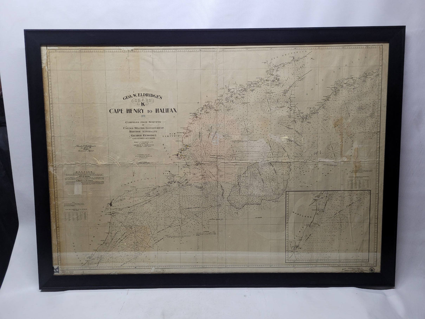
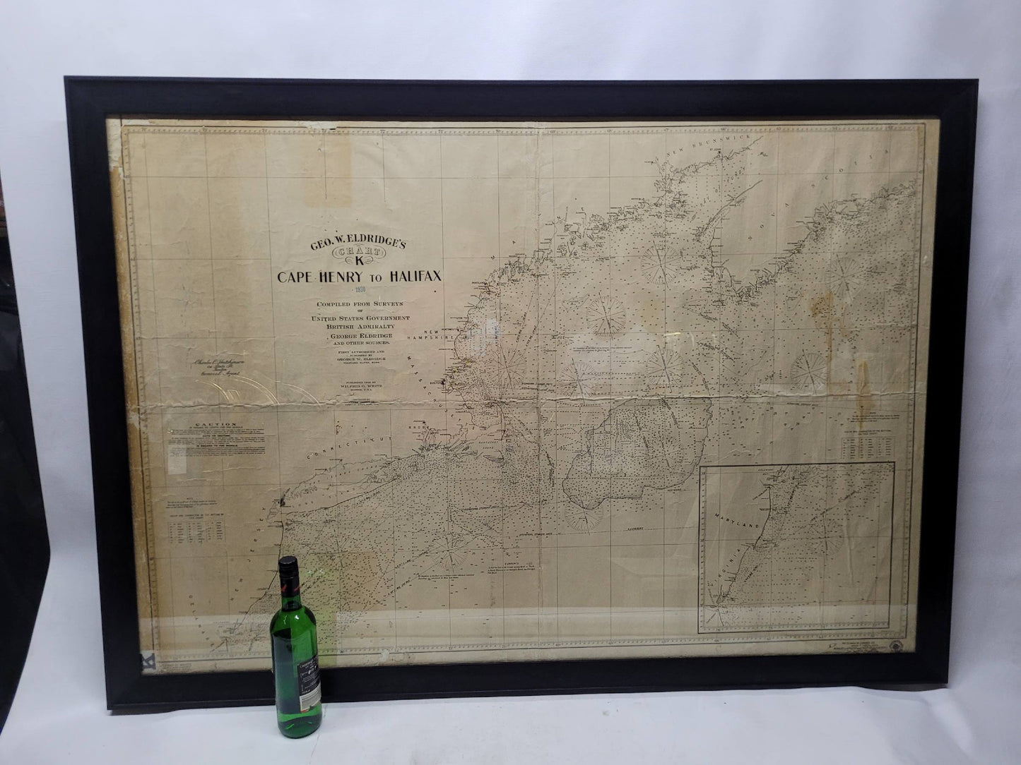
Antique Maritime Chart of East Coast Virginia to Nova Scotia
Antique Maritime Chart of East Coast Virginia to Nova Scotia
Regular price
$ 3,495.00 USD
Regular price
Sale price
$ 3,495.00 USD
Unit price
per
Couldn't load pickup availability
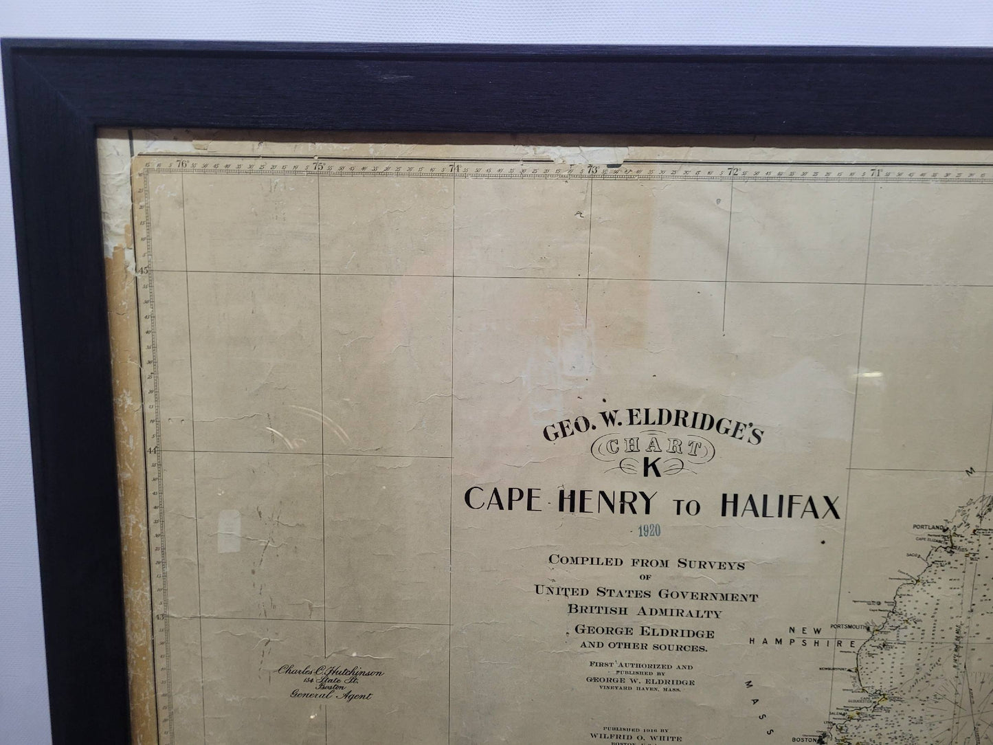
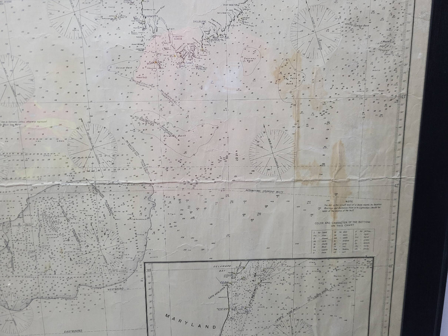
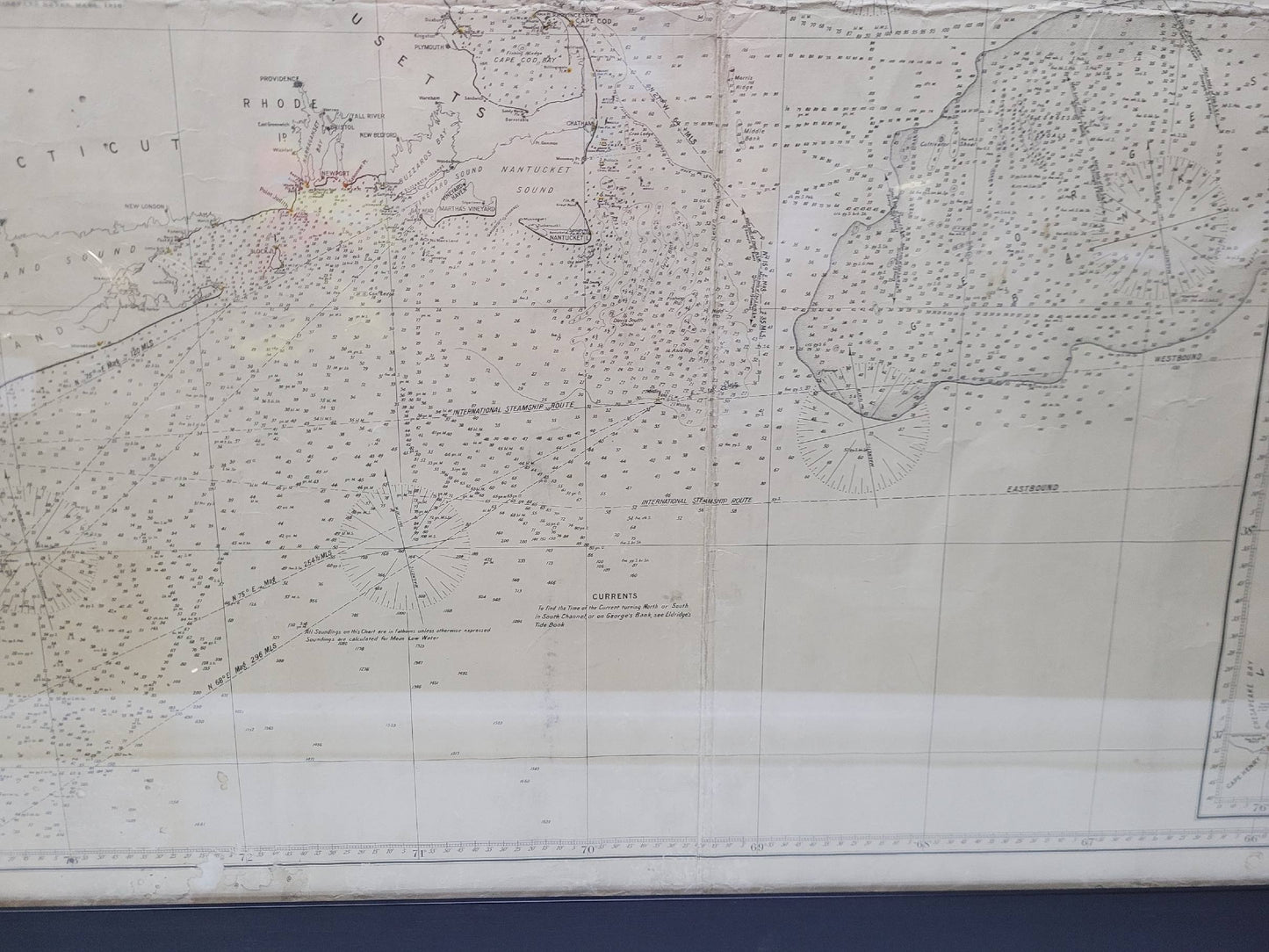
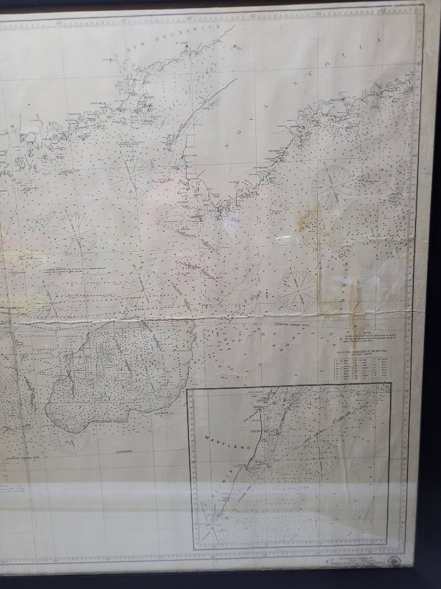
1920 nautical chart of the East Coast of the United States from Virginia to Maine, New Brunswick, and Nova Scotia. The chart shows Cape Cod, Long Island, the Connecticut coast, Jersey Shore, Maine, New Hampshire, etc. Very detailed, showing ports, lighthouses, shoals, depths, etc. The chart is by famous cartographer George W. Eldridge, compiled from surveys of the United States government, British Admiralty, George Eldridge, and others. First authorized by George Eldridge, published in 1916 by Wilfred O. White with a merchant's stamp of Charles Hutchinson, 154 State St., Boston.
Weight: 32 lbs.
Overall Dimensions: 42"H x 60"W
Made: America
Material: Paper
Date: 1920