


Lannan Gallery
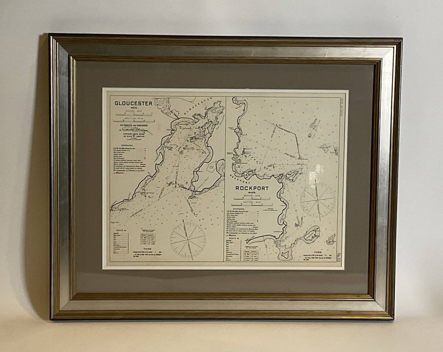
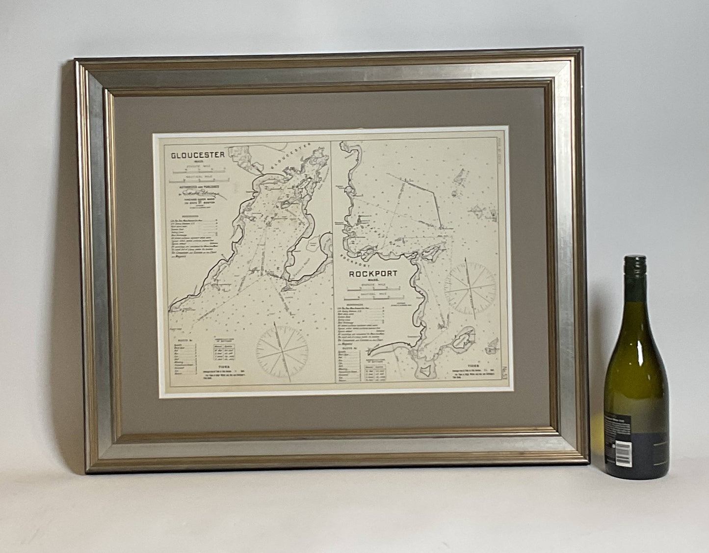
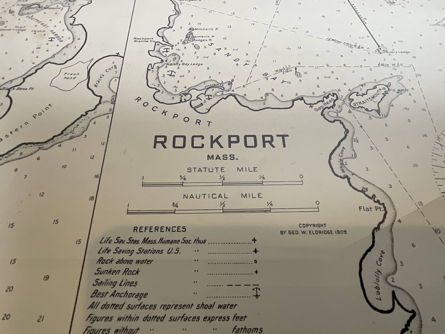
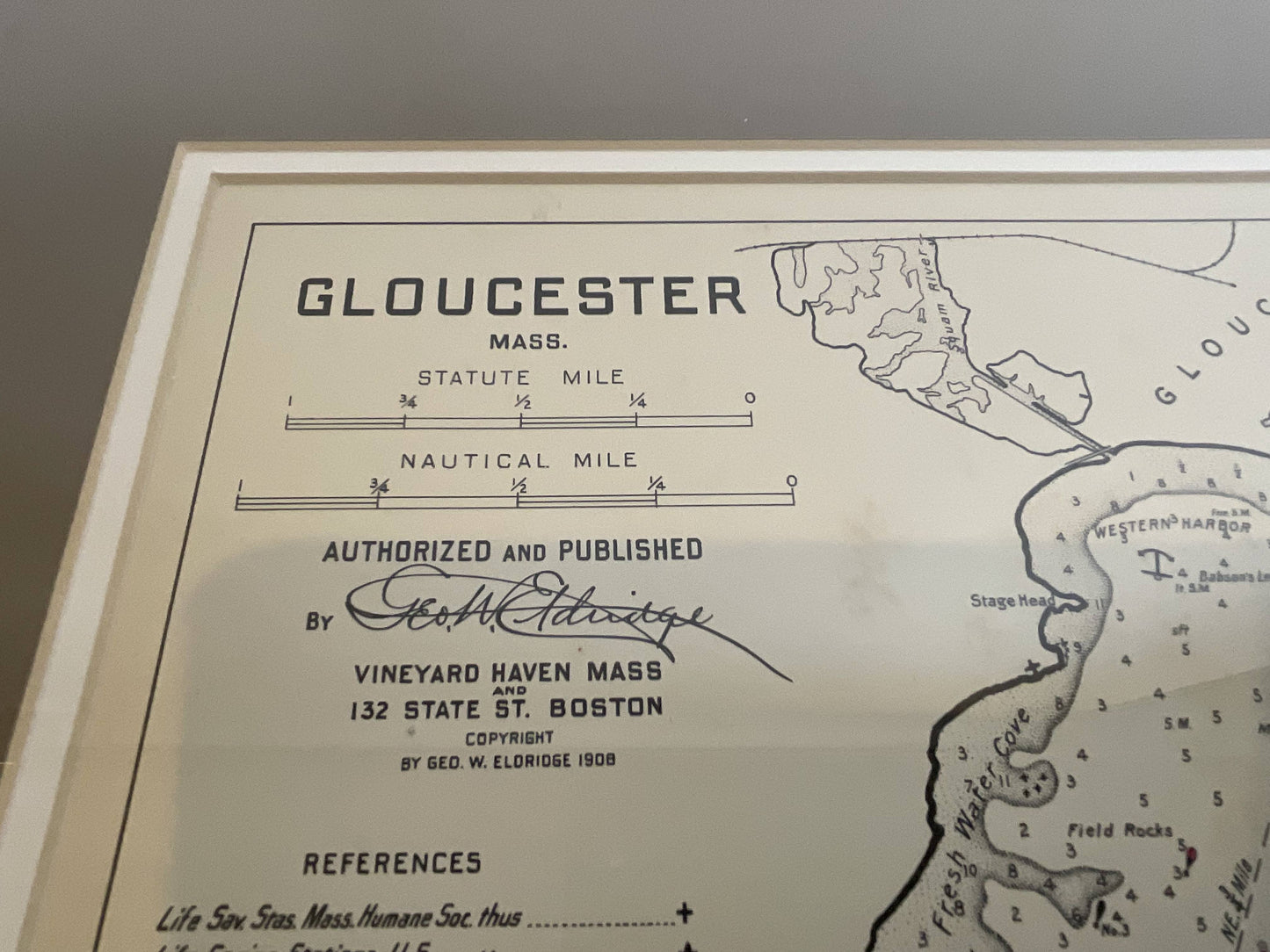
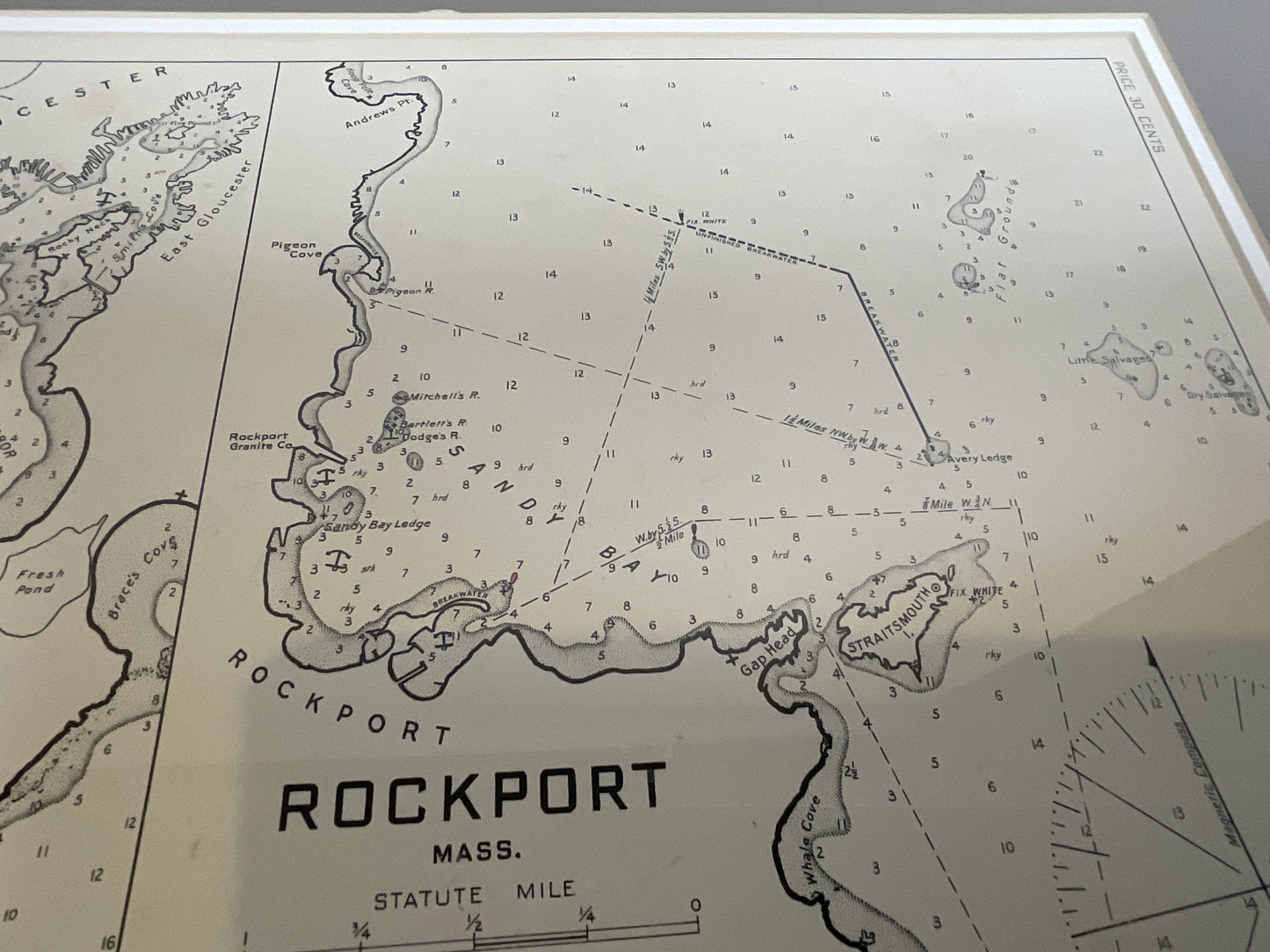
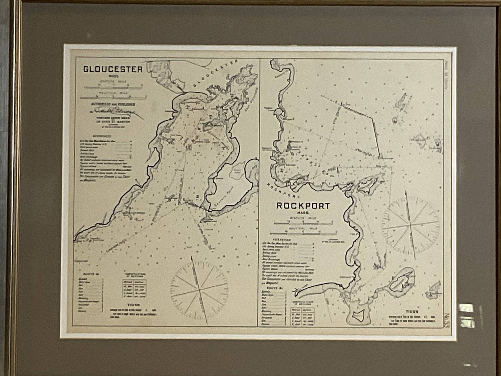
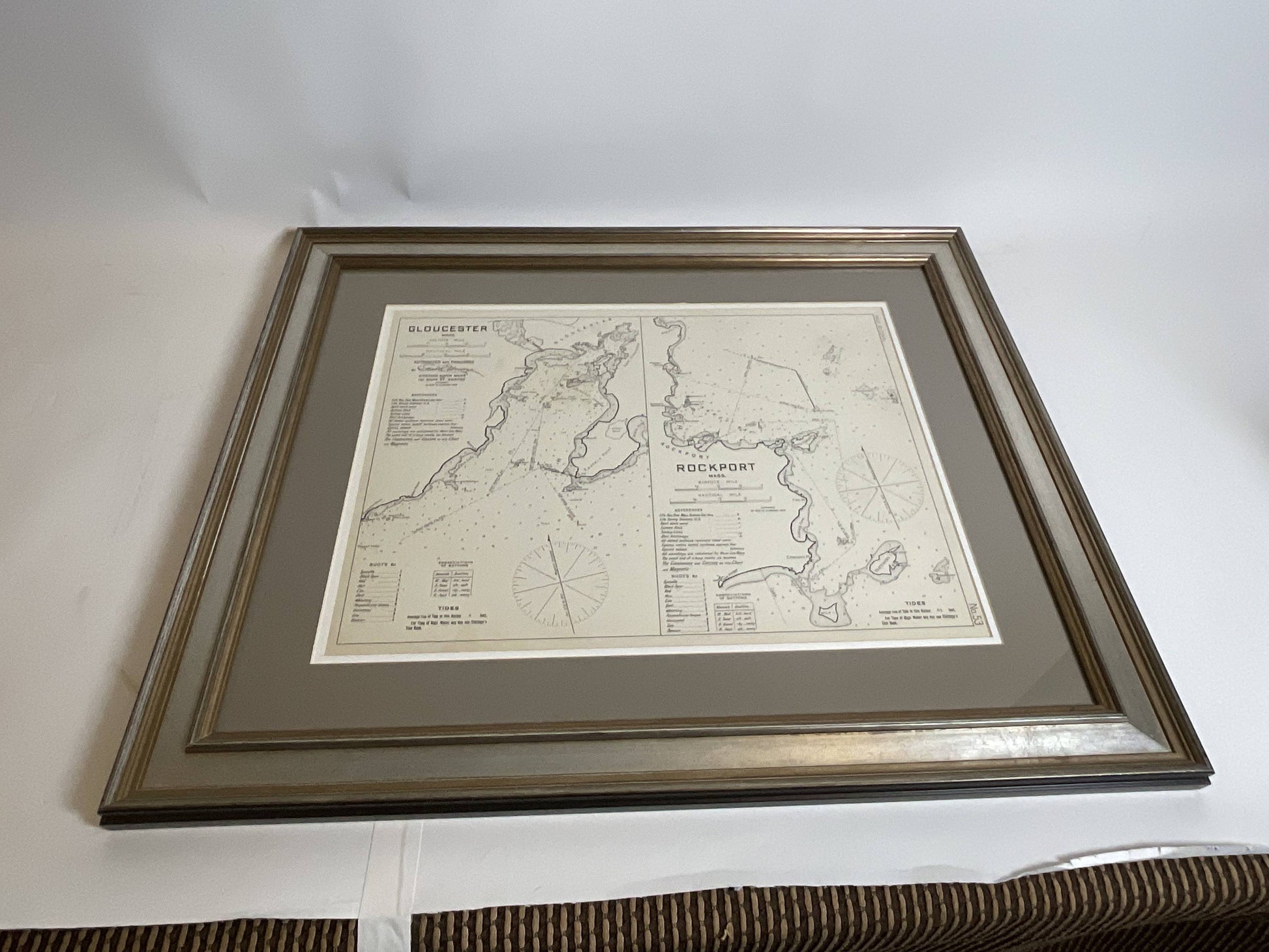
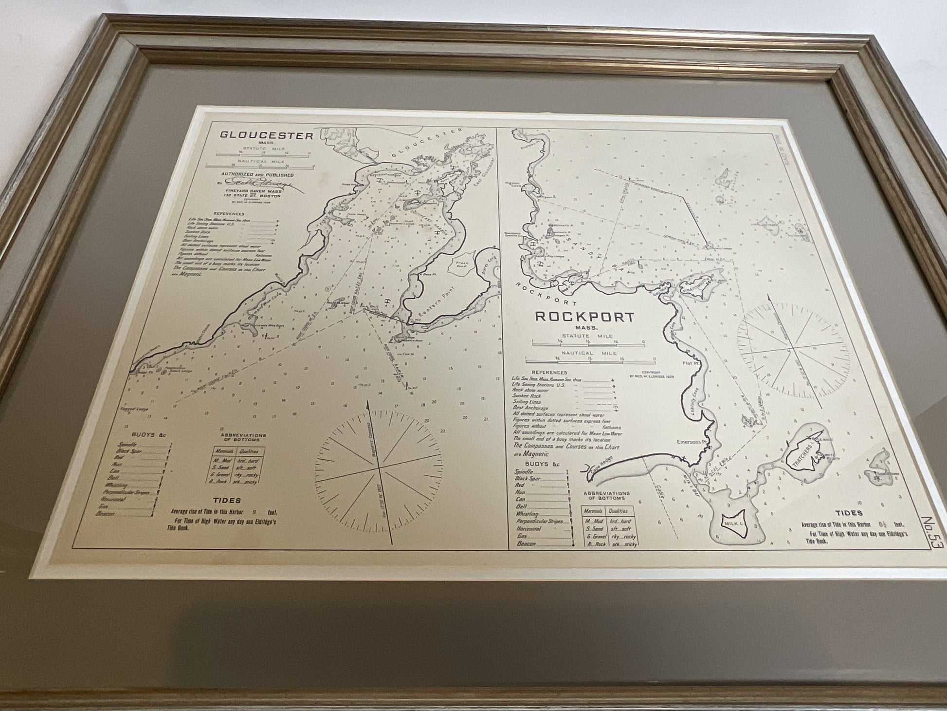
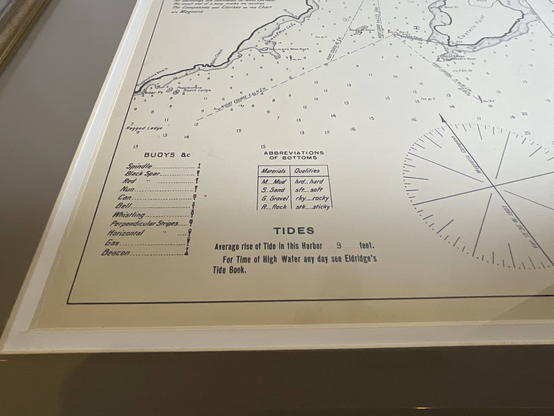
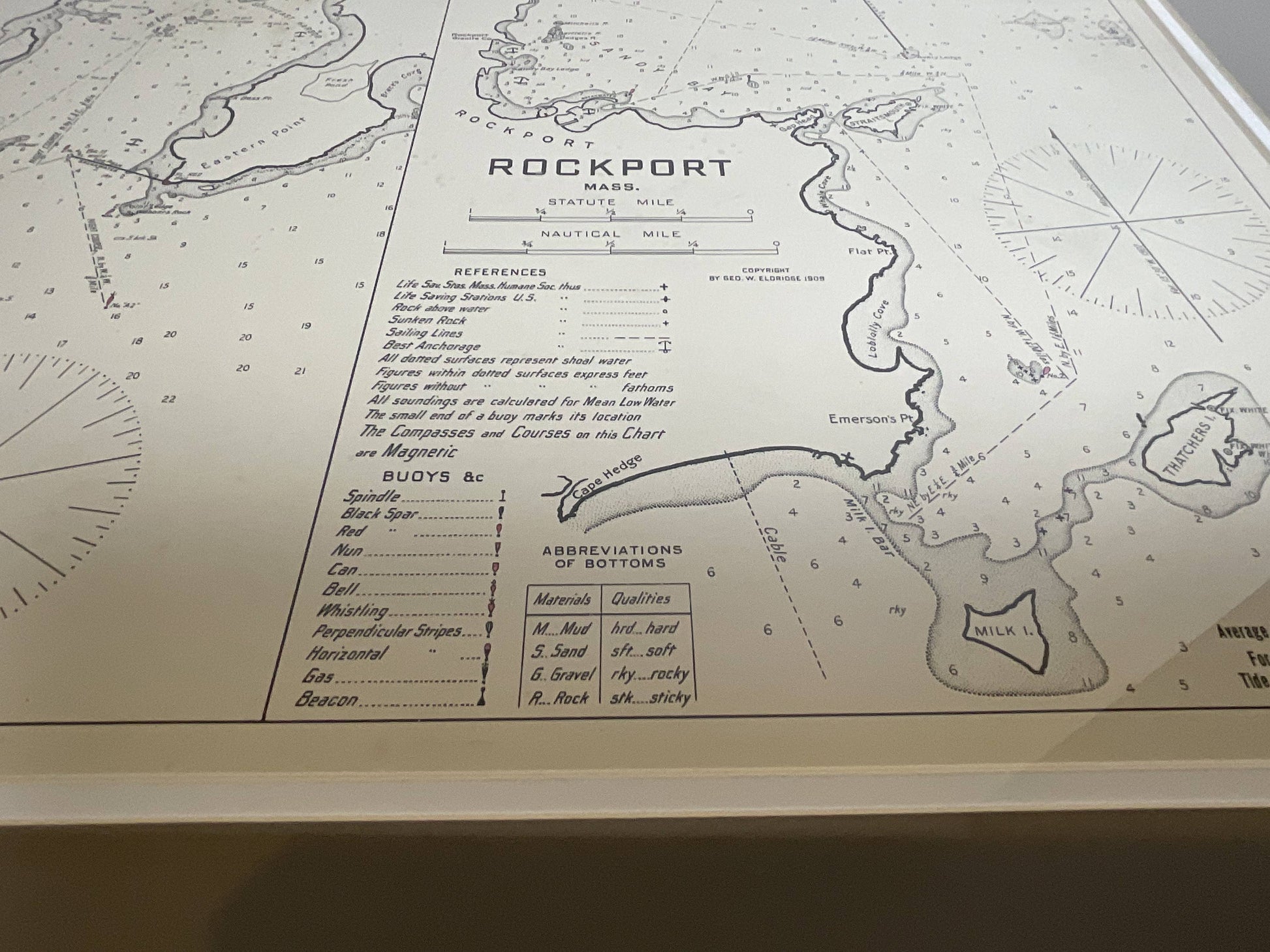
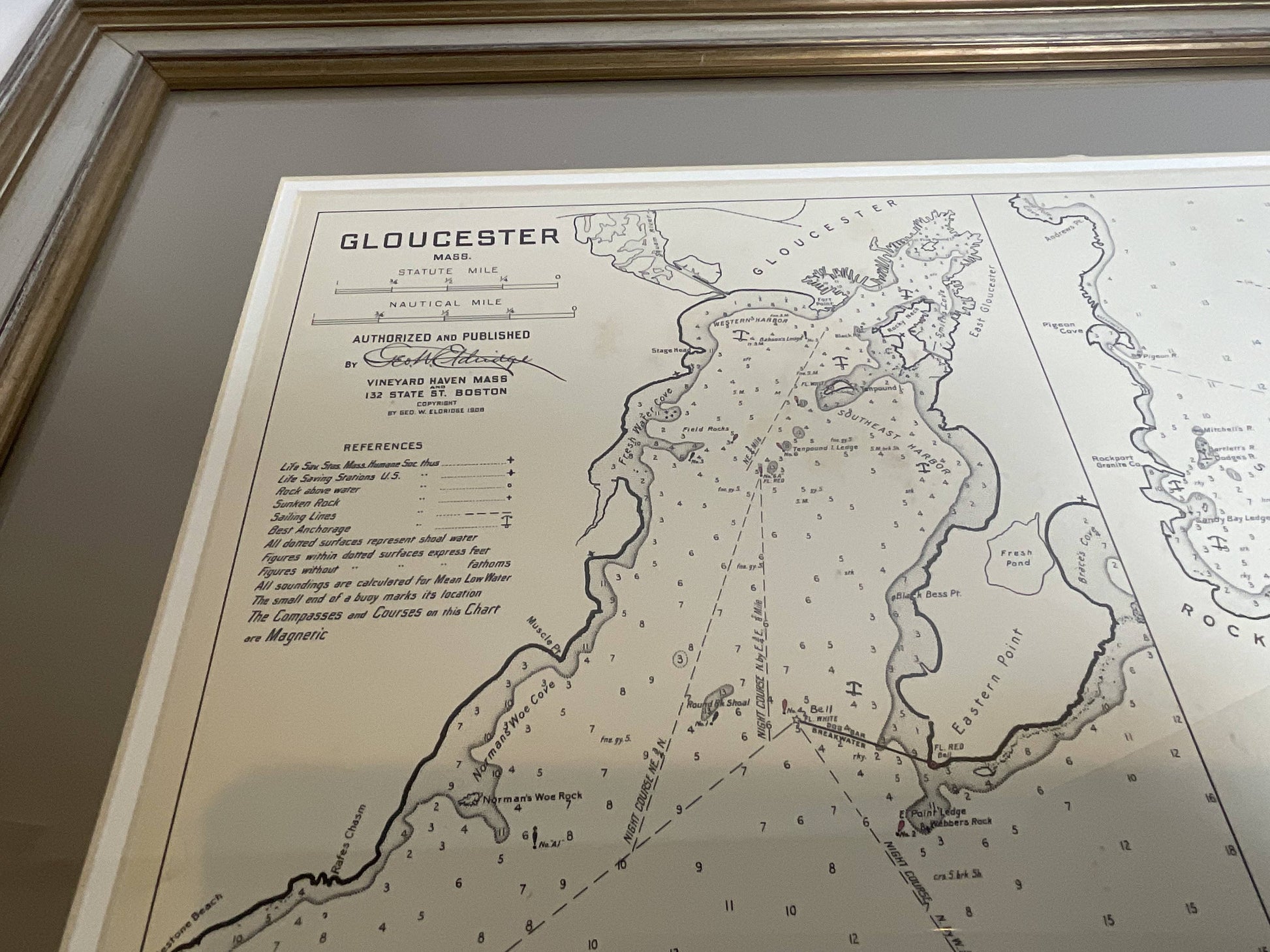
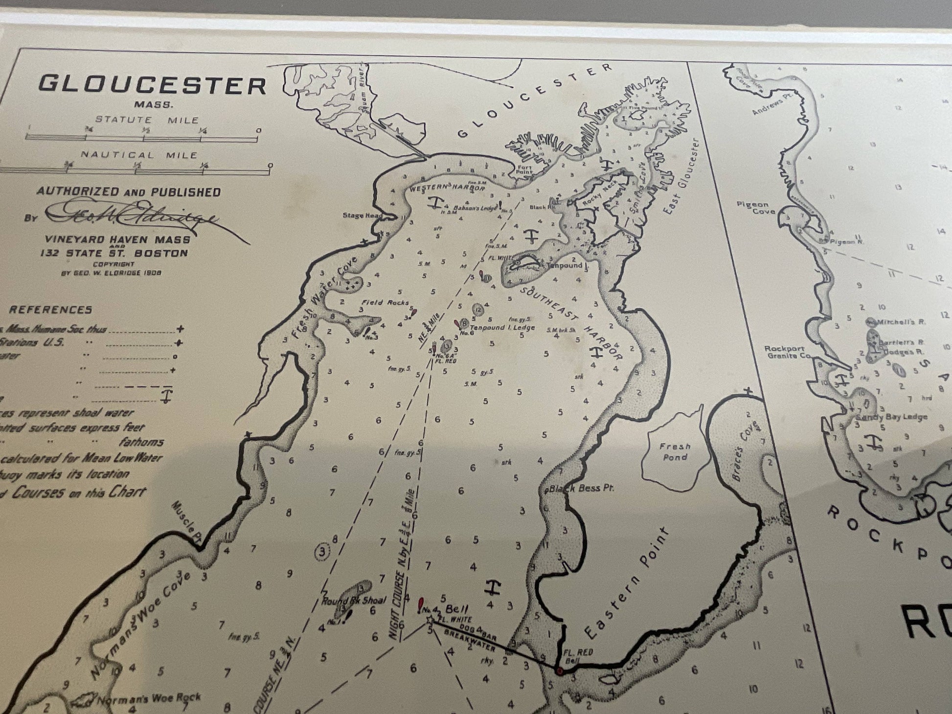
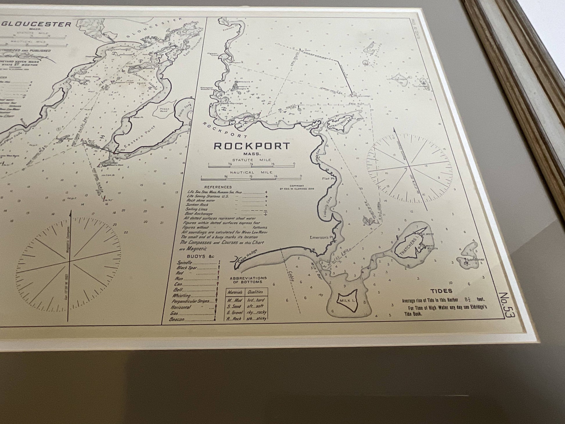
Mariners Chart of Gloucester and Rockport by George Eldridge 1910
Mariners Chart of Gloucester and Rockport by George Eldridge 1910
Regular price
$ 349.00 USD
Regular price
Sale price
$ 349.00 USD
Unit price
per
Couldn't load pickup availability
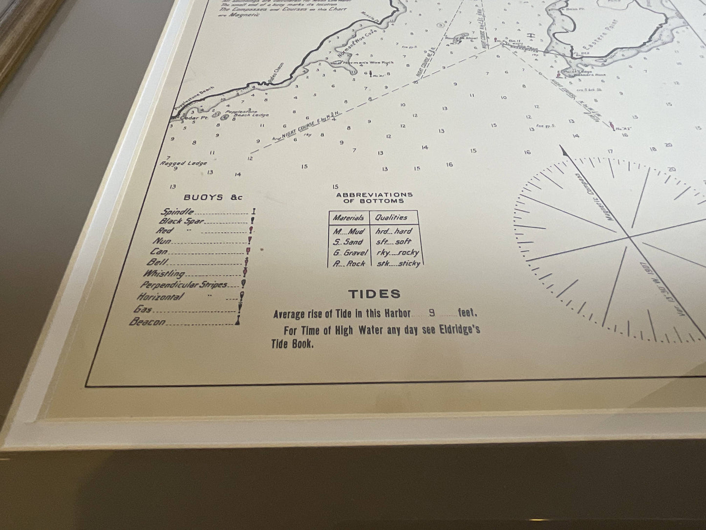
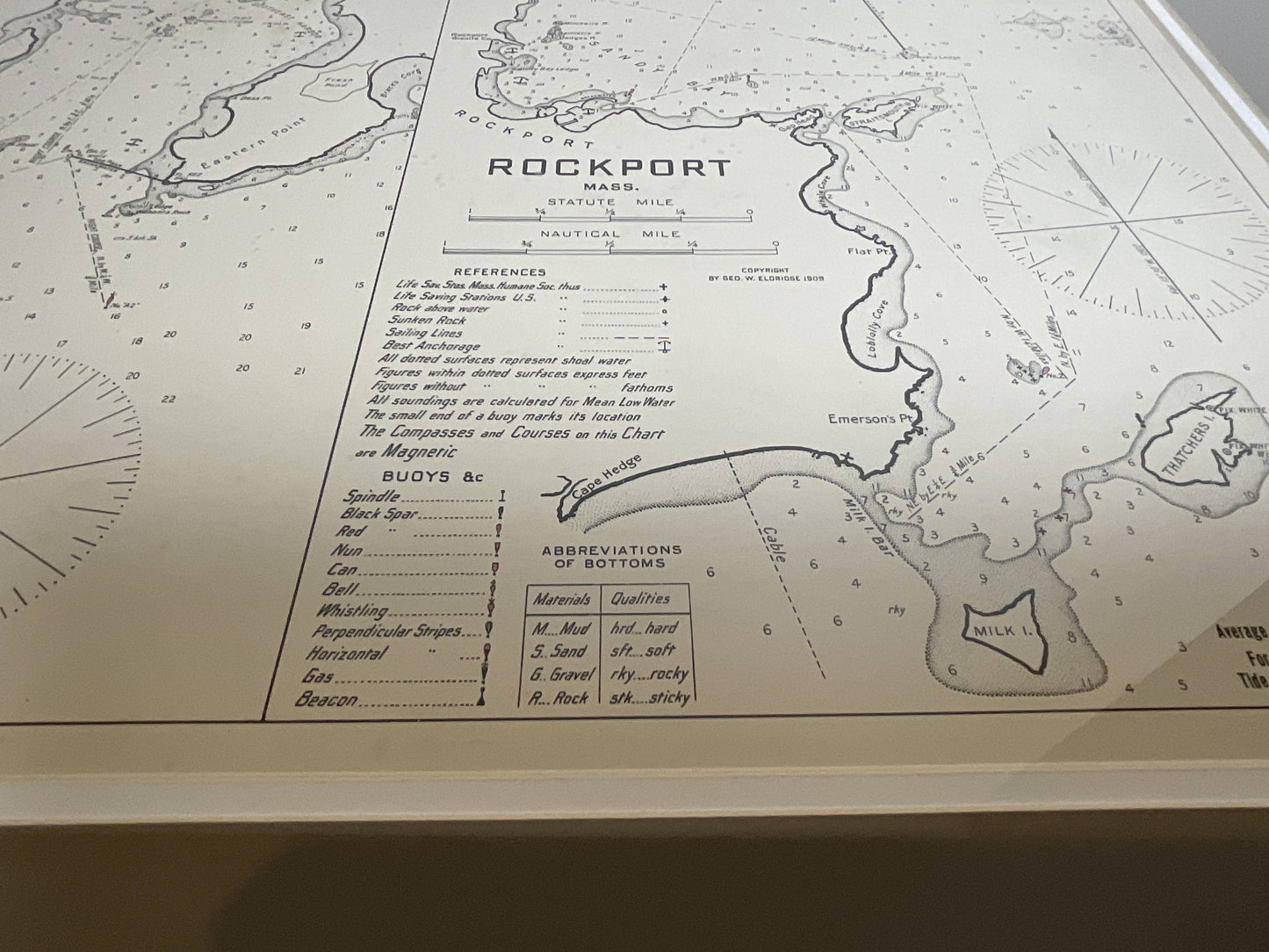
Nautical chart showing the harbor and local water. The chart display depths buoys, lighthouses, etc., This chart shows Eastern Point, Rocky Neck, Stage head, Thatcher Island, Sandy Bay, Pigeon Cove., (1821 - 1900) George Eldridge and his son George Washington Eldridge (1845-1912) were leading sea chart and sailing guide publishers from the mid 19th to the early twentieth century. George Eldridge was a fisherman who suffered an injury so he flourished as a cartographer. His bold easy to read charts were favored by mariners. He also issued an annual tide book. Matted and framed.
Weight: 7 lbs.
Overall Dimensions: 23"H x 28"W
Made: America
Material: Paper
Date: 1910