


Lannan Gallery
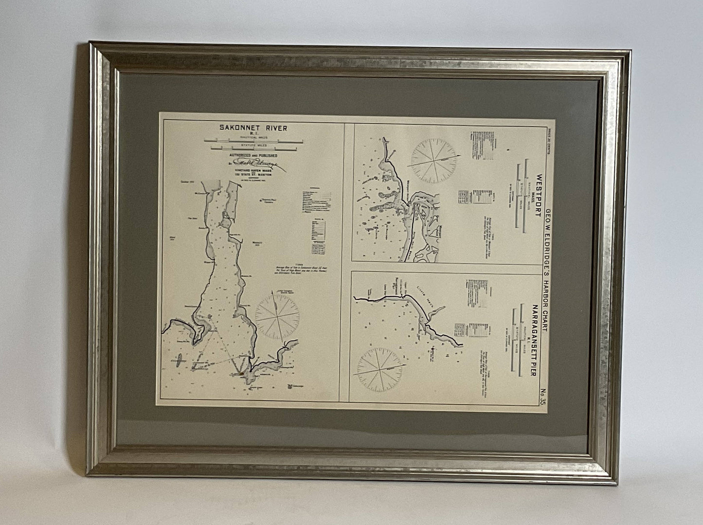
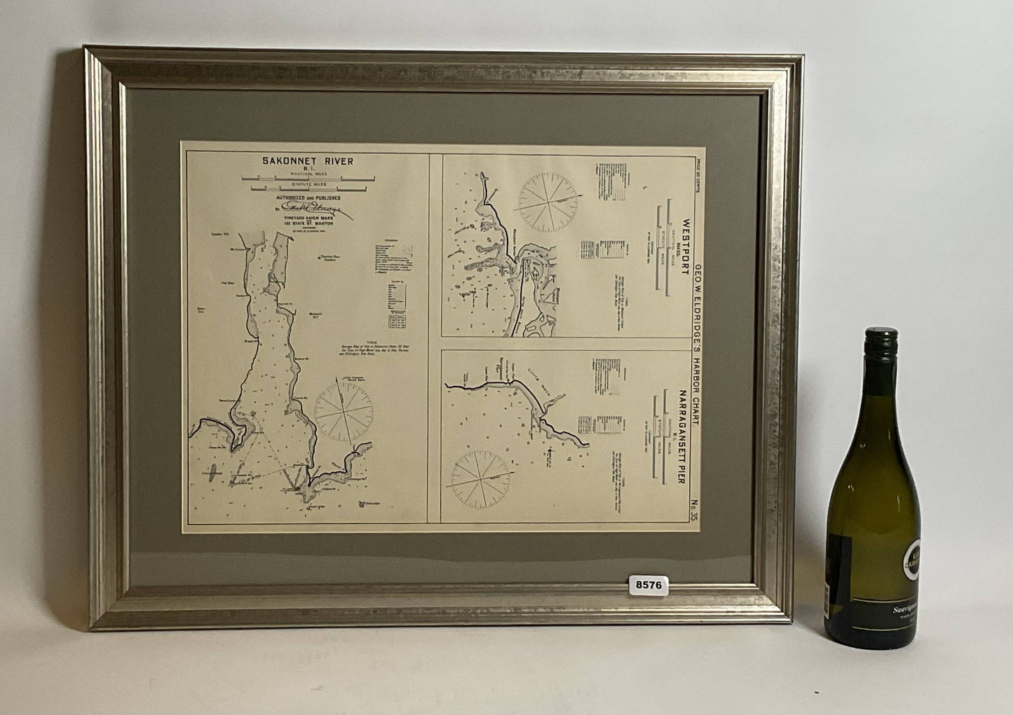
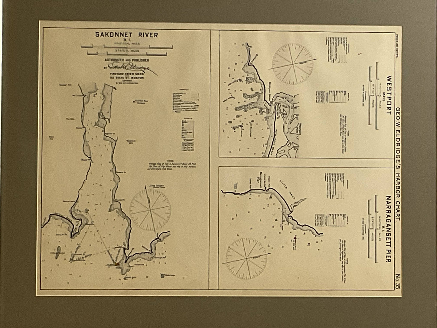
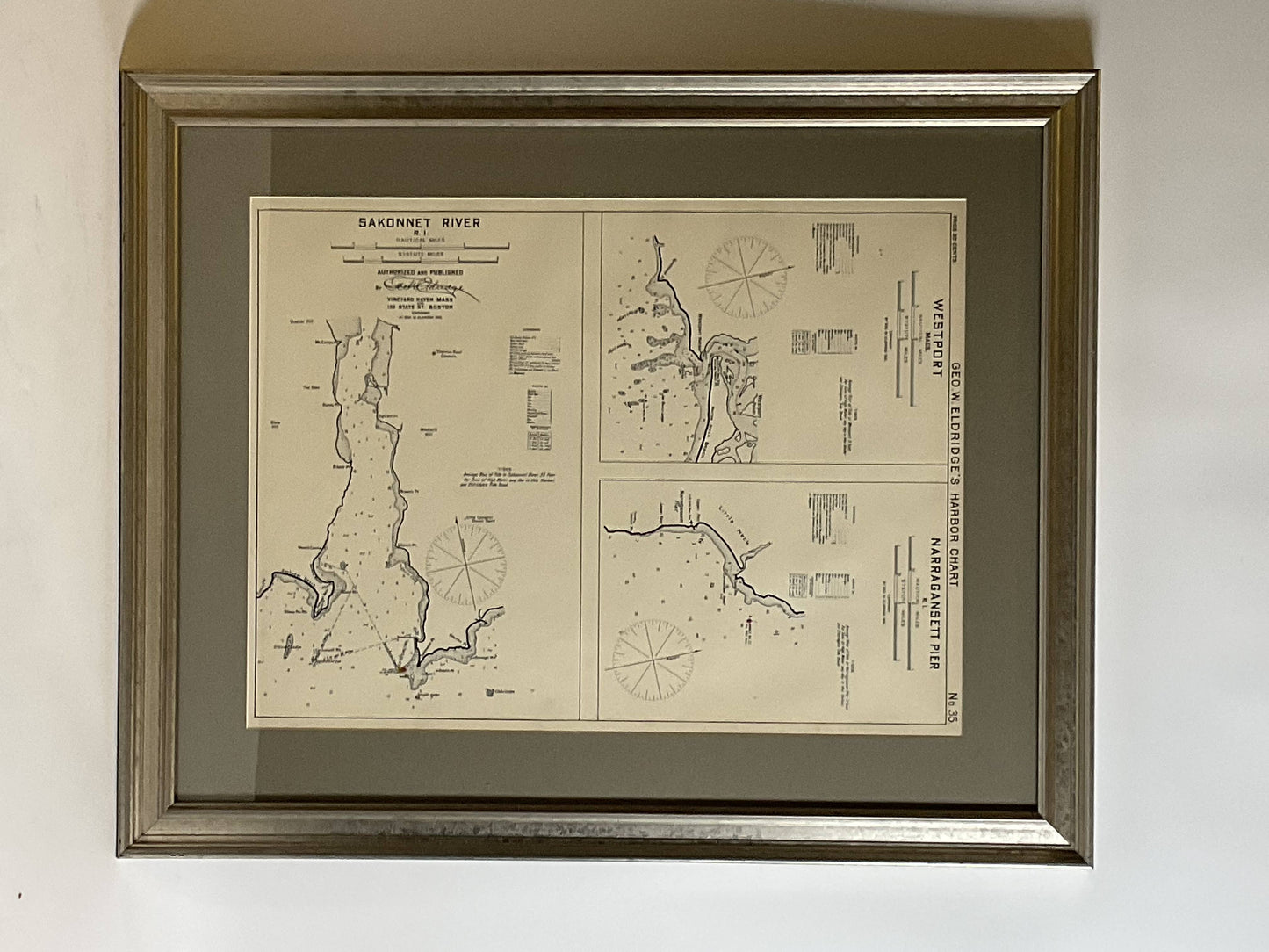
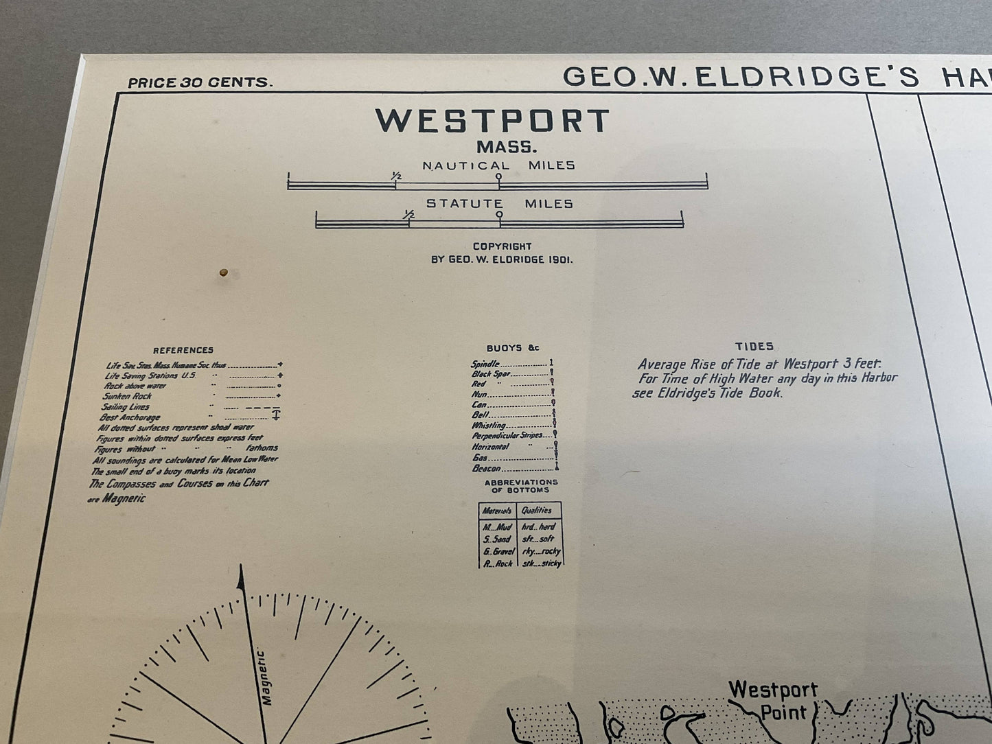
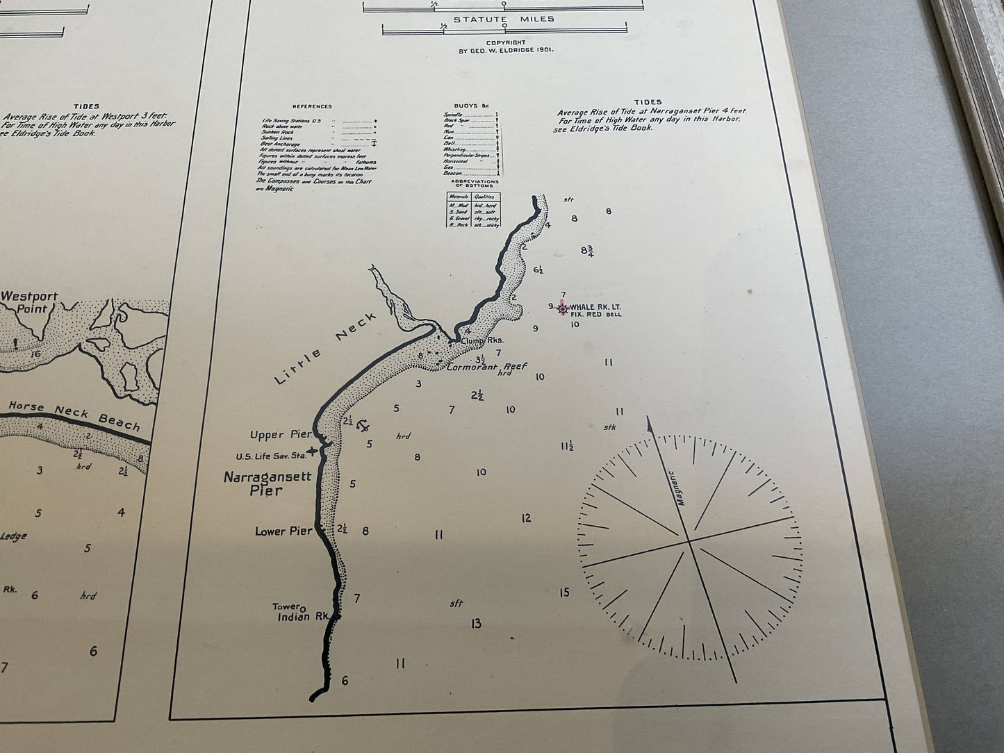
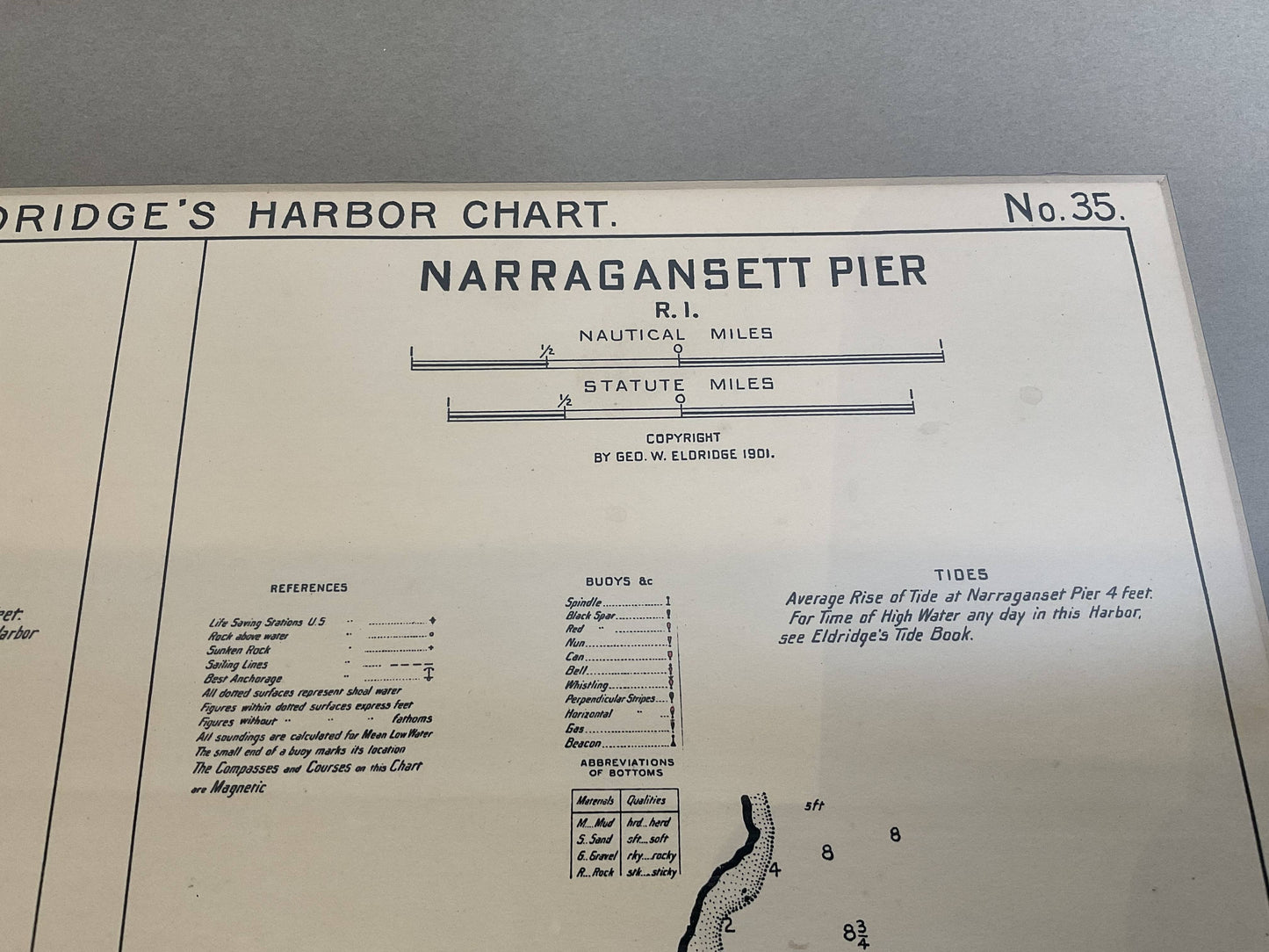
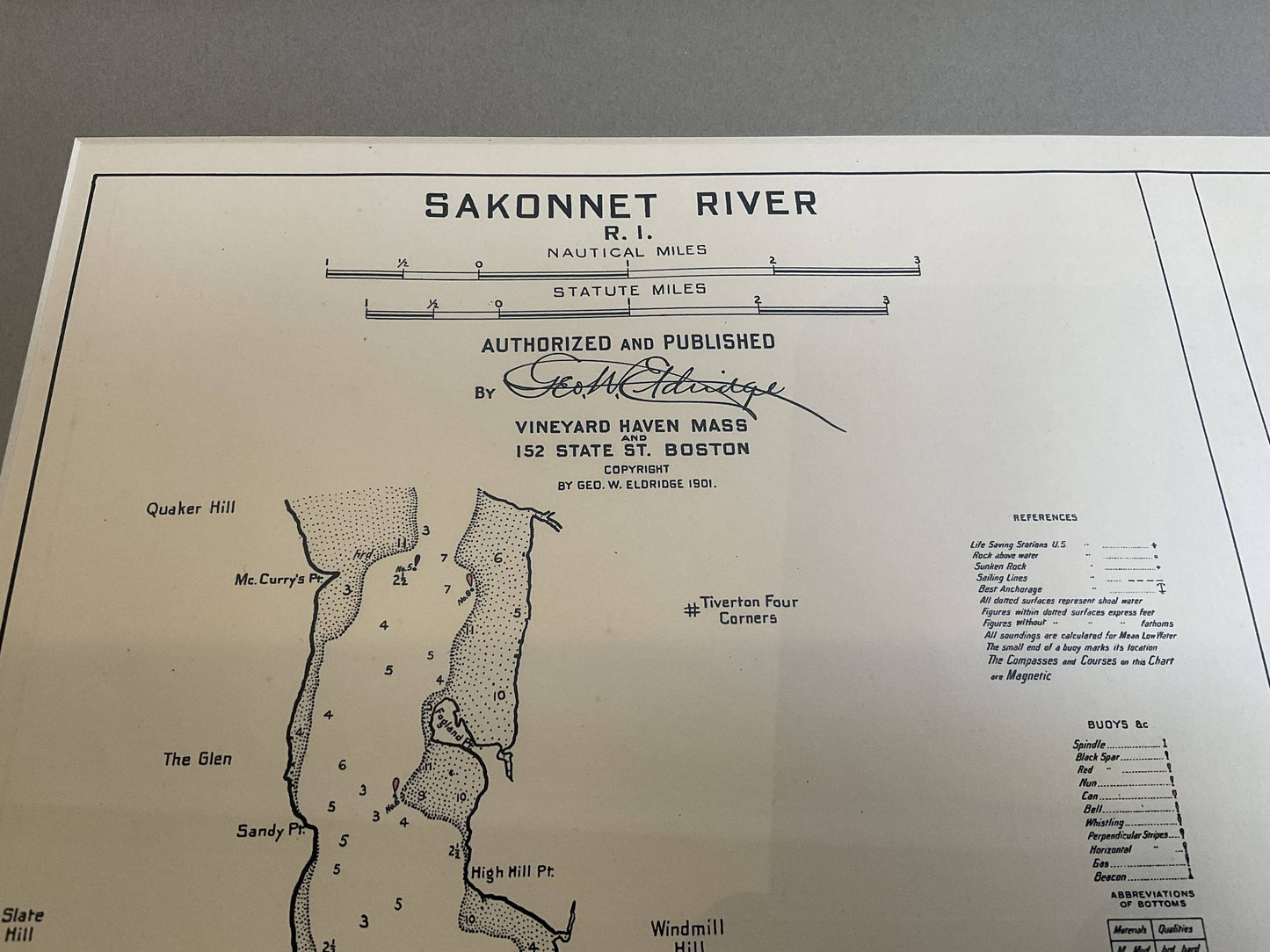
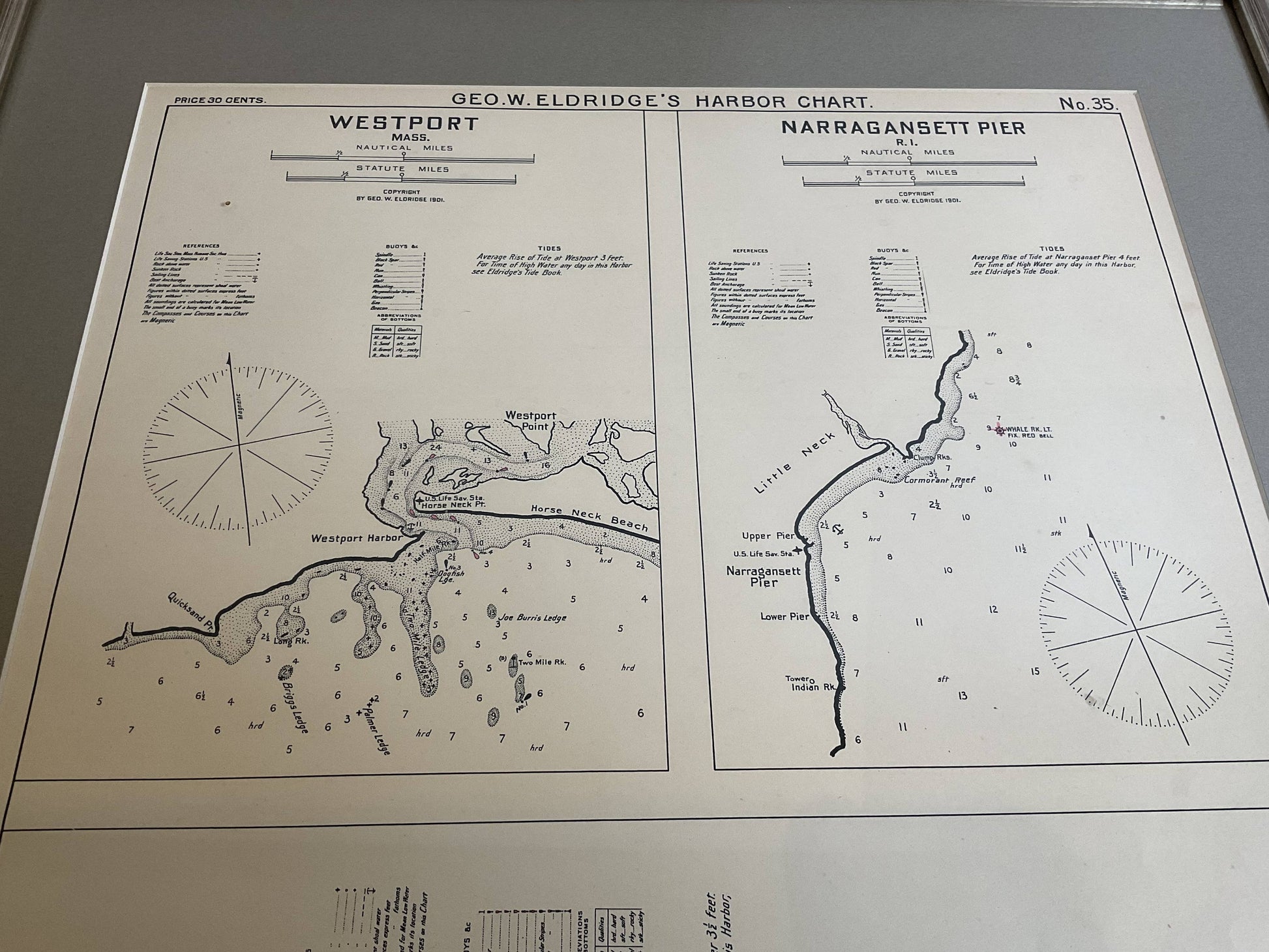
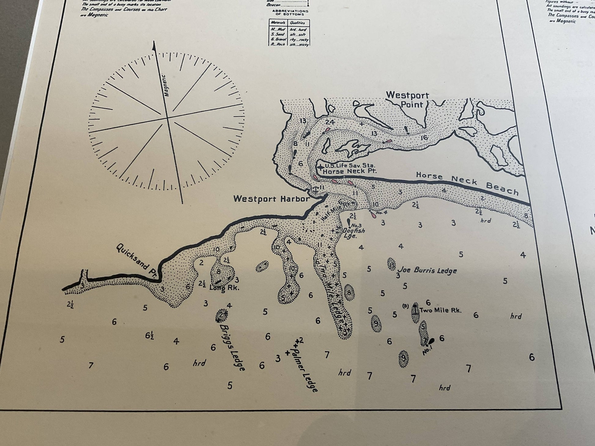
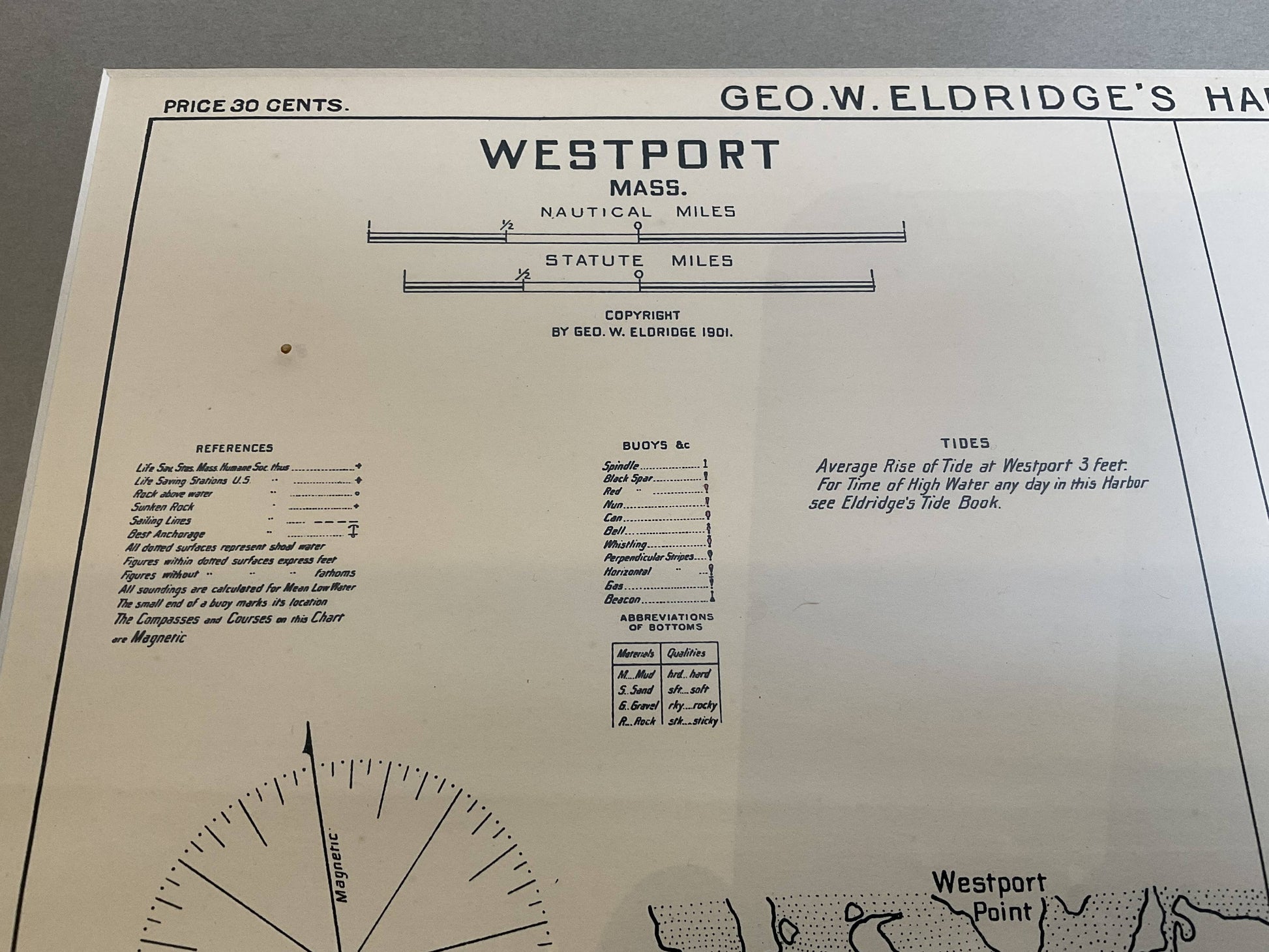
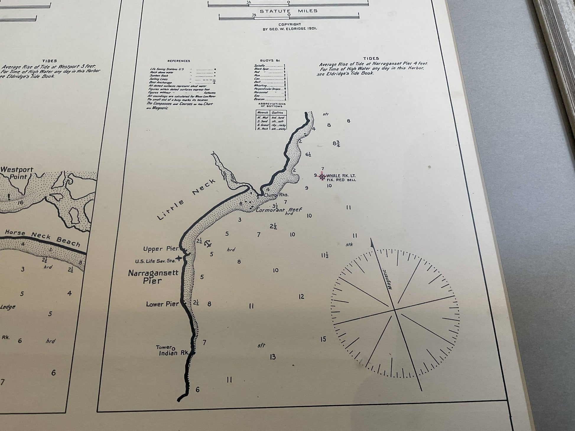
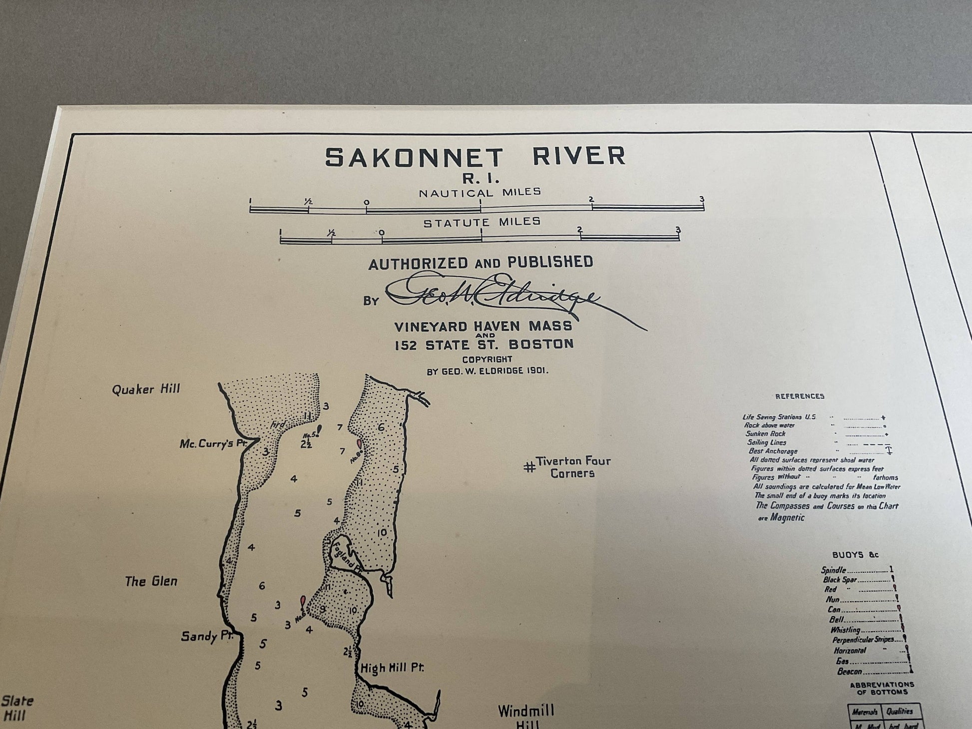
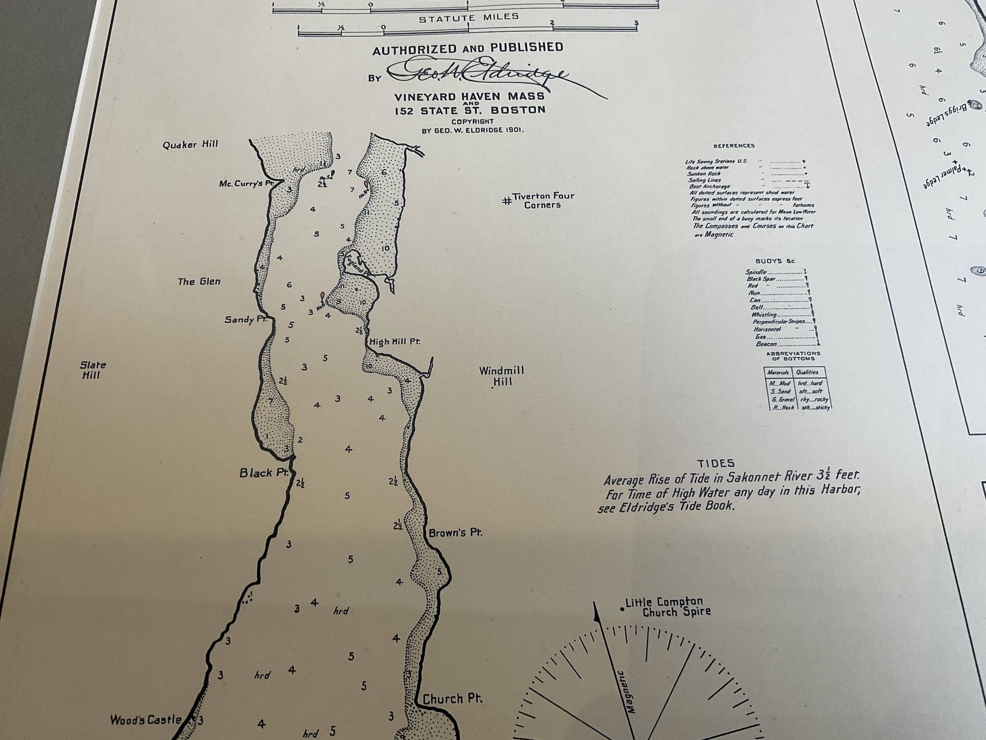
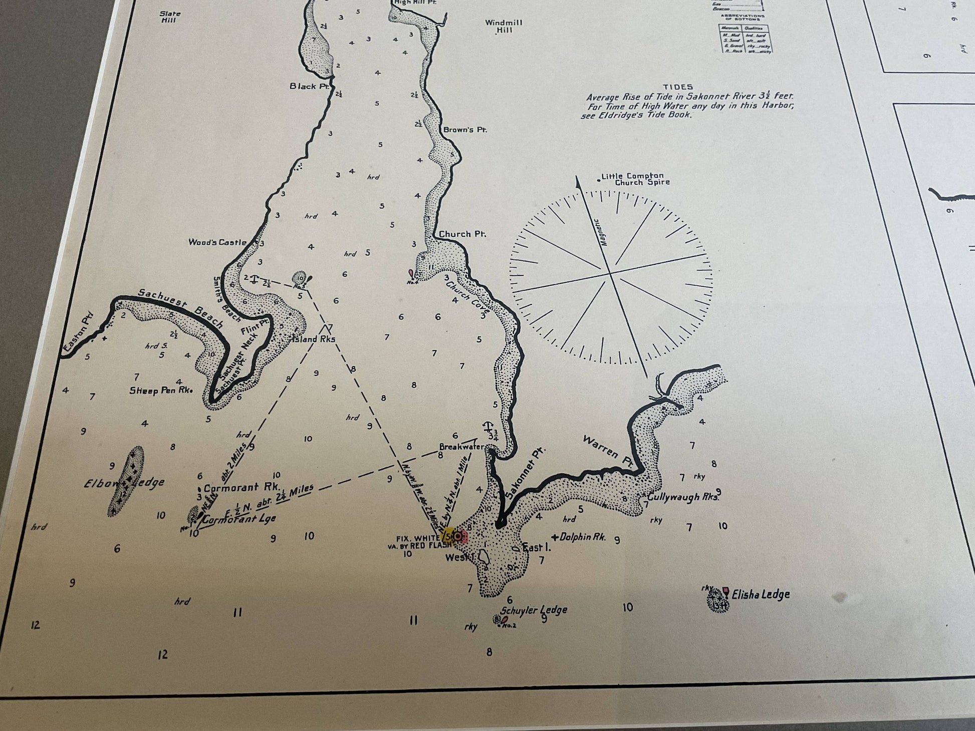
Mariners Chart of Westport Mass and Narraganset Pier by George Eldridge 1901
Mariners Chart of Westport Mass and Narraganset Pier by George Eldridge 1901
Couldn't load pickup availability
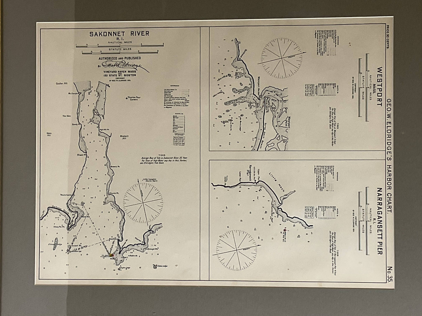
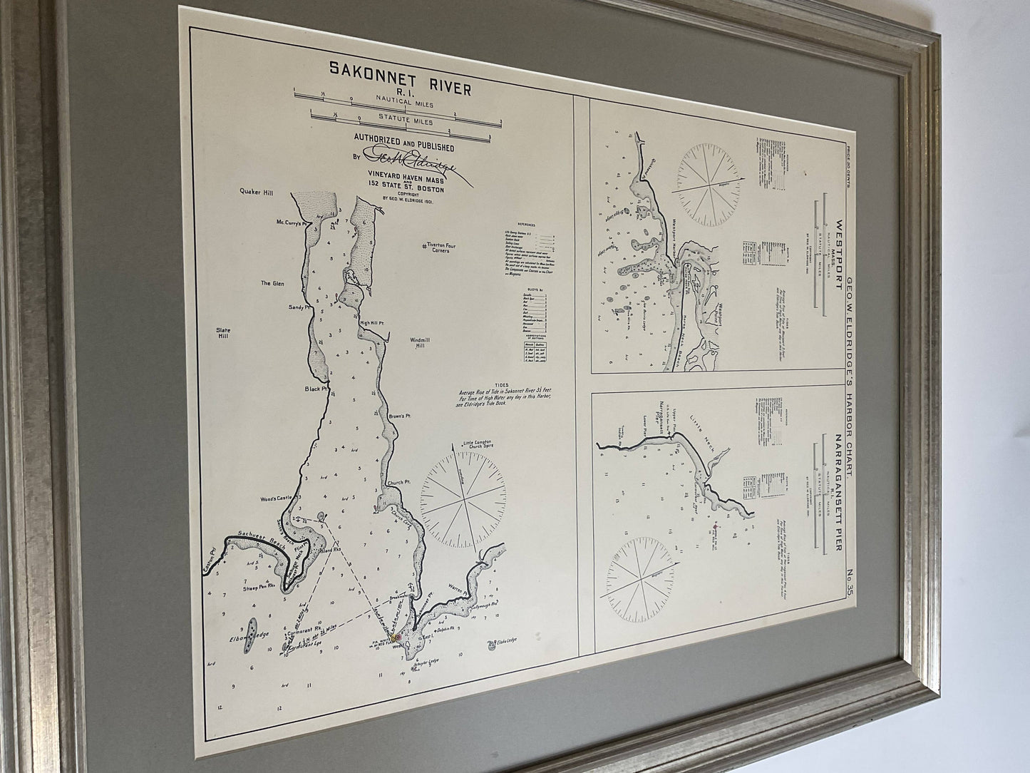
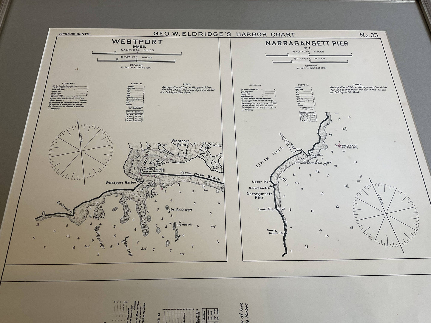
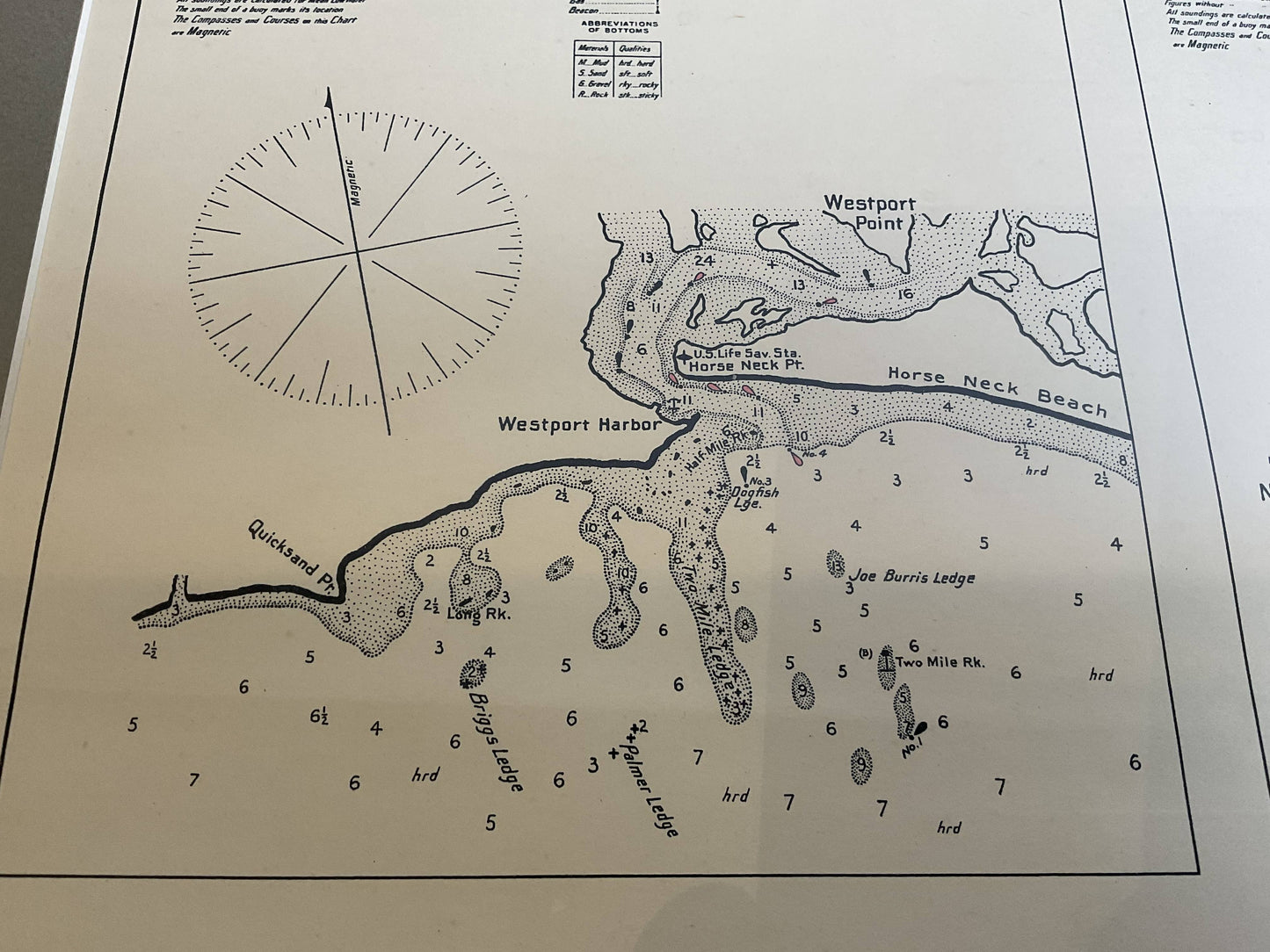
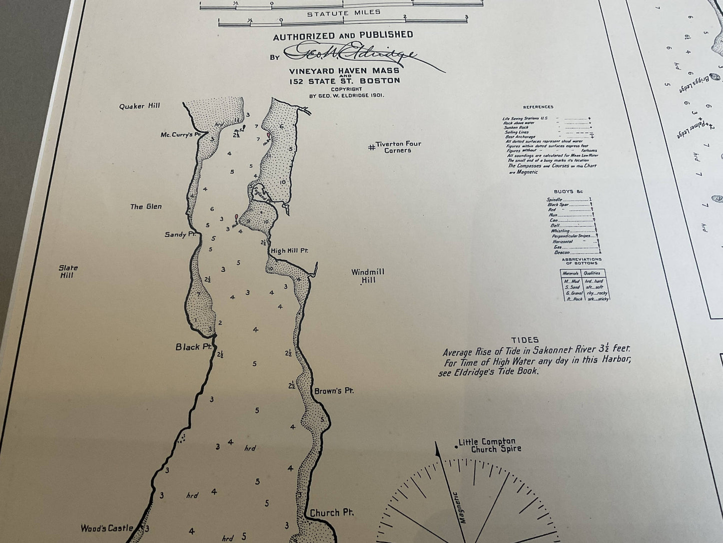
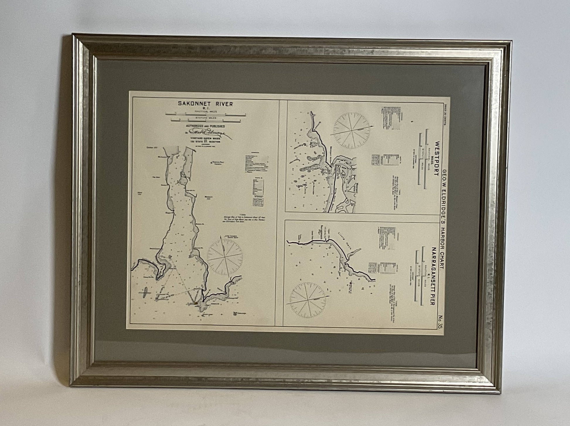
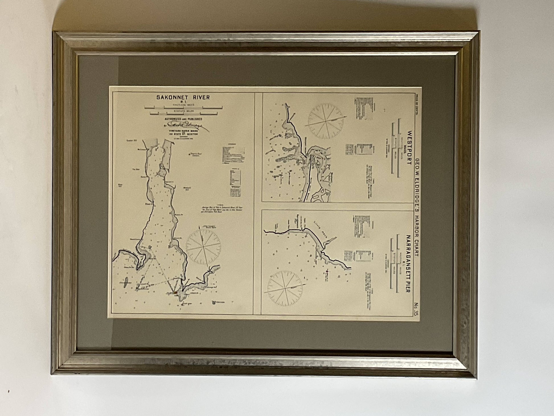
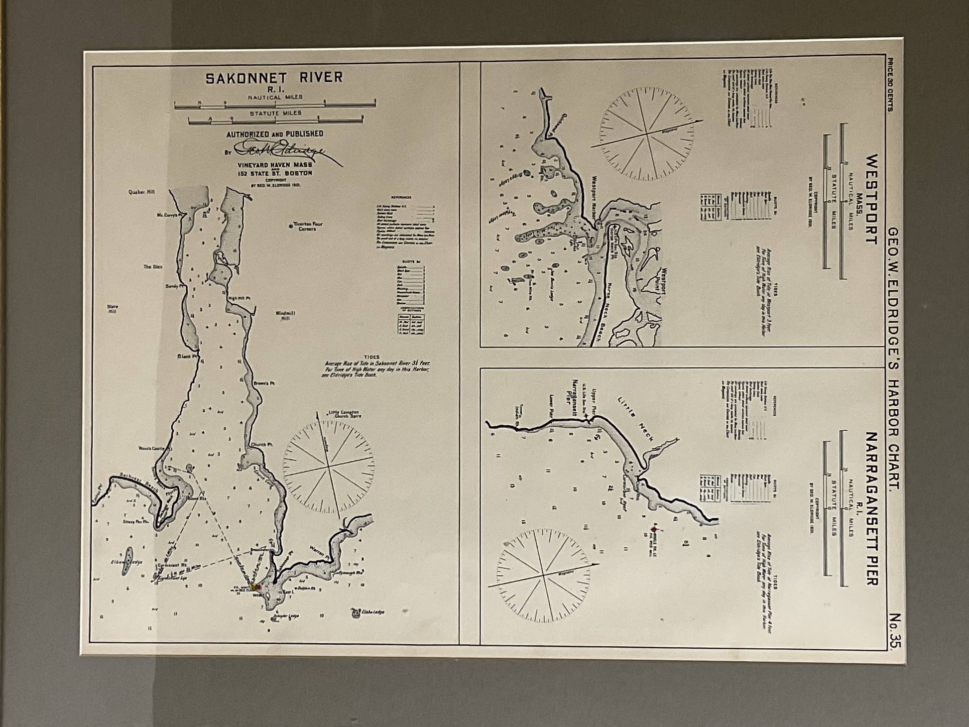
Original Nautical chart showing the harbor and local waters of Westport Mass, Narraganset Pier R.I. The chart displays depths, the Narraganset Pier, Little Neck Westport Harbor, Horse Neck Beach, the Sakonnet River, Warren Point, Black Point, etc. (1821 - 1900) George Eldridge and his son George Washington Eldridge (1845-1912) were leading sea chart and sailing guide publishers from the mid 19th to the early twentieth century. George Eldridge was a fisherman who suffered an injury so he flourished as a cartographer. His bold easy to read charts were favored by mariners. He also issued an annual tide book. Dated 1901. Matted and framed.
Weight: 7 lbs.
Overall Dimensions: 23"H x 28"W
Made: America
Material: Paper
Date: 1901