


Lannan Gallery
Mariners charts of Massachusett Long Island by George Eldridge 1901
Mariners charts of Massachusett Long Island by George Eldridge 1901
Couldn't load pickup availability
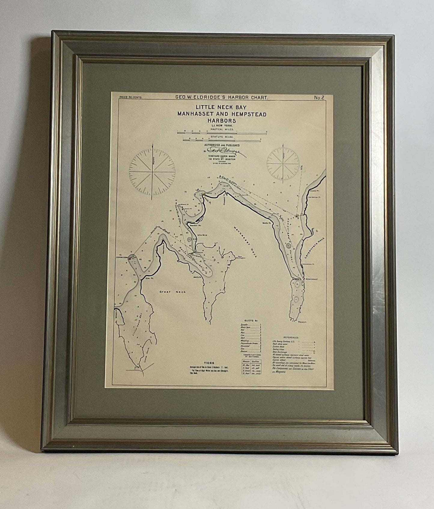
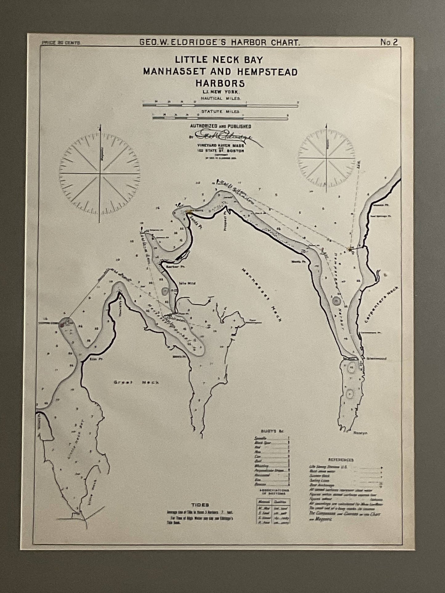
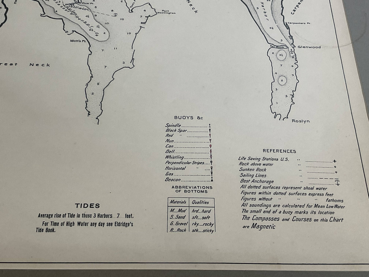
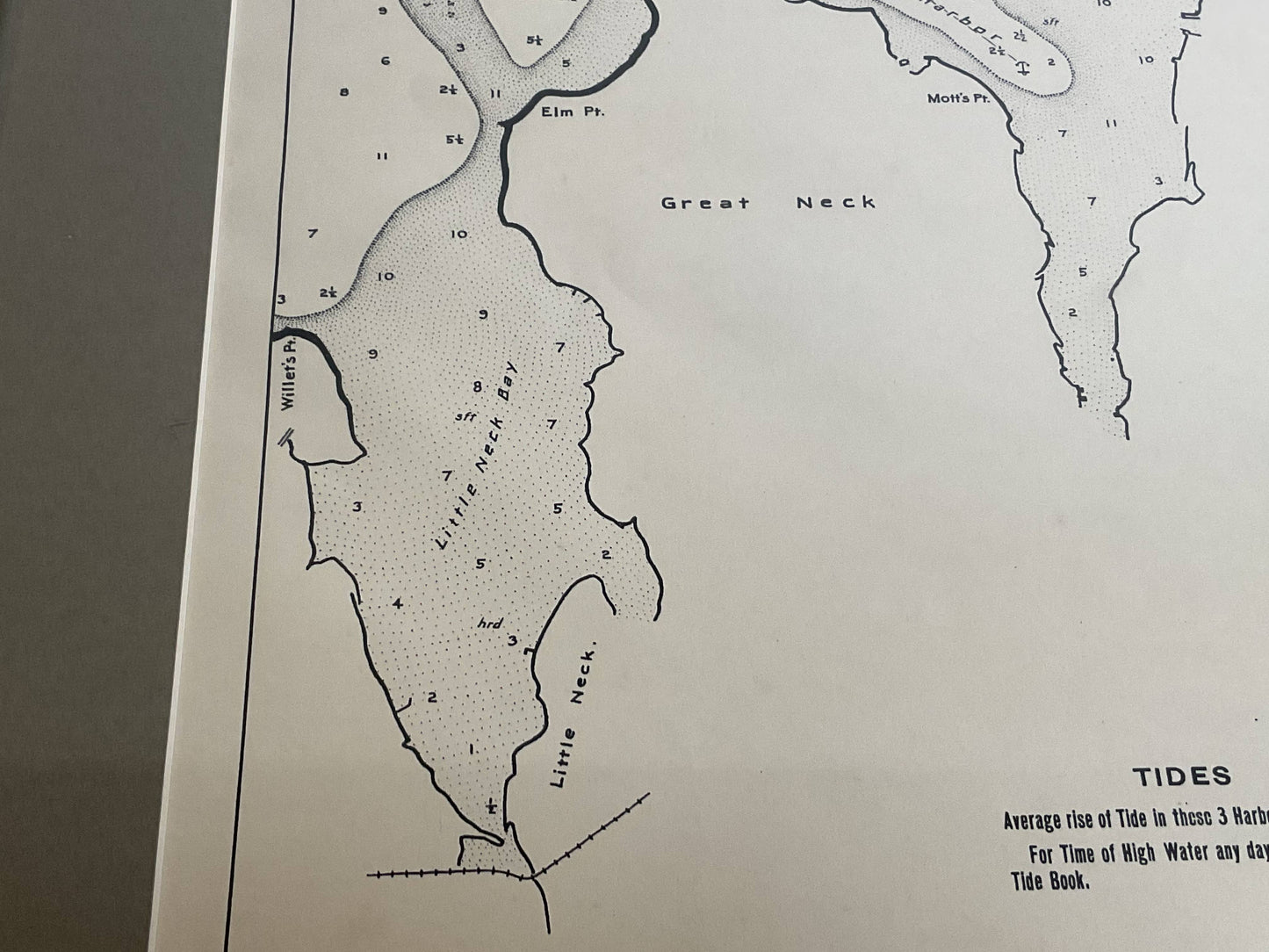
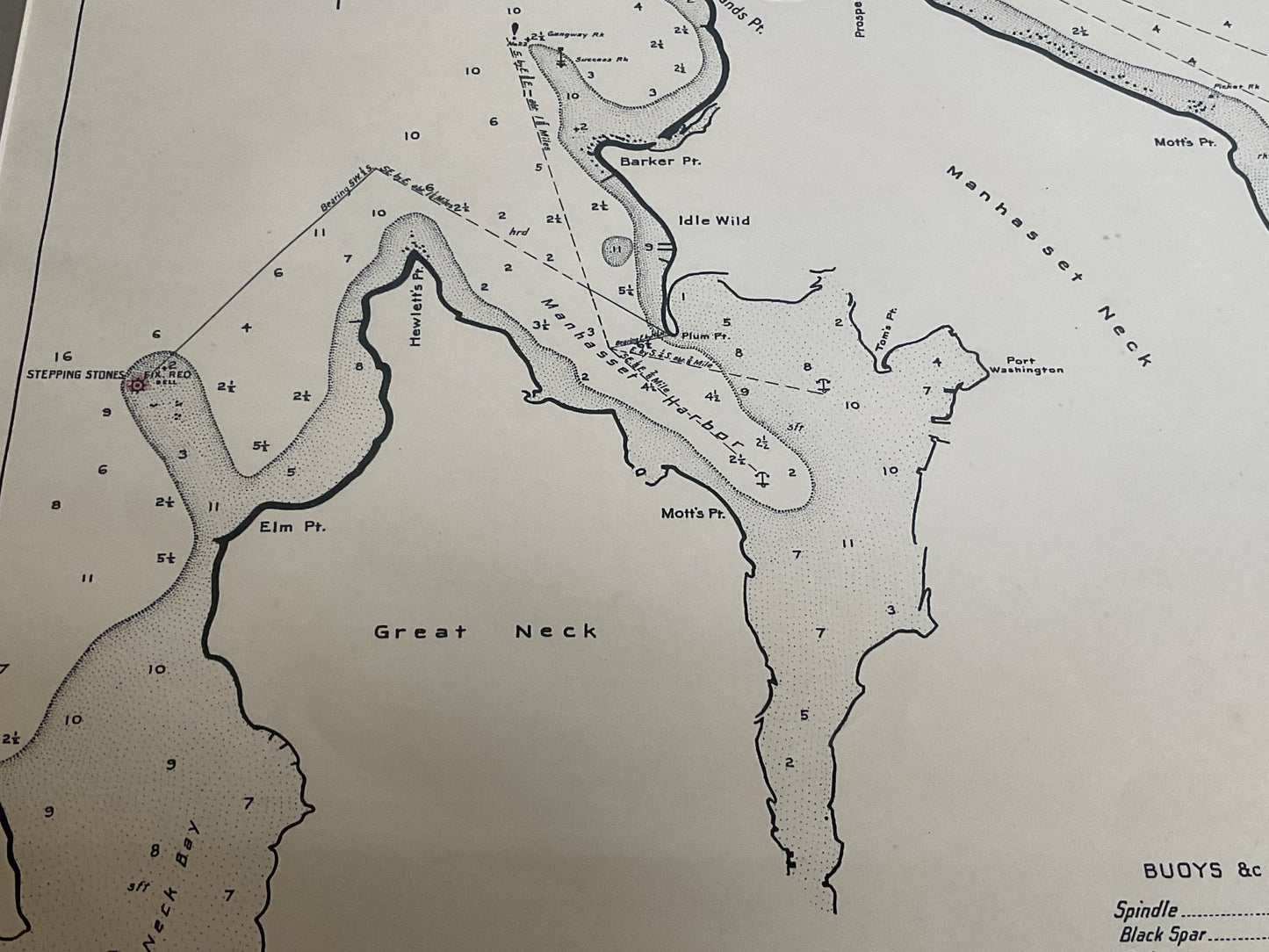
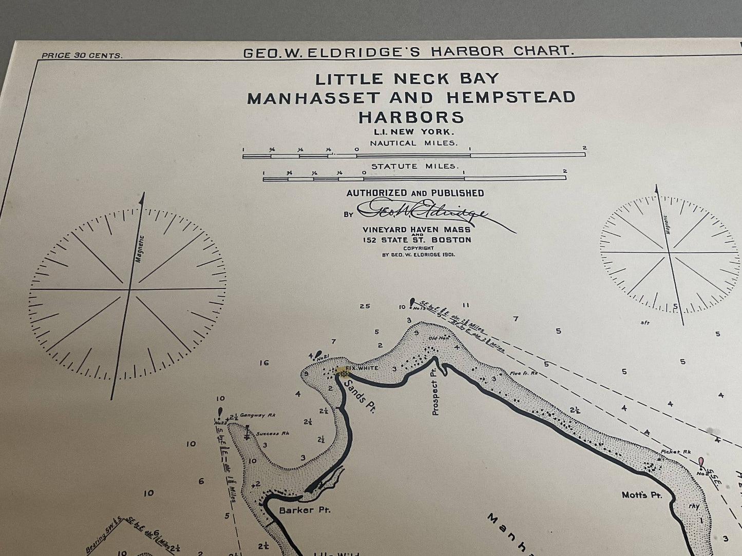
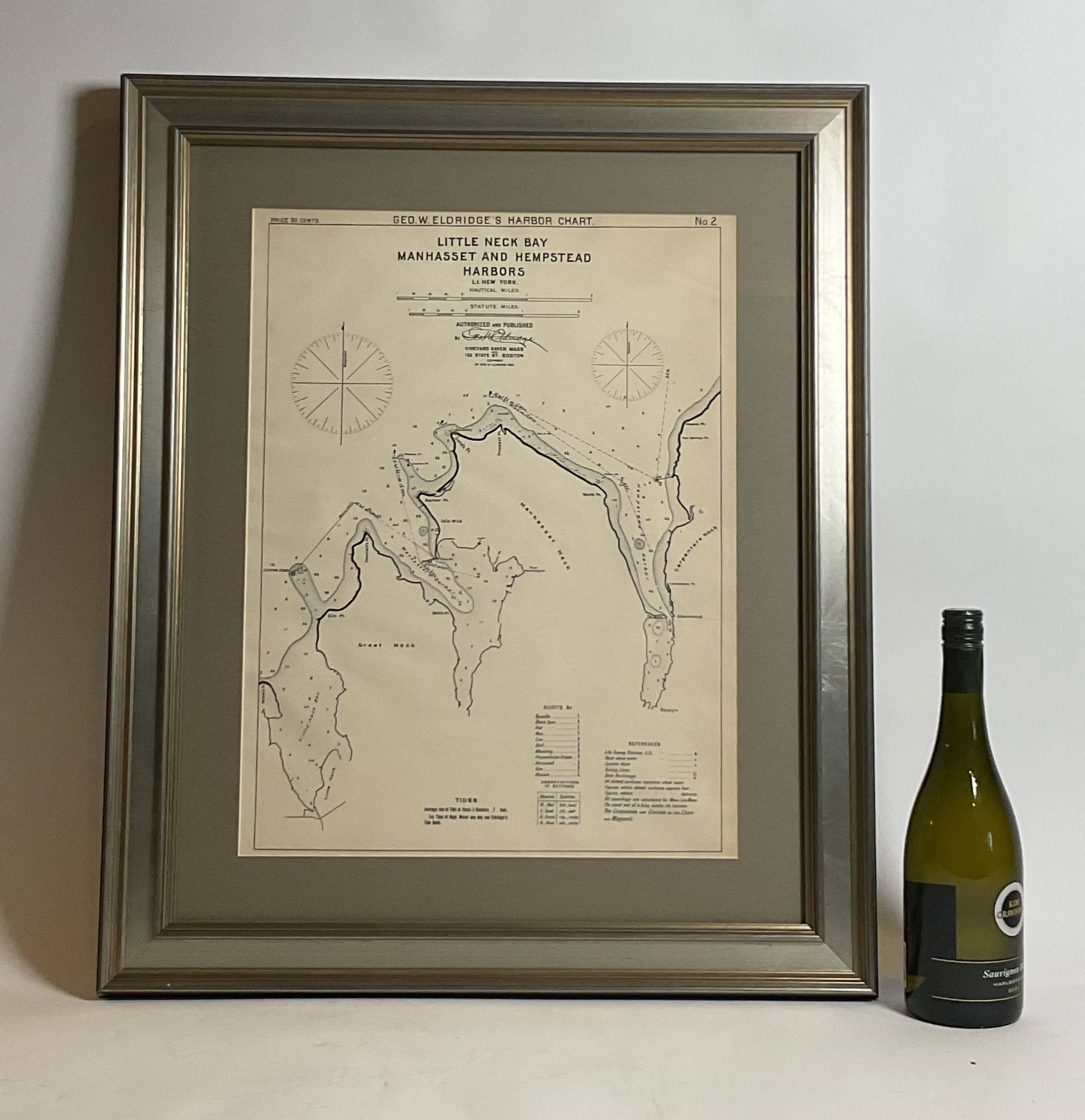
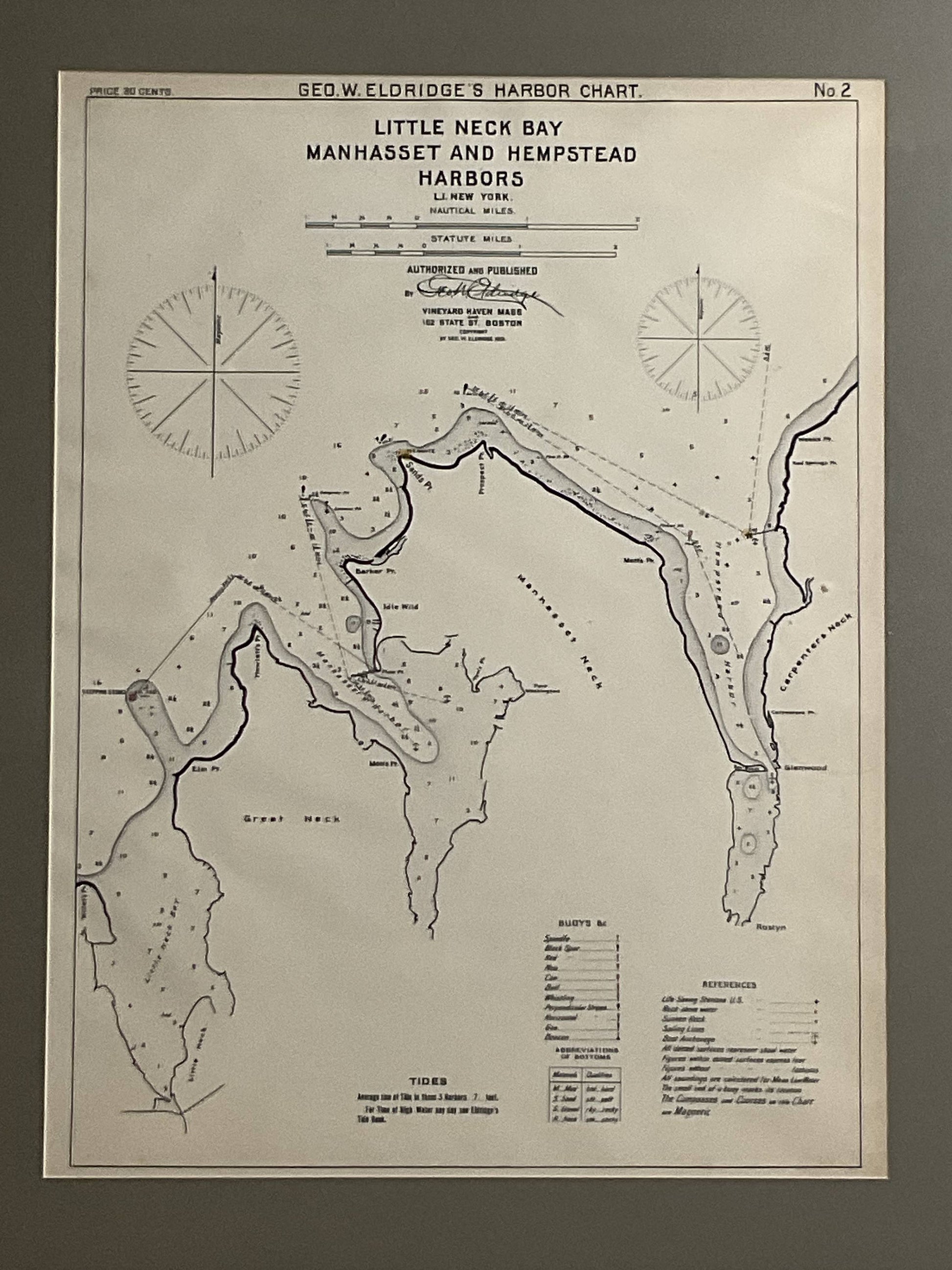
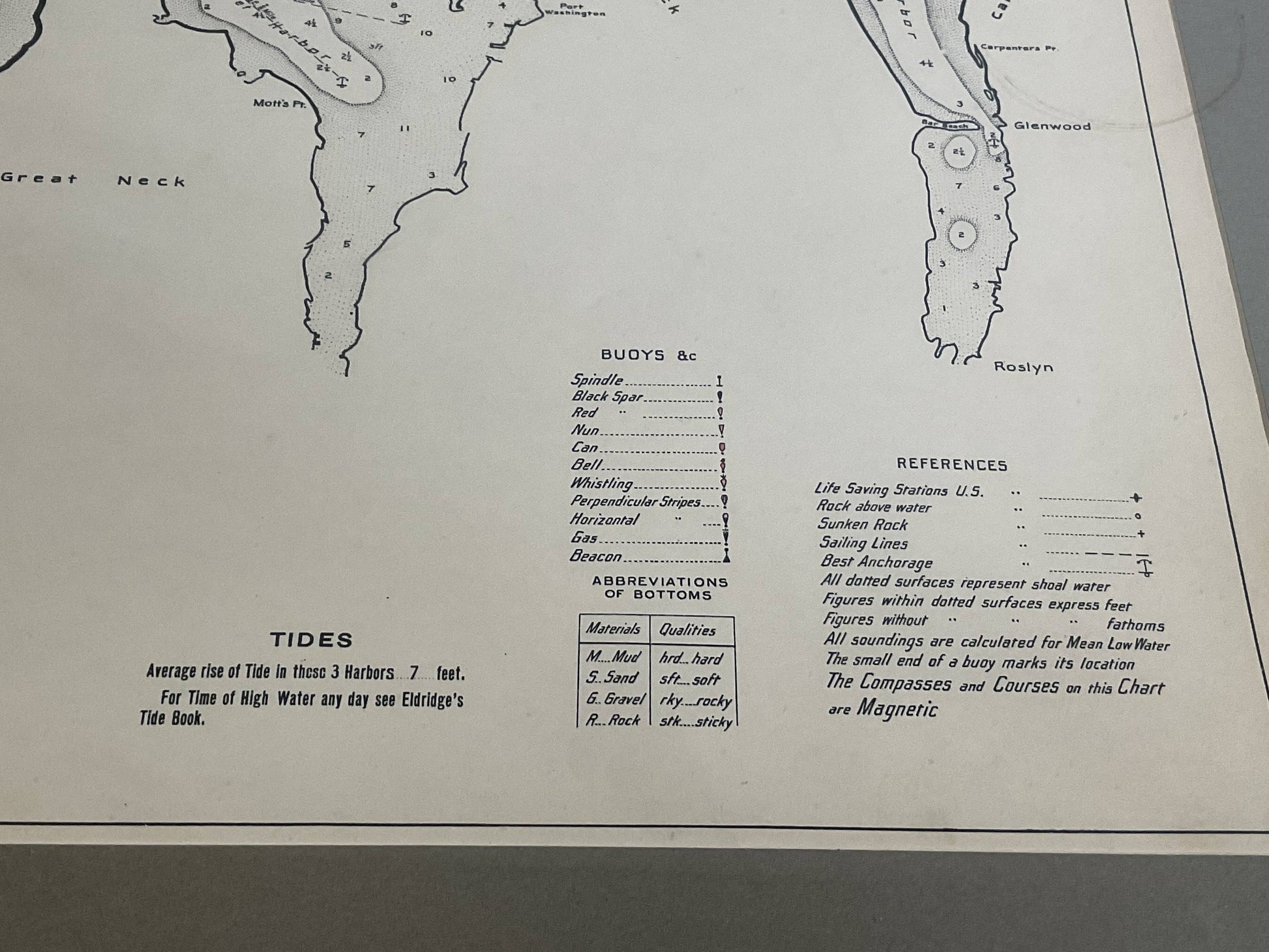
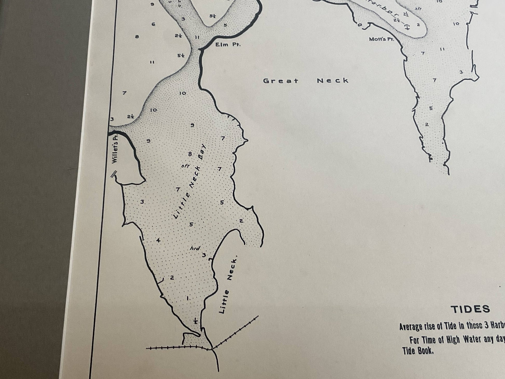
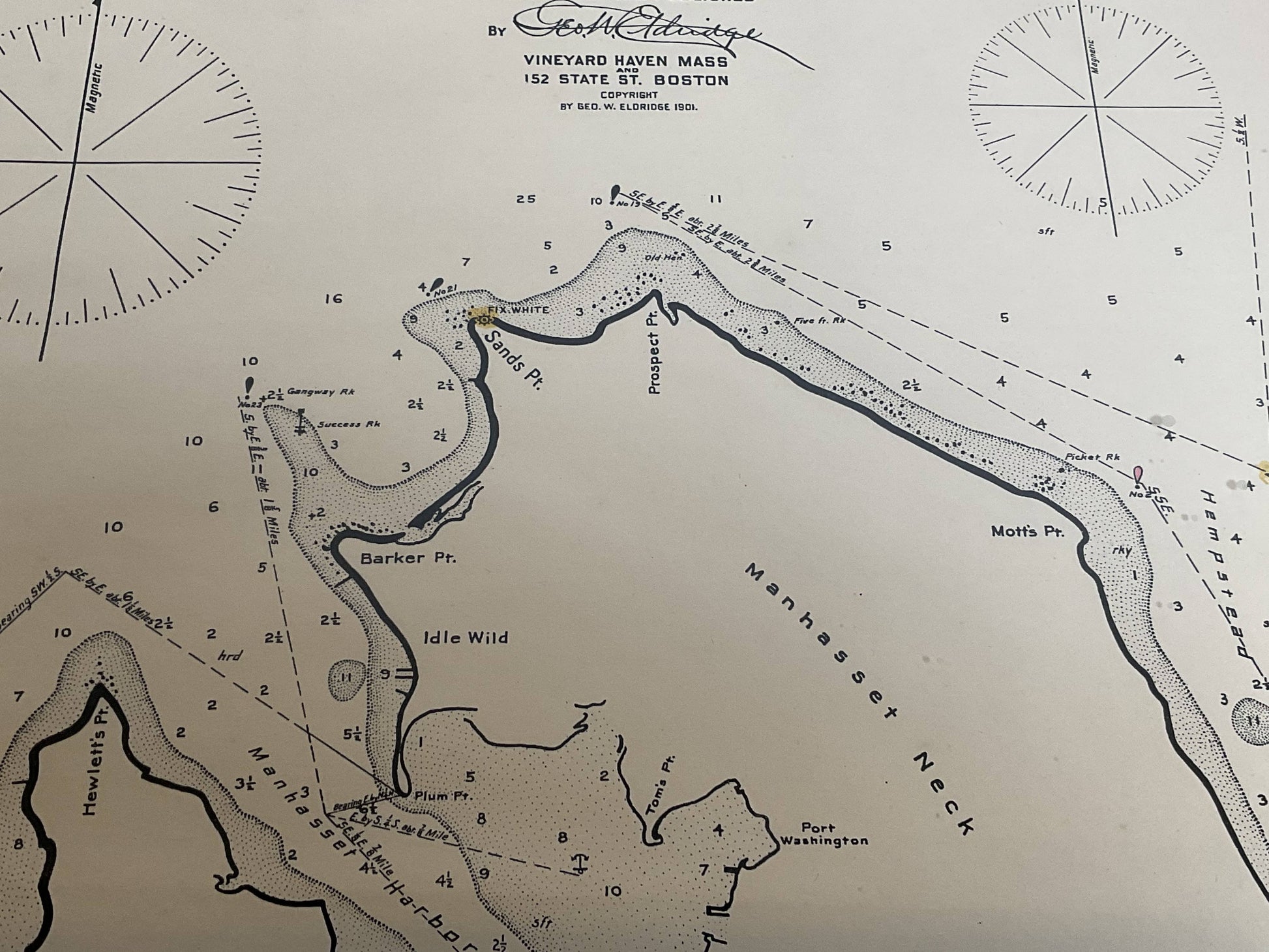
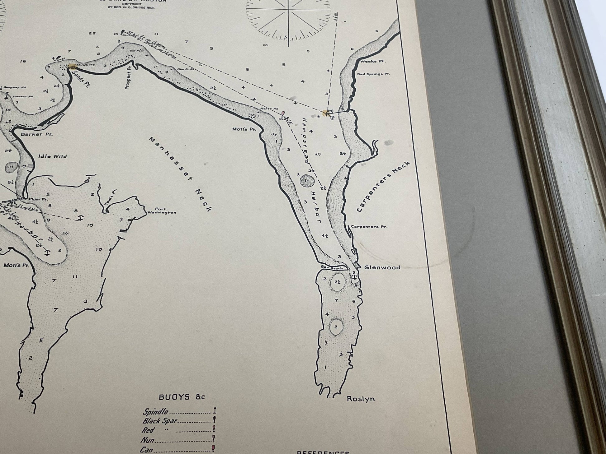
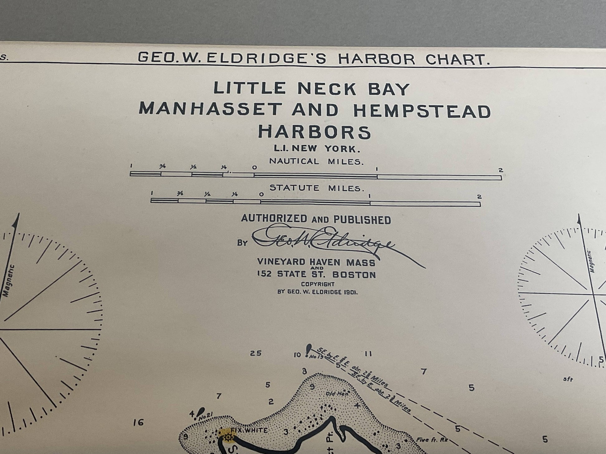
Nautical Chart showing the harbor and local waters of the Little Neck Bay, Manhasset and Hempstead Harbors. The chart displays depths, buoys, lighthouses, etc., Shown is Manhasset Neck, Carpenters Neck, Idle Wild, Sands Point, Hewitt Point, Great Neck, Roslyn, Motts Point, etc. (1821 - 1900) George Eldridge and his son George Washington Eldridge (1845-1912) were leading sea chart and sailing guide publishers from the mid 19th to the early twentieth century. George Eldridge was a fisherman who suffered an injury so he flourished as a cartographer. His bold easy to read charts were favored by mariners. He also issued an annual tide book. Dated 1901. Matted and framed.
Weight: 8 lbs.
Overall Dimensions: 28"H x 23"W
Made: America
Material: Paper
Date: 1901