
Lannan Gallery
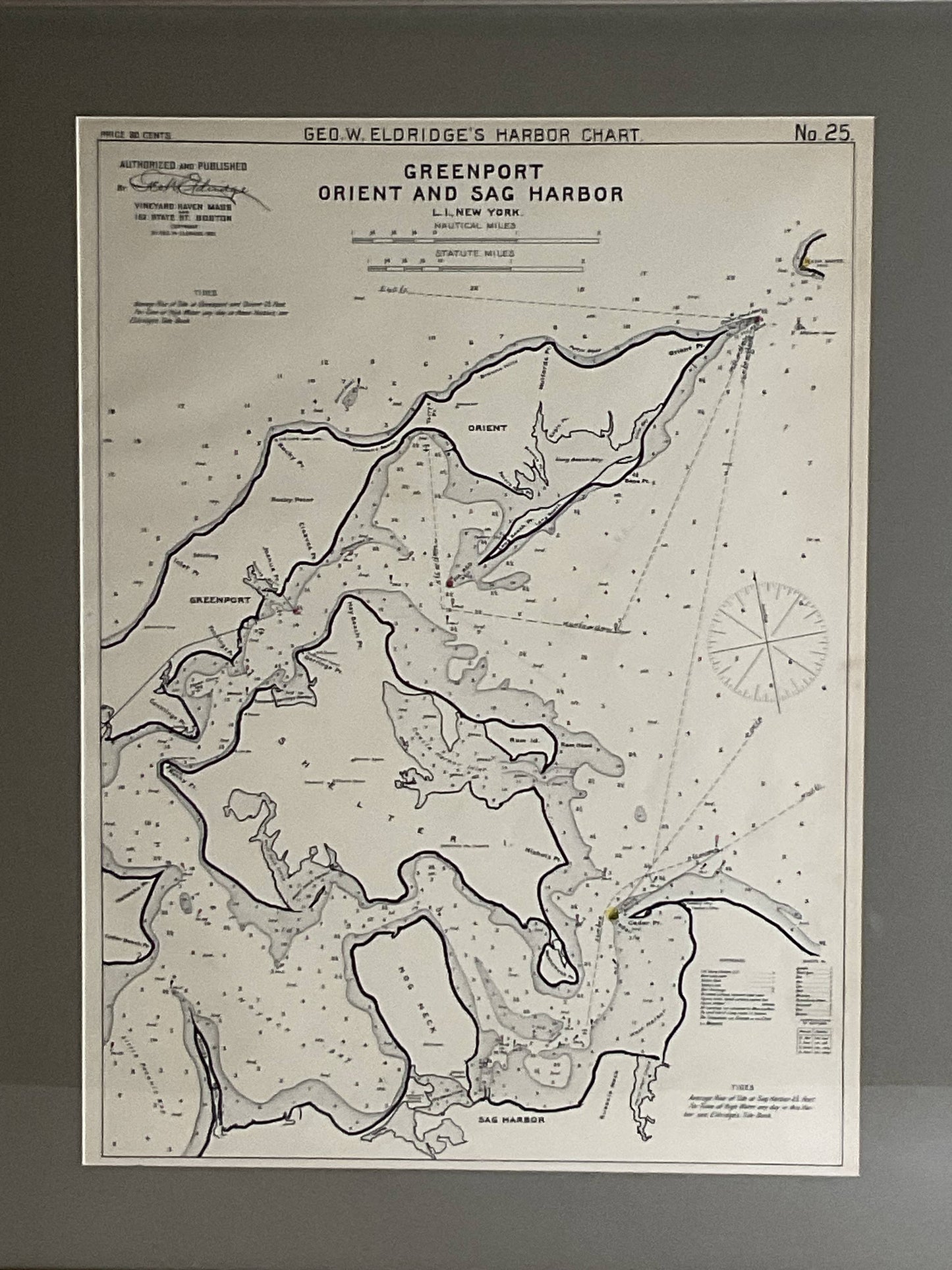
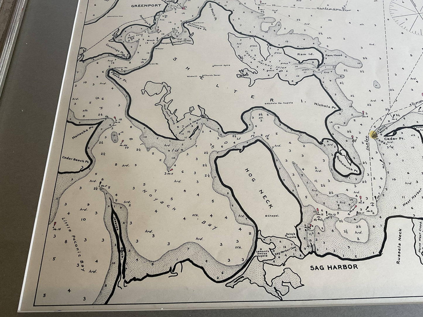
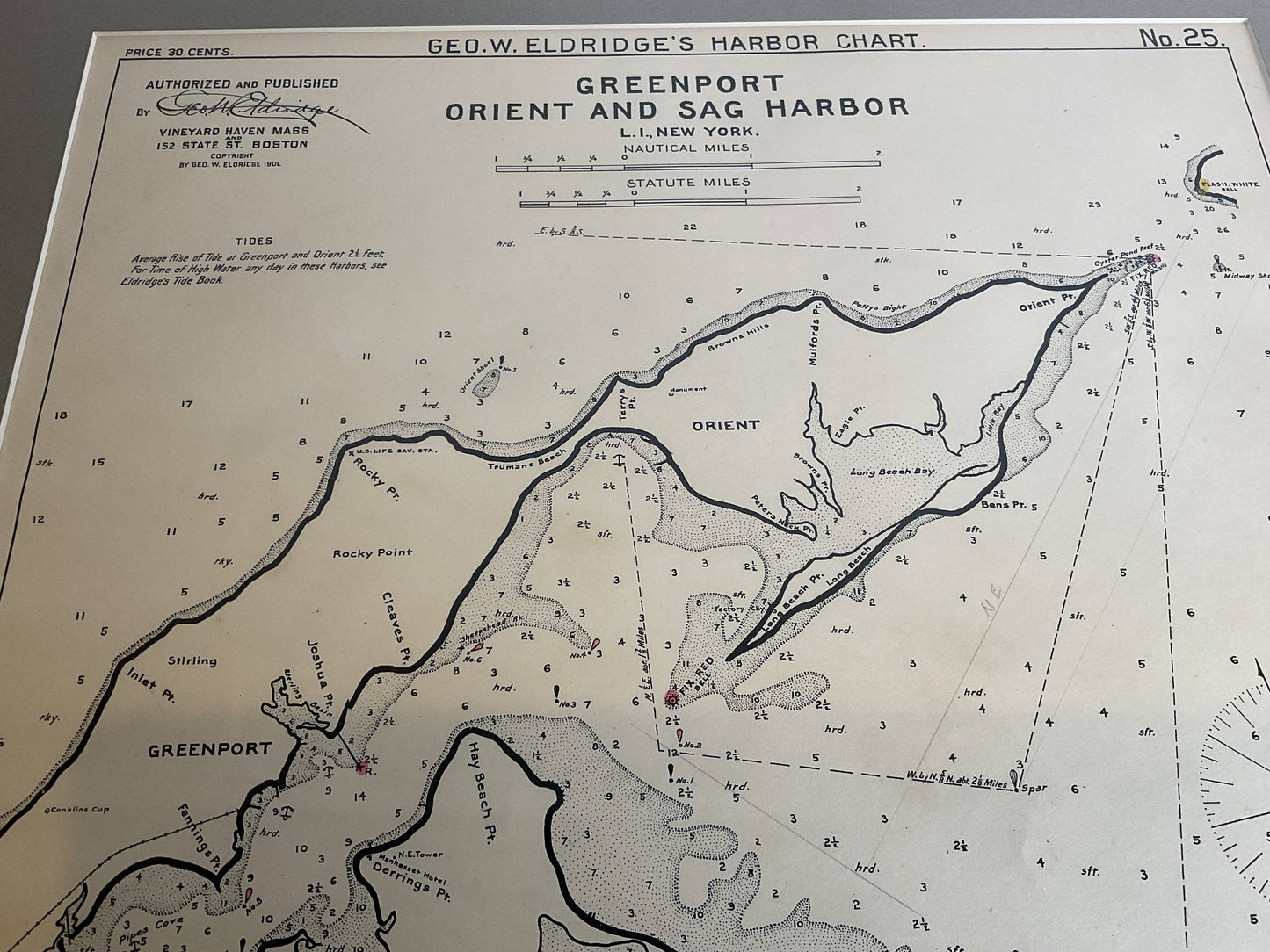
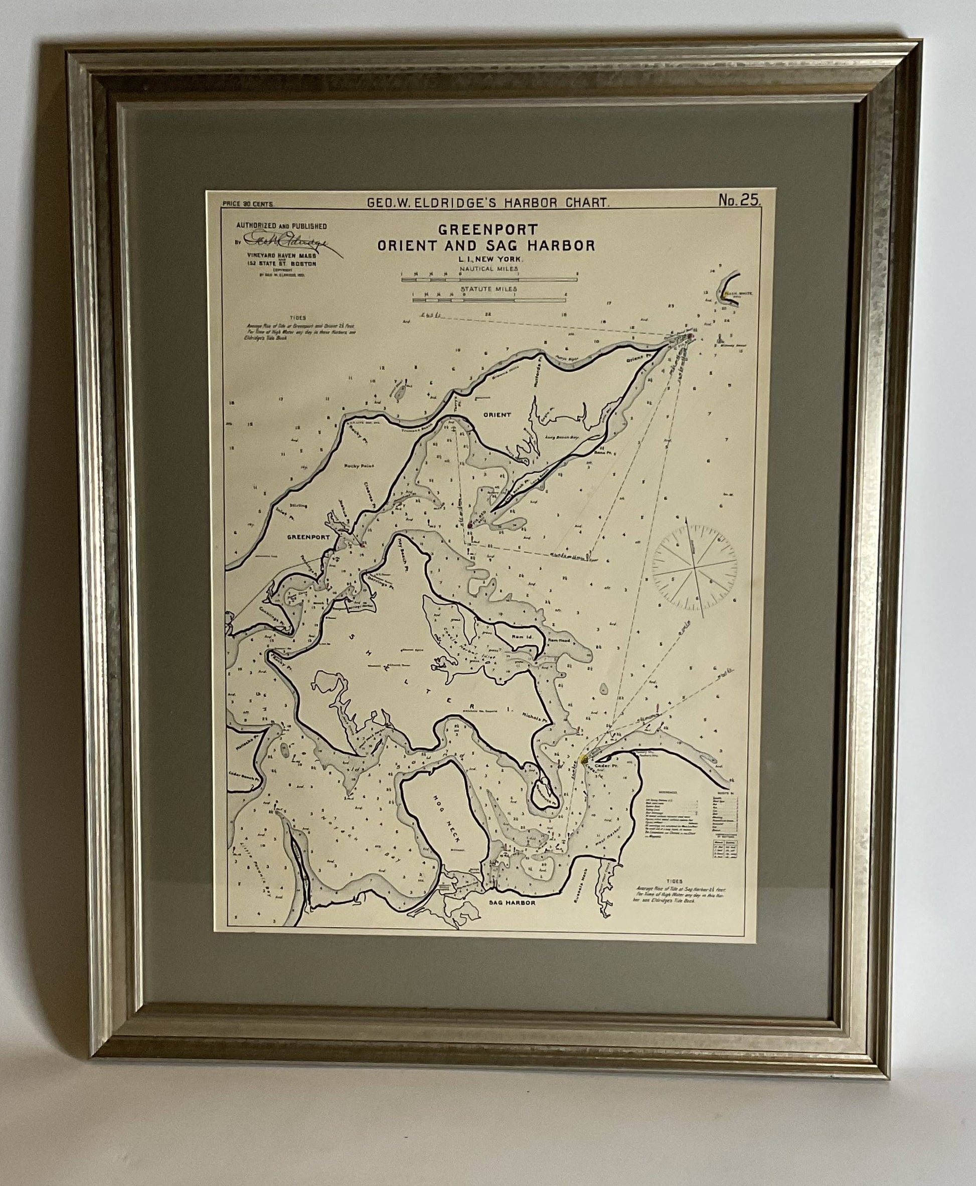
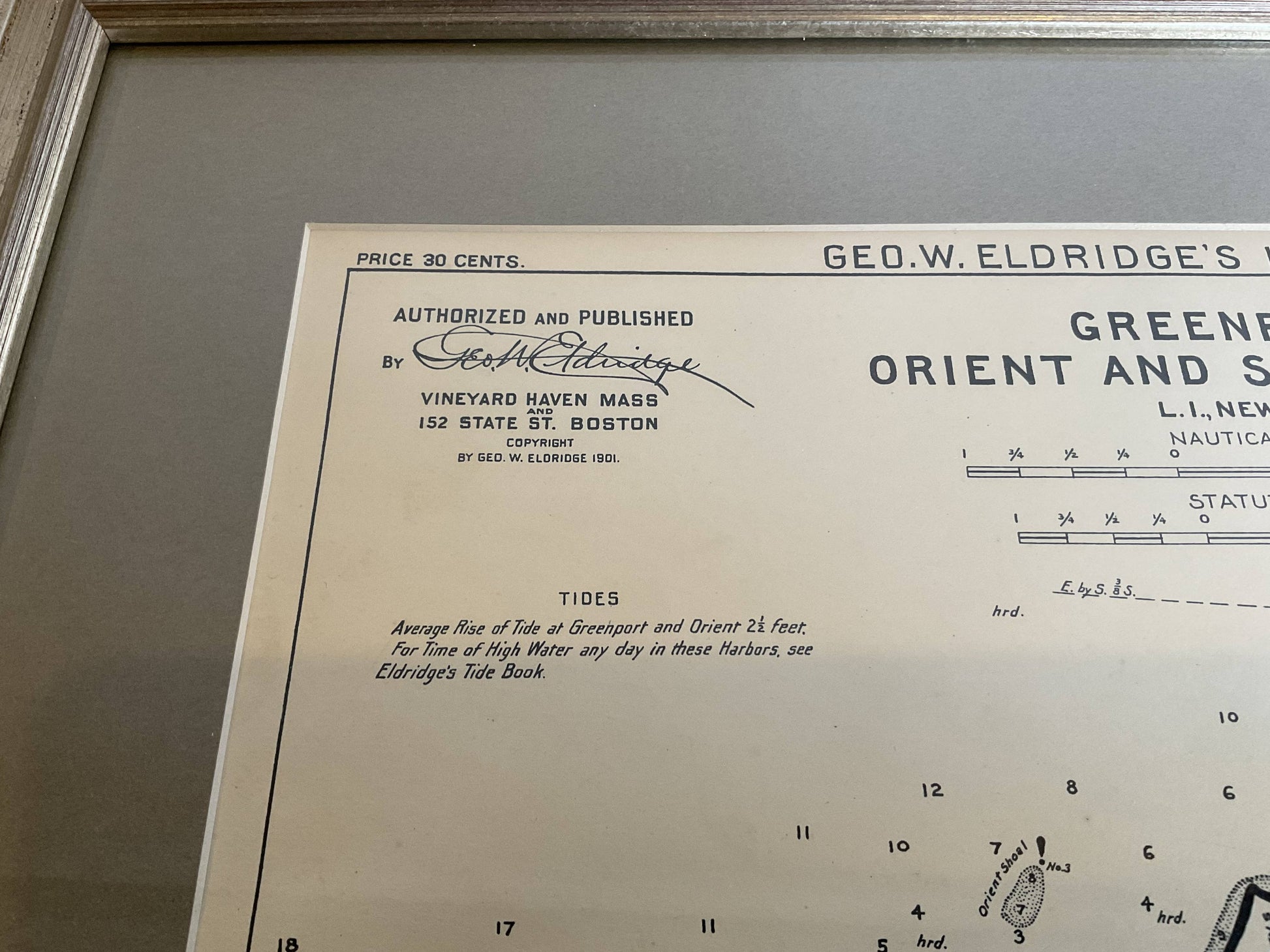
Sag Harbor Nautical Chart
Sag Harbor Nautical Chart
Regular price
$ 300.00 USD
Regular price
Sale price
$ 300.00 USD
Unit price
per
Couldn't load pickup availability
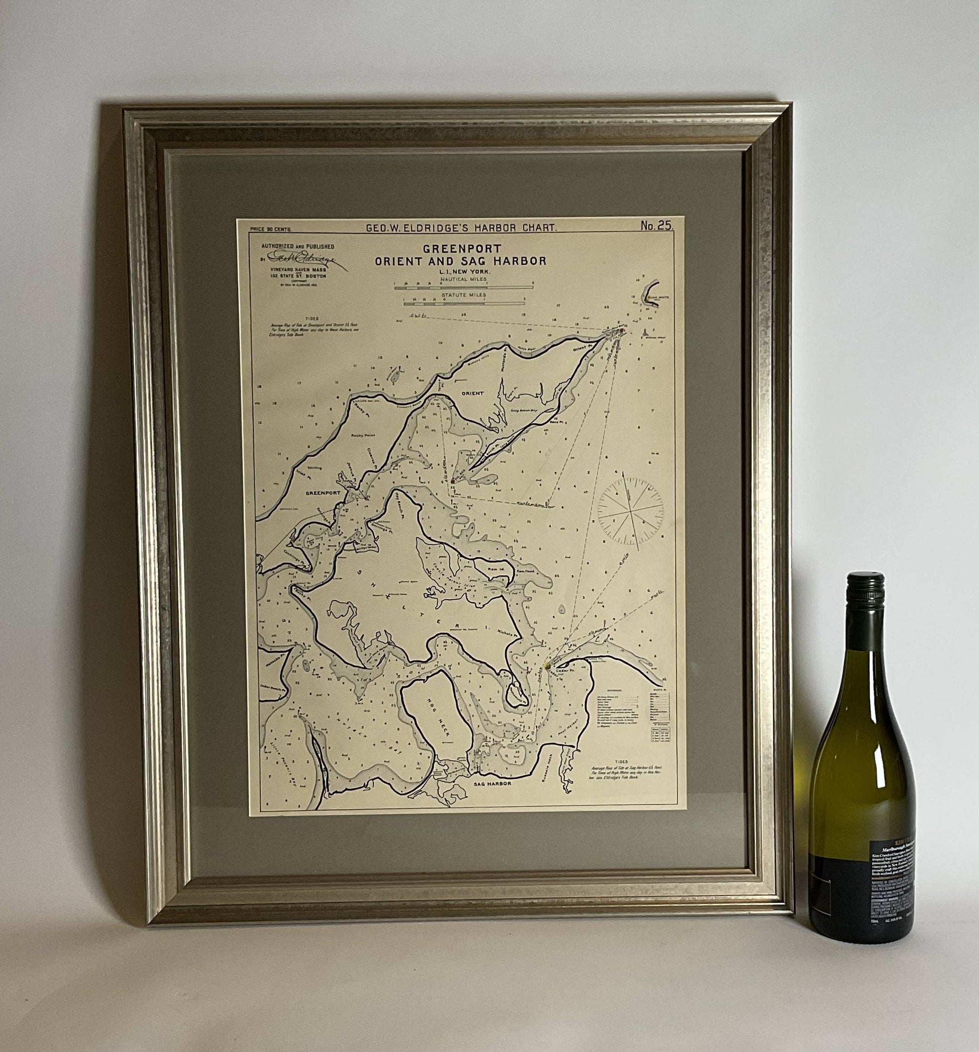
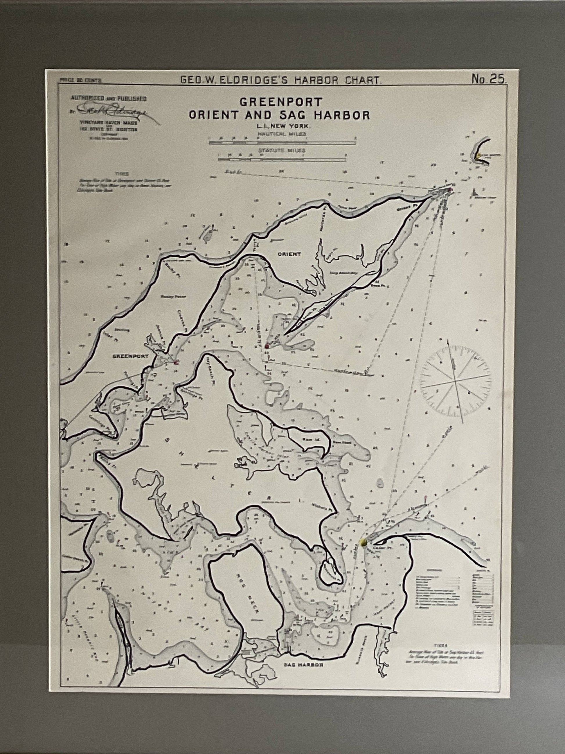
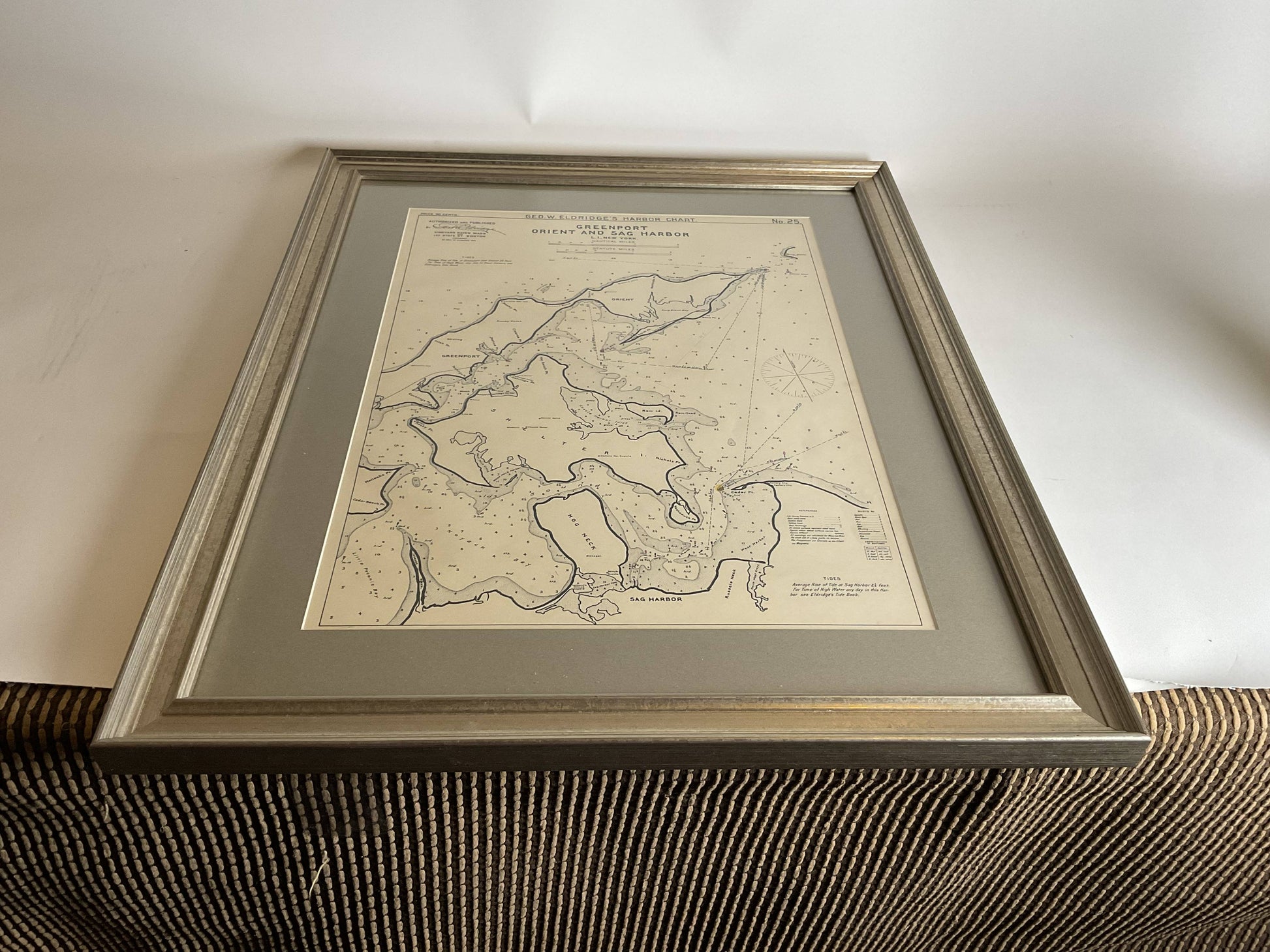
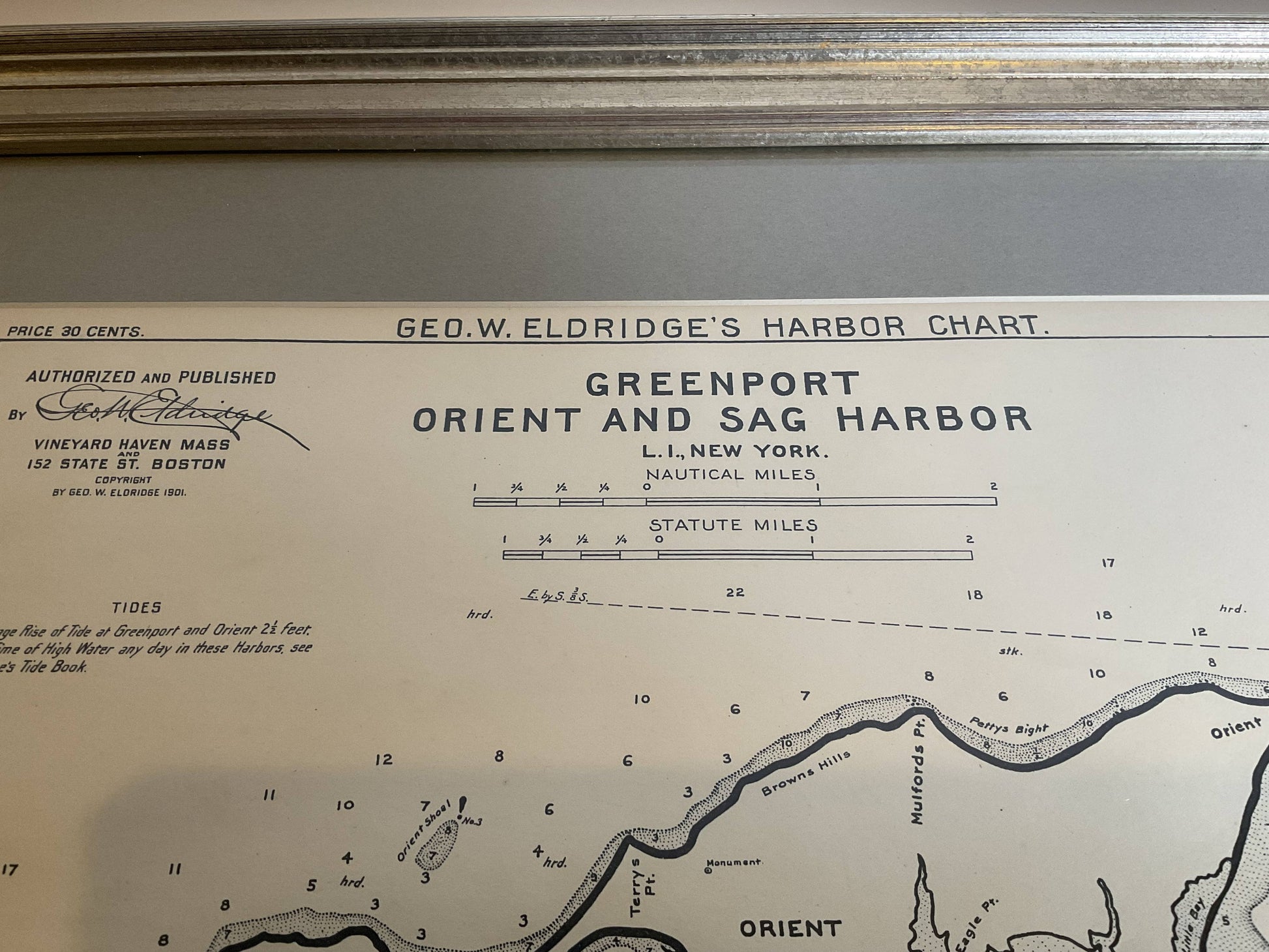
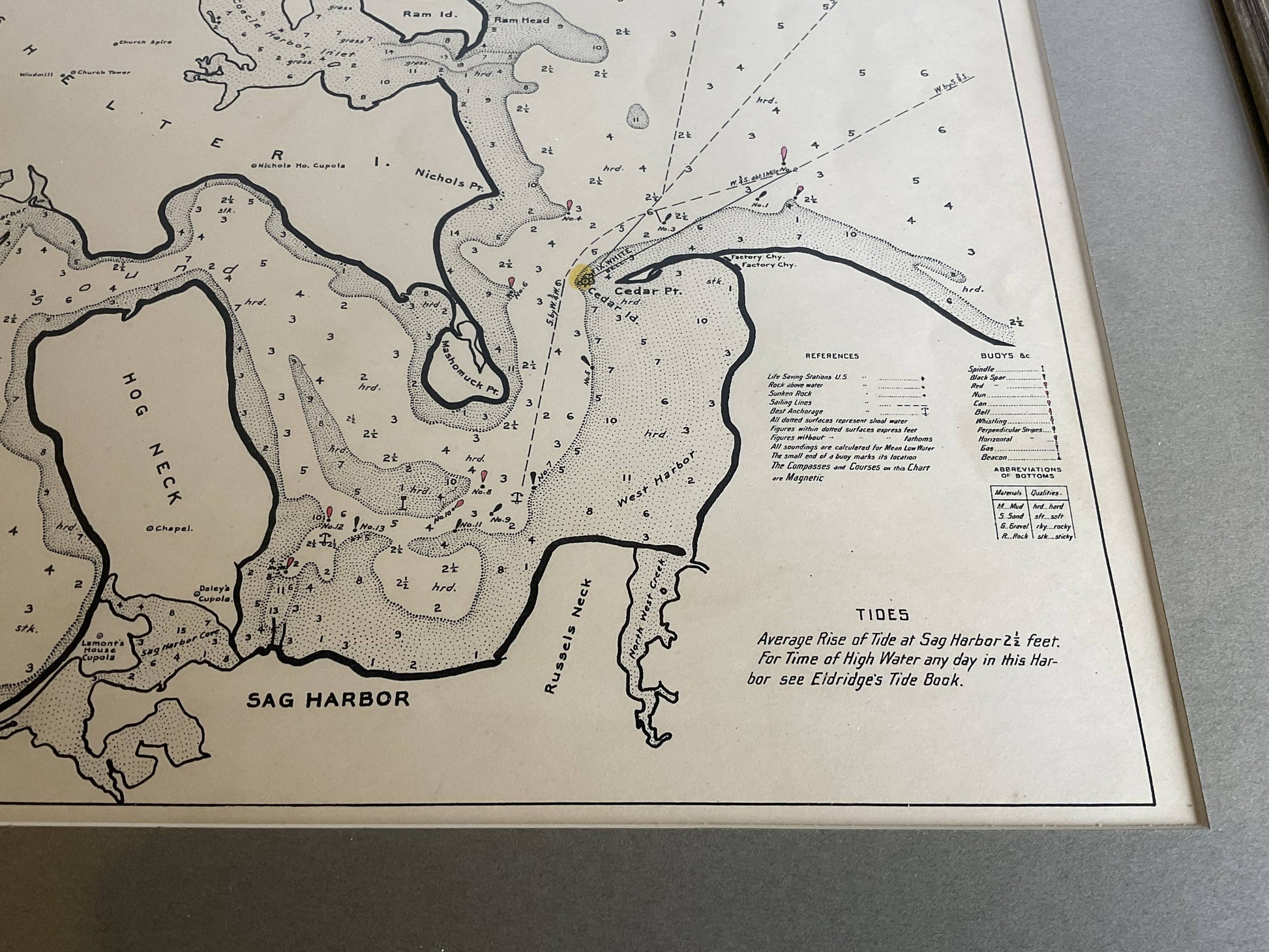
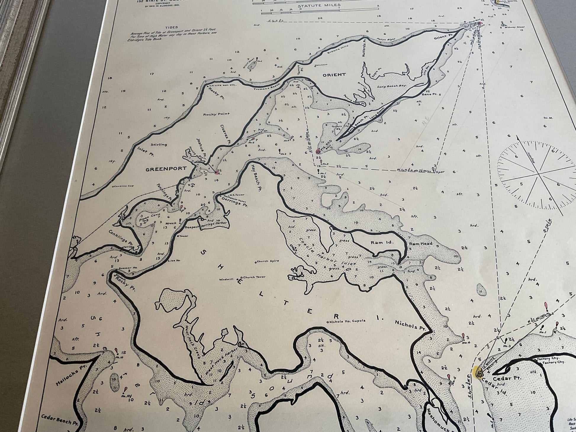
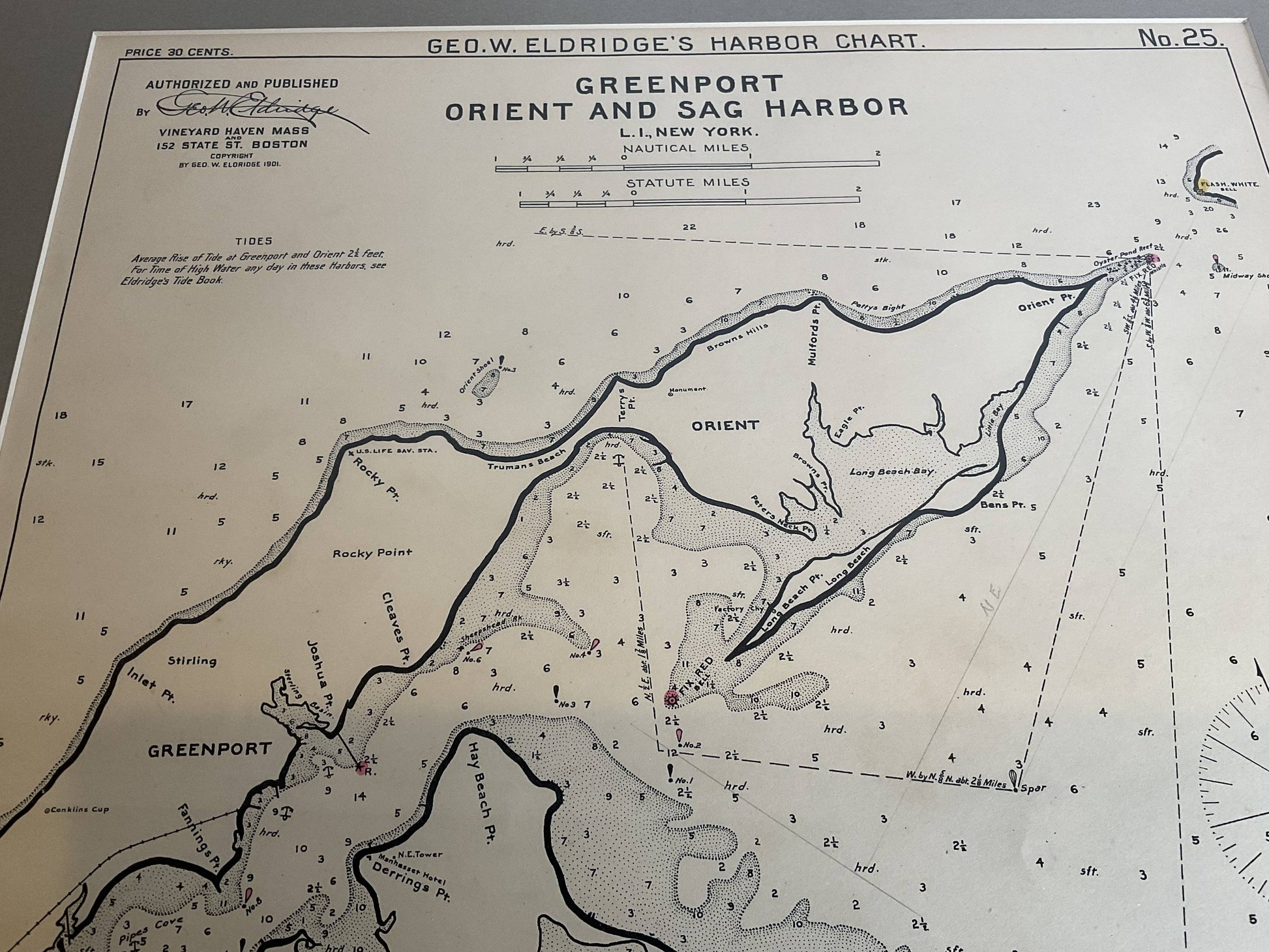
Marine chart of Greenport, Orient, and Sag Harbor New York published by George Eldridge in 1901. Details include the areas of Greenport, Orient, Shelter Island, Hog Neck, Sag Harbor, etc., dated 1901. Chart shows water depths, buoys, lighthouses, etc., This is from 1901. Nicely matted and framed.
Weight: 6 lbs.
Overall Dimensions: 26"H x 22"W
Made: America
Material: Paper
Date: 1901